Temblor chats with Gill Jolly, research leader for the Natural Hazards and Risks arm of GNS Science Te Pū Ao, the government agency that conducts geological and geophysical monitoring of Aotearoa New Zealand. They discuss how the island nation manages the many natural hazards that come with such a beautiful, dynamic landscape.
By Laura Fattaruso, Simpson Strong-Tie Fellow (@labtalk_laura)
Citation: Fattaruso, L., 2023, Earthquakes, volcanoes, tsunamis and landslides: How Aotearoa New Zealand manages a medley of hazards, Temblor, http://doi.org/10.32858/temblor.302

In November 2022, a magnitude-5.7 quake rumbled under Lake Taupō in the North Island of New Zealand. The supervolcano Taupō lies underneath the lake’s disarmingly tranquil surface; its caldera forms part of the lake’s rim. For seven months prior, seismic unrest had geologists and the public on alert, with some wondering if the activity was warning of an impending eruption. Then, in November, the quake hit, causing strong ground shaking in the vicinity as well as a small tsunami on the surface of Lake Taupō.

More recently, in February 2023, Cyclone Gabrielle inundated the North Island of New Zealand with heavy rain and wind, causing widespread flooding and subsequent landslides. The country declared a state of emergency, incurring over NZ$13 billion in damages. With 11 confirmed deaths and thousands of people missing, the cyclone has been the deadliest for the country since Cyclone Giselle in 1968.
To understand New Zealand’s complicated tectonic setting and the nation’s other geologic hazards, geologist and Temblor Simpson Strong-Tie Writing Fellow Laura Fattaruso chatted with Gill Jolly, research leader for the Natural Hazards and Risks theme of GNS Science Te Pū Ao, the government agency that conducts geological and geophysical monitoring of Aotearoa New Zealand. (Editor’s note: Aotearoa is the Māori language name for the country; GNS Science Te Pū Ao uses the combined names Aotearoa New Zealand in its communications.)
This interview has been edited for length and clarity.

Laura Fattaruso (LF): Why does New Zealand face so many geologic hazards?
Gill Jolly (GJ): In New Zealand, we have just about every kind of natural or geological hazard. We sit on a tectonic plate boundary between the Australian Plate and the Pacific Plate, and the boundary basically runs all the way through New Zealand.
New Zealand sits between two subduction zones: the Hikurangi Subduction Zone, which is offshore of the North Island, and the Puysegur Subduction Zone off the southern tip of the South Island. In between is New Zealand. We’ve essentially got a train crash where the two plates are colliding into each other.
In that “train crash,” there’s a complex fault zone, with the main fault being the Alpine strike-slip fault on South Island. Between the mountain building, geologically young, soft sediments, and heavy rains we have, that gives rise to earthquakes and landslides.

The subduction zones also mean magma is being produced underneath New Zealand. We have a line of volcanoes stretching along central North Island, from Ruapehu in the south, all the way up to Whakaari/White Island and then offshore into the Tonga-Kermadec Islands. Then a little bit farther back from there [the central line of volcanoes] you’ve got Taranaki volcano. And we have volcanic fields, particularly the Auckland volcanic field, on which the city of Auckland is built.
Everything gets thrown at us in some shape or form, which is challenging, but it also gives us a lot of opportunity for learning more about how the Earth works and how we can mitigate those hazards.

LF: What happened in the magnitude-5.7 earthquake at Taupō in November?
GJ: That earthquake happened in the middle of Taupō, which is a caldera-forming volcano with a lake (Lake Taupō) currently filling its caldera. It’s had a range of different eruption styles over its lifetime. It’s probably best known as a supervolcano. It’s had some enormous eruptions, particularly one about 26,000 years ago, and then one in 232 AD, which were quite devastating eruptions. What’s perhaps lesser known is that between those two massive eruptions, there were sequences of many, much smaller eruptions too. Although Taupō is capable of bigger eruptions, a smaller or moderately sized eruption is more likely.
We interpret these smaller quakes as magma moving and heating up the groundwater, so that’s creating small earthquakes within the volcanic area. Taupō does this on a regular basis. The last period like this was 2019; before that, there was a similar period in 2008. Over the last 150 years or so, it’s been roughly every decade or so that the volcano has this level of unrest.
We’d actually been having a number of earthquakes in and around the volcano since about May 2022. In the middle of the year, it reached the threshold of activity where we decided that it merited increasing the volcanic alert level to one, which means a low level of volcanic unrest.
The volcano is telling us it’s still a volcano.
The earthquake in November was within the sequence, though it was much larger than many of the others.

LF: Did the earthquake occur on a known fault? Or was it just from movement of magma?
GJ: With any situation like this, it’s really hard to untangle what’s related to the volcano. There are lots of faults running through there, so a lot of the activity occurs on the faults as well as within the volcanic system. It’s difficult to untangle — they’re not independent. Nevertheless, [the November quake] was a significant event that caused a degree of ground shaking in the vicinity.
Perhaps one of the more significant consequences was the small tsunami the quake caused within Lake Taupō. We’re still trying to understand how that occurred, but it was possibly related to the ground movement from the earthquake and also potentially some slumping of a submarine lake shore.
One of the challenges with Taupō is the fact that the volcano is under a lake, so effectively monitoring that is very challenging. It’s really hard to put in seismometers, or to look at the ground deformation because it’s all hidden by the water.
LF: Looking now at New Zealand more broadly, are there any specific faults that you’re especially concerned about?
GJ: There are a couple of ways of looking at this concern. You can look at the big faults with the potential for the biggest earthquakes, but those big quakes happen less frequently. In that respect, the Hikurangi Subduction Zone is the most capable of creating a magnitude-8 [earthquake] and above. The consequences of that are not only significant ground shaking, landslides, liquefaction and the usual earthquake hazards, but also tsunami hazards. I often describe hazards in terms of my “worry-ometer” and that’s quite high on my worry-ometer, but with low probability.
The other way of looking at it is what is most likely. There’s been a fair amount of research done over the last few years looking at the Alpine Fault. The Alpine Fault has worked almost like clockwork; it ruptures on a very regular basis. There is a very high probability, about a 75% likelihood, of a rupture on the Alpine Fault in the next 50 years. The Alpine Fault tends to have magnitude-7 or 8 quakes. So in terms of my worry-ometer, that’s probably one of the more likely earthquakes to happen in our lifetimes. That quake would have a particularly strong impact on the South Island.
As a country, there’s been a lot of really good planning work put into assessing what the impacts of a magnitude-8 earthquake on the Alpine Fault would be, and how people can mitigate those impacts. It still will be a significant event, and resilience planning helps to reduce the risk to people, infrastructure and buildings.

LF: We’ve seen that the recent sequence of earthquakes in Turkey has been catastrophic and resulted in a tragic scale of fatalities and injuries. Could you explain why these earthquakes have been so devastating? Given that New Zealand is likely to experience a similar-sized earthquake on the Alpine Fault, are there any lessons to be learned from this disaster?
GJ: It is heartbreaking to see the devastation caused by the recent earthquakes. There were two large earthquakes very close to each other in space and time and close to areas with high population densities. The earthquakes were shallow and this contributed to the massive impact to buildings and infrastructure. There have also been many aftershocks, which have made the recovery efforts very difficult. After an event of this size, there are always lessons to be learned for any country with active seismicity — this could be new knowledge about how earthquakes are generated, or how the surface of the ground responds to the earthquake, or it could be better understanding of how to make buildings and infrastructure more resilient.
LF: Are there any volcanoes that you’re especially concerned about?
GJ: Again, it’s about that question of frequency versus magnitude. An eruption from a large volcano like Taupō or one of the other caldera-forming volcanoes is some-thing that doesn’t keep me awake at night, but if something like that were to happen, it would have a significant impact on New Zealand and potentially globally as well. But the caveat is that they’re very low probability events.
At the other end of the spectrum, you have smaller eruptions that happen more frequently. The more likely eruptions would be Ruapehu or Tongariro volcano, in the Tongariro National Park. The national parks have a lot of processes around risk management.

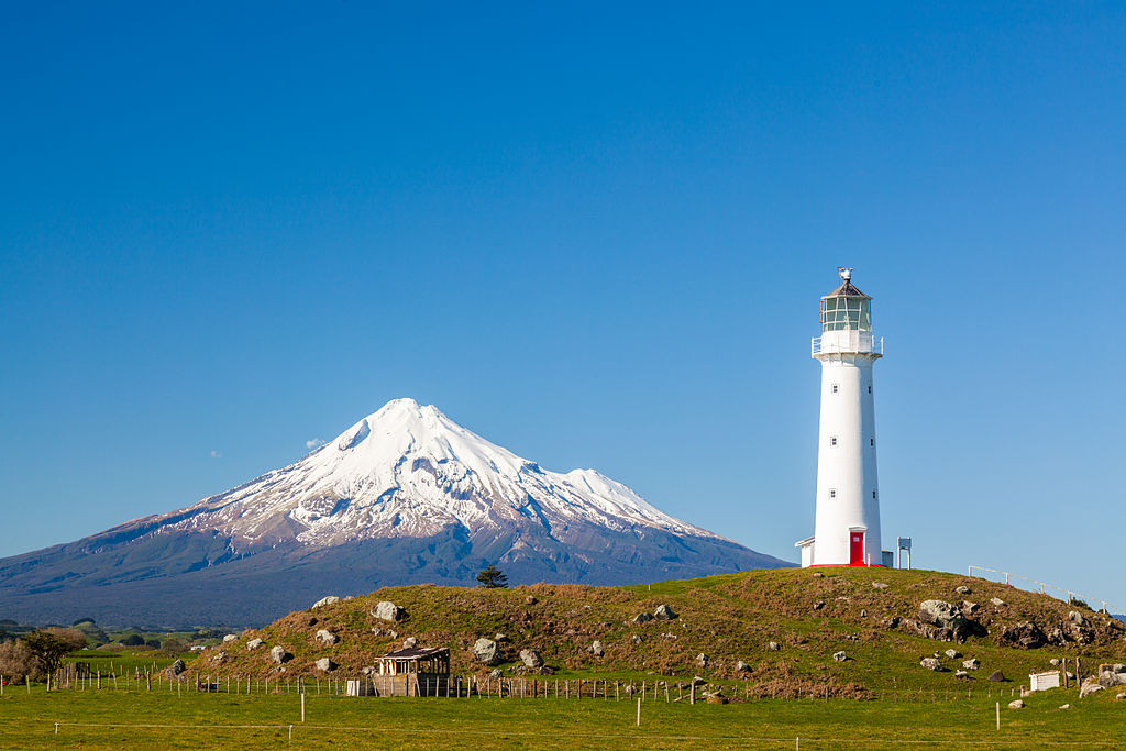
Another interesting volcano is Taranaki. Taranaki hasn’t erupted for a couple of hundred years, but it has a reasonably high probability of eruption within the next 50 years. There’s a 35-38 percent chance of eruption in the next 50 years. An eruption of Taranaki would have a significant impact on the agricultural sec-tor particularly, and the energy sector for New Zealand.
In terms of risk management, Auckland volcanic field is another interesting one, because Auckland is our biggest city and it sits right on top of a volcanic field. With volcanic fields, you don’t know where the next eruption is going to take place. It could be anywhere within the city limits, essentially, impacting a sig-nificant population. A lot of work has been done in partnership between science and stakeholders around what those eruptions might look like and how they can be mitigated.
LF: Is there a reason why Auckland would be built in such a dangerous place? I’m sure there’s a good reason— was the danger not recognized at the time or is there a particular advantage to that location?
GJ: When Auckland was initially populated, there would have been no knowledge of the potential for eruptions. The last eruption in the Auckland volcanic field was probably about 500 years ago, before European settlement. There is evidence of Māori people walking through the ash; there are footprints preserved in lithified ash. But Auckland has two harbors, so it’s a natural place for any settlers to put their initial stake in the ground.
There’s a very rich Māori tradition around Auckland. The individual volcanoes, which are called the maunga, meaning mountain in Māori, are seen as important cultural landmarks.

LF: How have the society and the government in New Zealand prepared for natural disasters?
GJ: We have a national disaster resilience strategy with the intent of making our communities more resilient.
In New Zealand, many different agencies have risk management responsibilities. One of the key ones is the National Emergency Management Agency (NEMA), which has a similar role as FEMA in the U.S. They have most recently been leading the response to Cyclone Gabrielle.
We have a national natural hazards insurance scheme, called the National Disaster Fund, run by Toka Tū Ake Earthquake Commission (EQC). Essentially, when anyone in New Zealand buys insurance for their house, they pay a levy toward EQC that goes into the National Disaster Fund. So if we have a national disaster, the Fund provides a portion of the coverage for damages to domestic housing stock. Homeowners can also add private insurance on top of the $300,000 covered by national insurance. EQC does not cover commercial or industrial properties.
New Zealand is one of the most highly insured countries in terms of domestic residents, with 97 percent of homes covered by building insurance. And the National Disaster Fund was hugely successful during the Christchurch (2010-2011) and Kaikōura (2016) earthquakes, although we’re still rebuilding our funds as we recover. This innovative program has proven its worth over time. I would say that’s one of the real positives around how New Zealand manages its natural hazards.
Land use planning is another key risk management strategy. A good example is guidance around where you can build close to an active fault. If you know there’s a fault running through the property, then there’s an exclusion zone inside of which you can’t build, to keep people from building on top of the fault.
Building codes are important as well. We have a national seismic hazard model, which directly influences the standards that go into building regulations. So they’re using the best science to inform what the building code should be.
LF: I’ve been following the impact of severe weather events on Aotearoa New Zealand in early 2023. Has GNS been involved in providing science advice to the responding agencies?
GJ: The numbers and impacts of landslides has been extremely disruptive to infrastructure and tragically led to the deaths of two firefighters. Our role in an event is to provide the best possible science advice to support the responding agencies. For severe weather, our key expertise is our engineering geology team and they have been very busy over the last few weeks. As extreme Tropical Cyclone Gabrielle approached, we were using forecasted rainfall data to analyze the susceptibility of different areas to landslides — and our risk scientists were using that information to assess the likely risk to major infrastructure such as roads and rail. Then after the storms passed, our teams flew over the impacted areas to document the number and location of landslides. This information was passed on directly to civil defense so they could get very rapid situational awareness and prioritize how and where they should respond.
LF: What kinds of guidance is there for when a disaster strikes?
GJ: The risk management system is built on what we call the four R’s. Risk reduction is the first thing — for example, not building on an active fault. Then, readiness, or making sure that you know what to do. There’s a lot of public education around making sure you have your grab bag ready to go, so that if you need to leave your home quickly, you’ve got the essentials.
Then there’s response. What do you do in response to an emergency? For example, there’s a lot of public education around what to do if you feel a long or strong earthquake. The message is: “Long or strong, get gone!” because there could be a tsunami. I think most New Zealanders have that ingrained.
For an earthquake, there’s “Drop, cover, hold.”

LF: Is there anything that people traveling to New Zealand should be prepared for? What should they know before they visit?
GJ: One of the key things is to learn what the hazards are in the area that you’re visiting. So if you’re in Northland, the far north, then you’re probably not going to get too much of a problem with earthquakes or volcanoes. But if you’re in Wellington, then yeah, you’re quite likely to actually feel an earthquake while you’re here. It’s unlikely to be a big one, but just be aware of the hazards in the area that you’re visiting.
If you’re staying along the coast, find out where your tsunami evacuation zones are. That’s a pretty critical one.
If you’re visiting the volcanoes, then be aware of what the current level of activity is. Go to the local information sources like the Department of Conservation or geonet.org.nz, which gives you up-to-date hazards information.
Check out Temblor Earth News’ prior coverage of New Zealand hazards here.
Laura Fattaruso is Temblor’s Simpson Strong Tie Fellow. They are a Ph.D. candidate at U Mass Amherst, where they study how rocks break to better understand earthquake processes (laurafattaruso.com). Simpson Strong Tie is sponsoring a science writing fellow to cover important earthquake news across the globe.
- Venezuela’s doublet leaned toward Caracas - June 30, 2026
- Is Southern California’s Cajon Pass an ‘earthquake gate’ ready to open? - June 29, 2026
- Philippines magnitude 7.8 shock may have loaded the central Cotabato subduction zone - June 11, 2026