By David Jacobson, Temblor

Three evacuations this month
For the third time this month, mandatory evacuations have been ordered for residents in parts of Santa Barbara due to fear of mudflows. All of the residents impacted by these evacuation orders live below the hills that were ravaged by the Thomas, Sherpa, and Whittier fires. According to Santa Barbara County, all residents must be evacuated by noon today (Tuesday March 20, 2018). To see which residents are being forced to evacuate, either see the map below, or click here.

The mandatory evacuations currently in place include the area in Montecito that was devastated by a mudflow on January 9th. That flow destroyed over 100 homes, and left 21 people dead. Therefore, these mandatory evacuation orders are aimed at preventing further tragedy.

An “atmospheric river” is about to hit Southern California
The reason for these evacuations is because of a powerful storm that is expected to hit Southern California tonight. This “atmospheric river,” is being called the worst of the winter season. Total rainfall over the next few days could reach 5-10 inches of, and at some periods, the intensity could be up to one inch per hour, which is double what the USGS states is often required to trigger debris flows and flash floods. Additionally, heavy precautions are being taken because the five to ten inches of rain predicted is more than the 3-6 that fell across the region prior to the deadly Montecito mudflow.
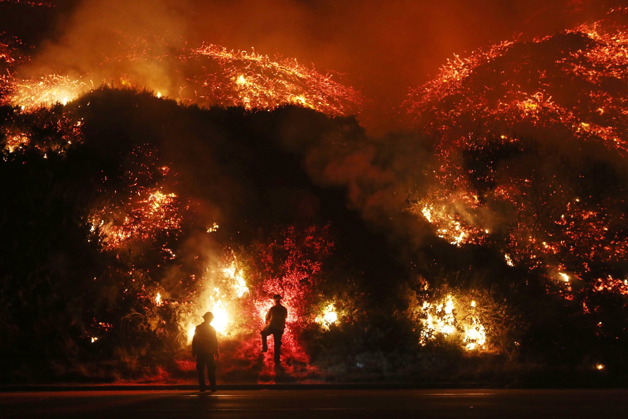
Why are these mudflows happening?
Under normal circumstances, the likelihood of mudflows would not be so high. However, the December fires, including the Thomas Fire, the largest ever in the state’s history, left the hills barren. This means that vegetation that would have normally soaked up water is gone. Therefore, it does not take much rain to produce mudflows. Combine this with the intense rain expected, and the steep slopes of the area, and you have a disaster waiting to happen.

An important point which will likely be of interest to homeowners is that should there be mudflows which cause damage to property, they will likely be covered under fire insurance. Shortly after the Montecito mudflow, the California insurance regulator stated that insurers must treat mudflows that occur in areas recently burned by wildfires, as a peril from fire, if the fire is judged to have been a “proximate cause.” This means that should there be further damage, insurance companies will likely have to dig even deeper into their pockets as Aon Benfield estimates that losses from the Montecito mudflow could exceed $100 million. This news should also come as a relief to homeowners since most insurance policies exclude hazards such as mudflows, debris flows, and floods.
References
LA Times
The Insurance Insider
- Beware quiet segments of the Philippine Fault - May 16, 2025
-
ډیری عوامل افغاني ټولنې د زلزلې پر وړاندې زیانمنوي
- August 11, 2022 - What’s happening this week in Humboldt County, California: The squeeze - February 6, 2019