
By David Jacobson, M.Sc., Temblor
Click here to protect yourself from natural disasters

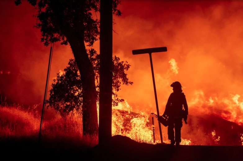
Blazes tear across California
As firefighters across the state battle 17 different fires, the largest, the Carr Fire in Northern California near Redding, has destroyed over 1,000 structures, claimed at least six lives, and has burned nearly 100,000 acres. The raging inferno, which started on July 23 when a vehicle suffered mechanical failure, is only 20% contained, threatens thousands more structures, and has forced the evacuation of nearly 40,000 people. Due to extremely high temperatures (the projected high today is 106°), strong winds, and dry conditions in Northern California, the blaze has moved rapidly, and has made fighting the fire difficult for the 3,000+ firefighters involved.

“A rate of spread that we have not seen before”
Because of the extreme conditions across the state, fires are moving differently than Cal Fire has ever seen. Cal Fire battalion chief and public information officer said that “what we’re seeing in California is more destructive, larger fires burning at rates that we have historically never seen. And our message is simply, if you feel like you could be in danger, to leave the area when these fires are burning.” Unfortunately, residents and firefighters are unlikely to get any respite as temperatures are likely to remain in the triple digits throughout the week, and the fire itself is large and hot enough to create its own weather system, making projecting its next move difficult.
While the blaze has consumed parts of west Redding, Cal Fire has been able to contain much of that, protecting the town. However, the fire continues to move, nearly uncontrolled in all other directions. The map below shows the eastern perimeter of the Carr Fire, and where parts of Redding burned.

Recognize your fire risk
What all of the fires currently raging across California and the rest of the country show is that given the right conditions, fires can spread extremely rapidly and that you should not take your fire safety lightly. It is important to recognize where your home is in relation to surface fuels that could burn. By doing this, you can take measures to protect you, your family, and your property.
In the middle of summer, during peak fire season, it can also be helpful to identify if you live in a region where there is significant wildland fire potential. The National Interagency Fire Center publishes maps highlighting areas of increased risk. The map below shows these areas for the month of August. Therefore, if you live in one of these zones, it may be in your best interest to assess if there are ways you could reduce your fire risk.

References
Cal Fire
CNN
National Interagency Fire Center
InciWeb
- Beware quiet segments of the Philippine Fault - May 16, 2025
-
ډیری عوامل افغاني ټولنې د زلزلې پر وړاندې زیانمنوي
- August 11, 2022 - What’s happening this week in Humboldt County, California: The squeeze - February 6, 2019