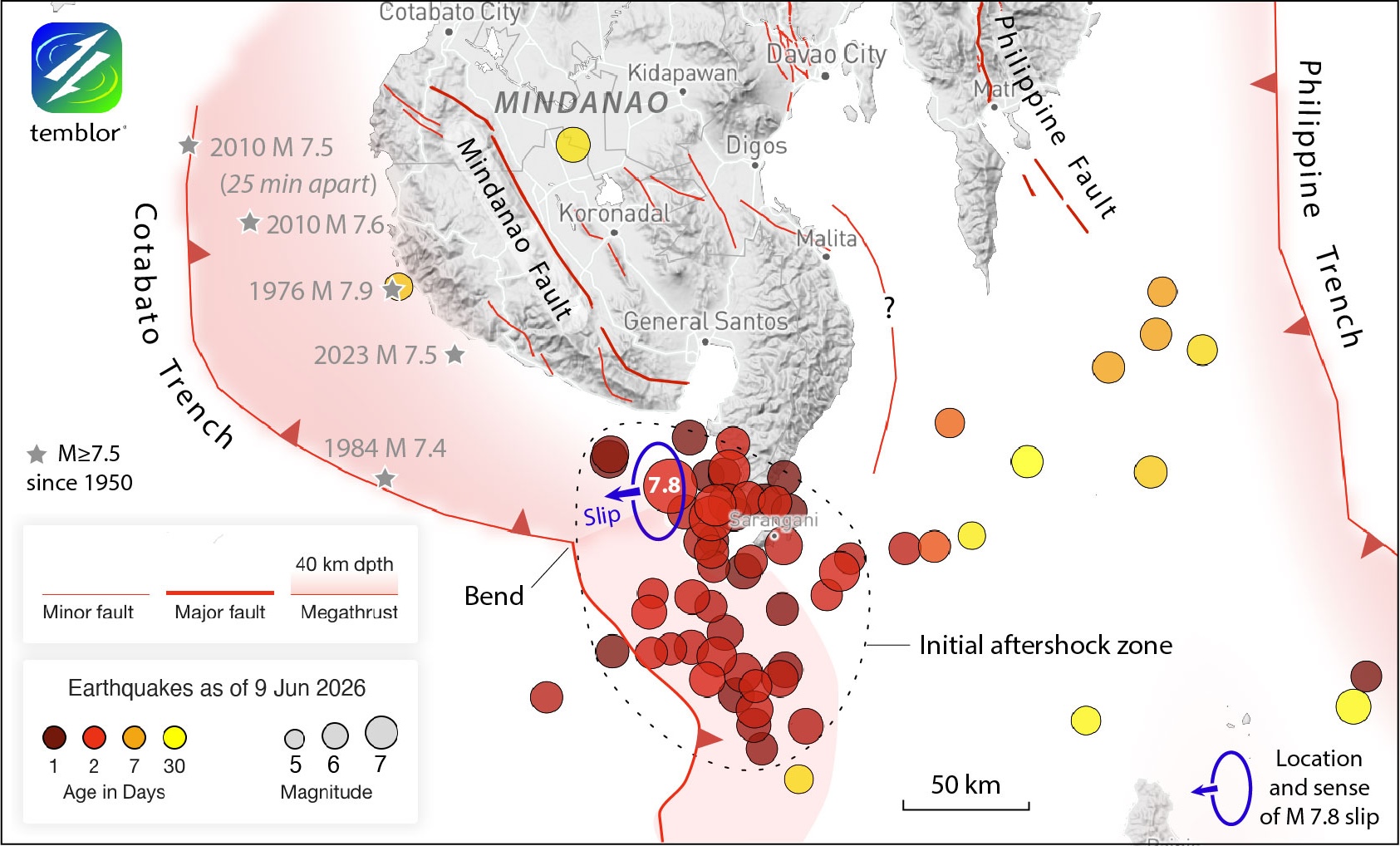
Figure 1. The initial aftershocks cover a 165 by 150 kilometer area south of General Santos City, on a rupture associated with the Cotabato Trench where it subducts beneath the southern island of Mindanao. A possible left-lateral strike-slip fault, the Mindanao Fault, lays to the north of the rupture. Another left-lateral strike-slip fault, the Philippine Fault, resides northeast of the rupture. The trace of the Cotabato Trench is from Llamas et al. (2026) and DOST-PHIVOLCS. The 100 kilometer-long section of the trench between the 2026 magnitude 7.8 quake and the 2023 magnitude 7.5 event could rupture next. Earthquake locations and magnitudes are from the USGS. Credit: Stein and Toda, 2026 CC BY-NC-ND 4.0
Alka Tripathy-Lang is a freelance science writer based in Chandler, Arizona, and holds a Ph.D. in geoscience.
Latest posts by Alka Tripathy-Lang, Ph.D. (see all)
- Living through the Loma Prieta earthquake - October 21, 2021
- The Great Quake Debate: an interview with seismologist and author Susan Hough - August 27, 2020
- Salton Sea Swarm quiets down - August 12, 2020