By David Jacobson, Temblor
Click here to protect yourself from natural disasters
At just past 1:30 a.m. local time Monday morning, a M=5.6 (the Japan Meteorological Agency recorded it as a M=5.8) earthquake struck western Japan, near Oda, in the Shimane Prefecture, approximately 770 km west of Tokyo. Despite this quake’s moderate magnitude, shaking was very strong. Three stations within 14 km (8 mi) recorded accelerations of 0.5-0.7 g, values normally associated with much larger earthquakes. There are probably two reasons for the severe shaking: the earthquake was very shallow (8km/5 mi) and Japan has a denser network of accelerometers than any other country on earth. This is an important reminder that small but frequent earthquakes can cause more damage over time than rare, great earthquakes.
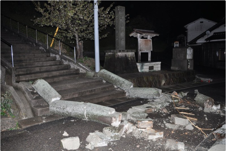
The M=5.6 earthquake resulted in minor injuries to at least five people, minor damage, including cracked roads, and some residents losing power and water in the city of 35,000 people. Additionally, there are some reports of small landslides in the area. Fortunately, no abnormalities were noted at the Shimane Nuclear Power Plant, which is northeast of the epicenter of the earthquake.

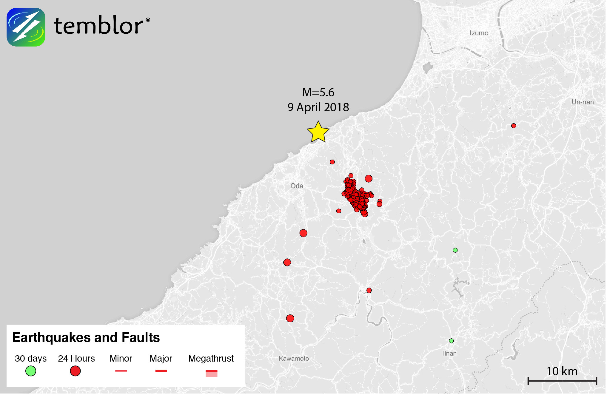
By using the USGS focal mechanism, and the aftershock pattern from the National Research Institute for Earth Science and Disaster Resilience (NIED) we believe this earthquake was left-lateral strike-slip in nature, on a fault oriented NW-SE. According to the Japan National Seismic Hazard Model (J-SHIS), this region has a low to moderate seismic hazard. In looking at the earthquake history of the region, very few M=5+ earthquake are seen in the last 40 years, with the largest being a M=6.7 in 2000, approximately 50 km to the east.

Even though this region has not seen a large earthquake recently, it does not mean that one is not possible. In the figure below, the Global Earthquake Activity Rate (GEAR) model is shown. This model uses global strain rates and the last 40 years of seismicity to forecast the likely earthquake magnitude in your lifetime anywhere on earth. From this map, we can see that in the location of Monday’s earthquake, a M=6.5 is likely. Therefore, the recent quake should not be seen as surprising, but should instead be a wake up call to residents of the region that they could be hit by a larger earthquake.

References
USGS
Japan Meteorological Agency
CBS News
Japan Times
Mainichi
Japan National Seismic Hazard Model (J-SHIS)
- Beware quiet segments of the Philippine Fault - May 16, 2025
-
ډیری عوامل افغاني ټولنې د زلزلې پر وړاندې زیانمنوي
- August 11, 2022 - What’s happening this week in Humboldt County, California: The squeeze - February 6, 2019