By Manuel Berberian, Ph.D. (University of Cambridge, UK); Elected Member, New York Academy of Sciences and David Jacobson, Temblor

Last night, at 5:32 a.m. local time, a M=6.0 earthquake struck eastern Iran. This quake comes less than three weeks after a damaging M=7.3 earthquake hit the country along the western border with Iraq. Last night’s M=6.0 quake took place in a rugged mountainous area, 50 km northeast of the provincial capital city of Kerman, which is home to over 500,000 people.
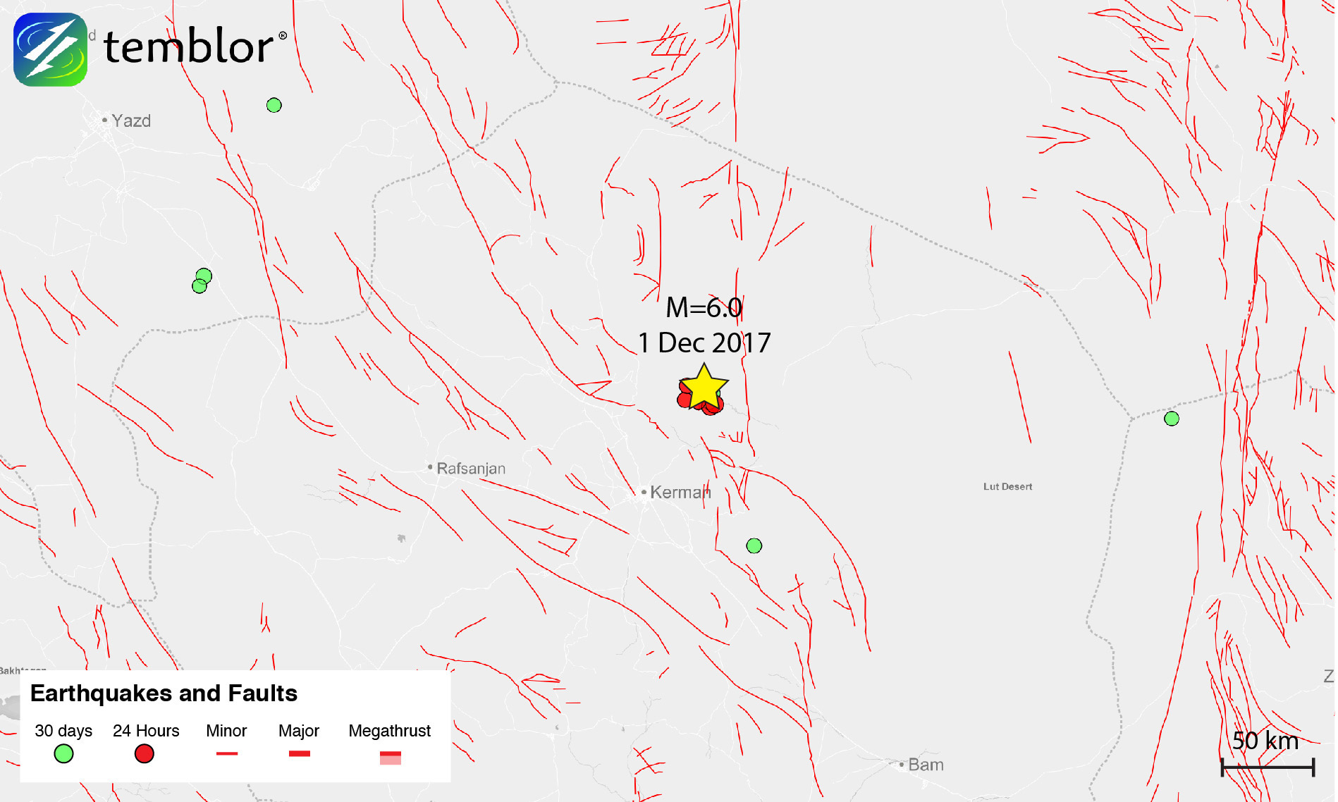
This earthquake is the latest in a series of several damaging events in the region, which is near the southern termination of the Kuhbanan mountain-bounding right-lateral strike-slip fault, where there are also numerous reverse faults. According to the USGS, last night’s quake was compressional in nature. This compression is related to the collision of the Arabian and Eurasian plates.

From the Google Earth imagery above, which has been annotated based on structural mapping in the area, and our own interpretation, the region contains numerous faults with variable motion. Because of the aridity and lack of erosion in the region, exposure is breathtaking, and structural features are extremely visible on the earth’s surface.
Even though this quake struck in a relatively sparsely-populated region, reports suggest that about eight villages were destroyed or damaged. Additionally, landslides and rock avalanches blocked mountain paths and roads, and 90% of the qanats, a gently-sloping underground channel used to transport water, collapsed, cutting water to many villages. Power outages have also been reported, but fortunately, there are no confirmed fatalities, though there are some injuries.

Based on the Global Earthquake Activity Rate model, which is available in Temblor, today’s earthquake should not be considered surprising. This model, which uses global strain rates and the last 40 years of global seismicity, forecasts the likely earthquake magnitude in your lifetime anywhere on earth. From the figure below, one can see that the likely earthquake in your lifetime in this area is M=6.75+. It should also be stated that this earthquake and the M=7.3 on November 12 are likely not related as they are approximately 1,200 km apart.

- Beware quiet segments of the Philippine Fault - May 16, 2025
-
ډیری عوامل افغاني ټولنې د زلزلې پر وړاندې زیانمنوي
- August 11, 2022 - What’s happening this week in Humboldt County, California: The squeeze - February 6, 2019