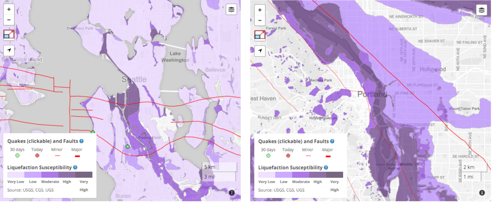
Temblor recently added liquefaction susceptibility maps for all of Oregon and Washington. These maps illustrate how large portions of both cities are susceptible to liquefaction. More Temblor maps of additional areas will be going up shortly.
Latest posts by Temblor (see all)
- Beware quiet segments of the Philippine Fault - May 16, 2025
-
ډیری عوامل افغاني ټولنې د زلزلې پر وړاندې زیانمنوي
- August 11, 2022 - What’s happening this week in Humboldt County, California: The squeeze - February 6, 2019