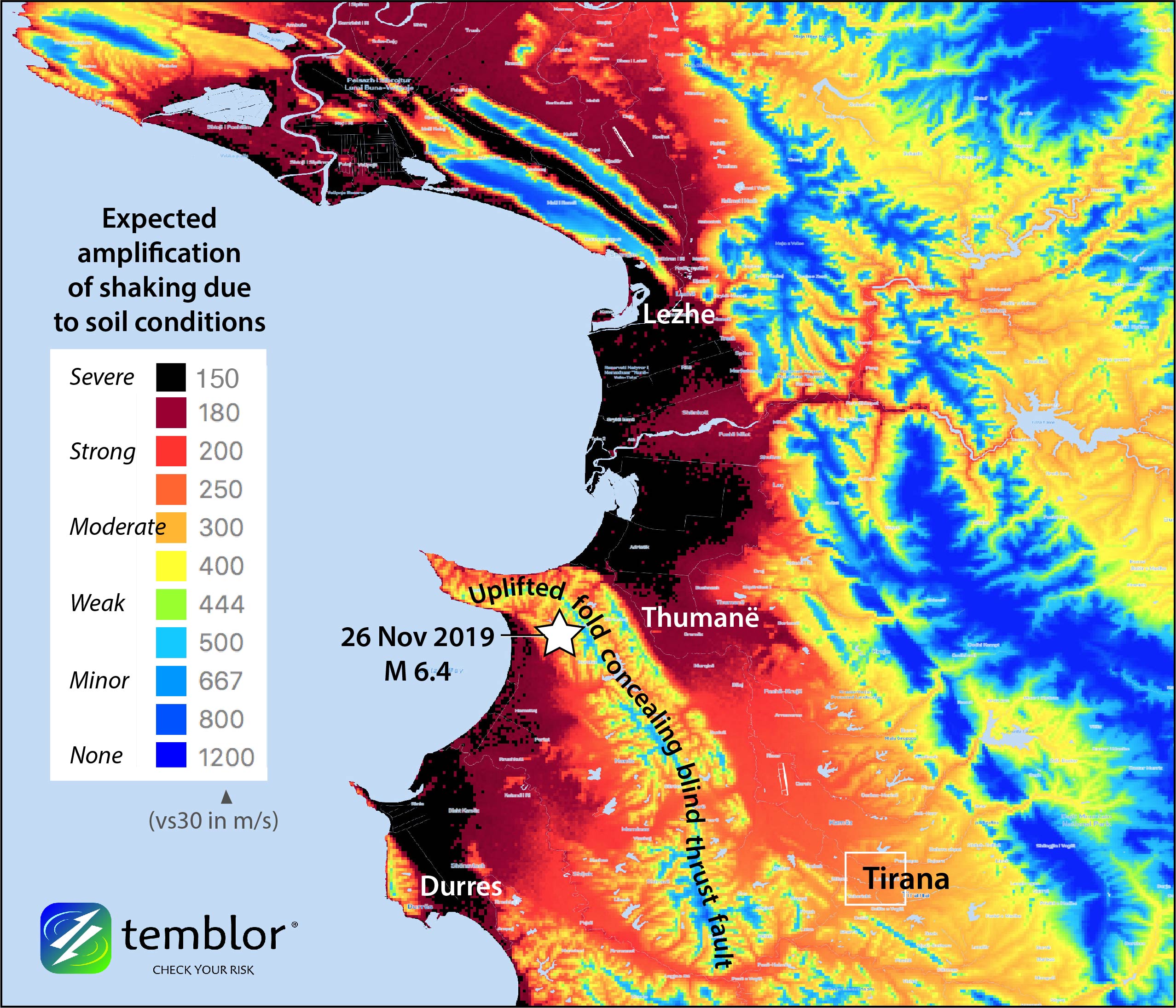
Temblor’s STAMP high resolution (200 m) model of site amplification reveals that in Thumanë, Durres, and Lezhe, the shaking could have been severely amplified, contributing to the damage of weak buildings. Areas in black likely shook four times higher than those in yellow. The black areas are water-saturated coastal estuaries and plains that might also liquify when shaken violently, which can cause buildings to sink and tilt, rendering them a total loss. The fault on which the Mag. 6.4 quake struck is probably concealed by a growing fold.
Latest posts by Temblor (see all)
- Beware quiet segments of the Philippine Fault - May 16, 2025
-
ډیری عوامل افغاني ټولنې د زلزلې پر وړاندې زیانمنوي
- August 11, 2022 - What’s happening this week in Humboldt County, California: The squeeze - February 6, 2019