
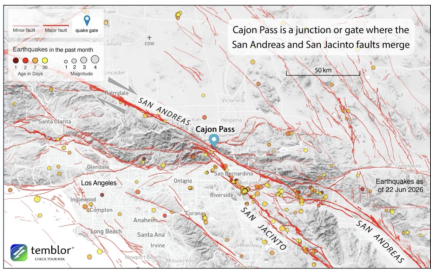
Figure 1. Mapped fault traces of Southern California, together with the past month of earthquakes (i.e., those from May 23 to June 22, 2026). The faults have sculpted the iconic Southern California landscape, with steep mountain ranges abutting the San Andreas and San Jacinto faults. Credit: Temblor, Inc. CC BY-NC-ND 4.0

Alka Tripathy-Lang is a freelance science writer based in Chandler, Arizona, and holds a Ph.D. in geoscience.
Latest posts by Alka Tripathy-Lang, Ph.D. (see all)
- Living through the Loma Prieta earthquake - October 21, 2021
- The Great Quake Debate: an interview with seismologist and author Susan Hough - August 27, 2020
- Salton Sea Swarm quiets down - August 12, 2020