By David Jacobson, Temblor
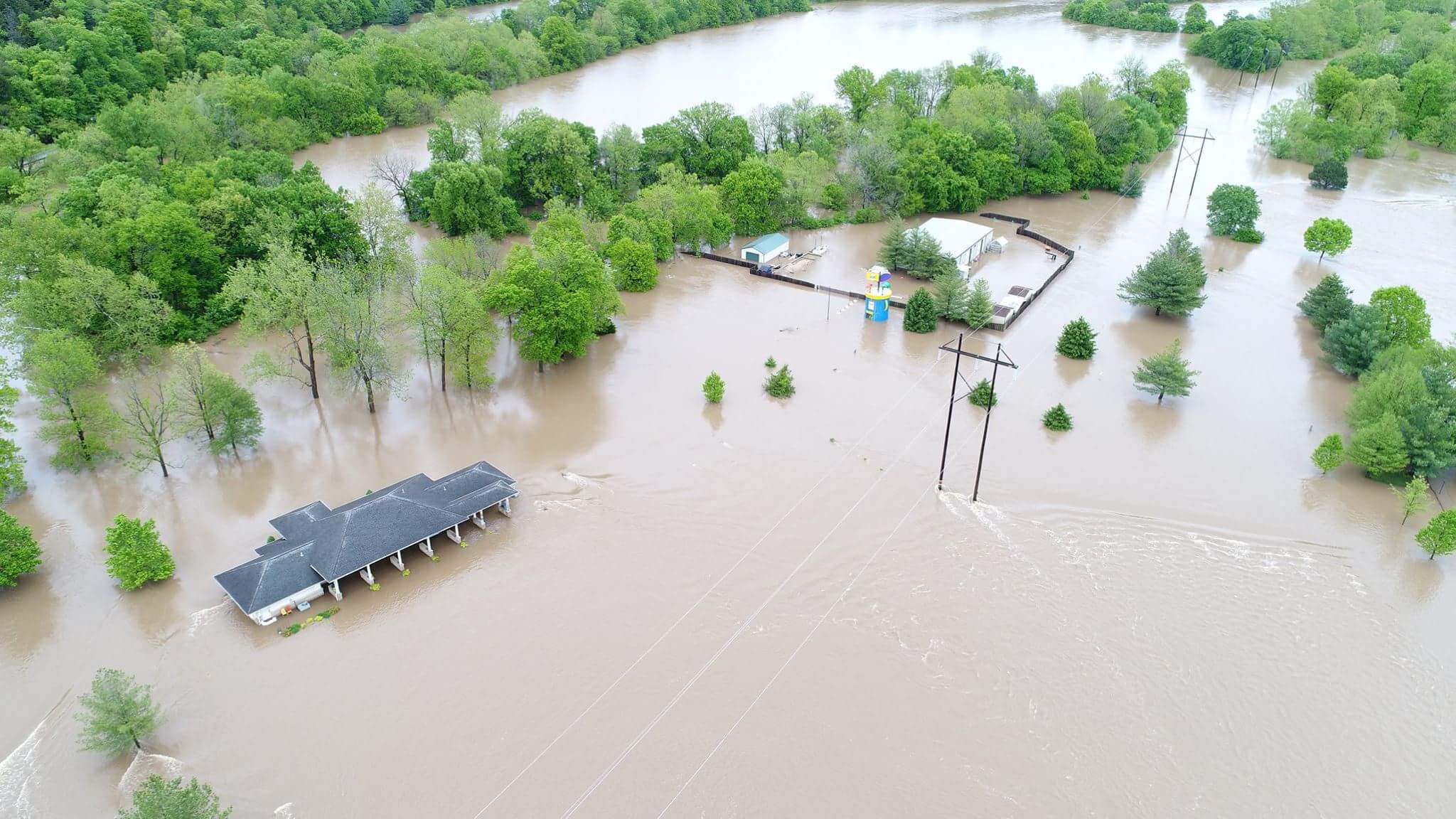
Over the weekend, torrential rain in Missouri, Arkansas, Oklahoma, and Illinois caused flooding, resulting in disruption and left at least 20 people dead. Depending on the location, between 6 and 12 inches of rain fell, leading to evacuations and hundreds of road closures. For many of these states, this is the most severe flooding in over 100 years, and many records have been smashed. Unfortunately, a new front is moving towards the area, which is expected to dump another 4-6 inches of rain on the already inundated area. Because of the scale of some of these floods, here we compare how well the flooding follows the FEMA flood maps.
The flood maps created by FEMA are intended to “identify flood hazards, assess flood risks, and provide accurate data to guide stakeholders in taking effective mitigation actions that result in safer and more resilient communities.” These maps are then used to support the National Flood Insurance Program, which lays out requirements for flood insurance. According to these requirements, only people who have a mortgage and are living in areas where there is a 10% chance of flooding per decade are required to carry flood insurance. By examining the scale of flooding, we can see if the maps accurately show where flooding is most likely. FEMA acknowledges that flood hazards can change due to weather patterns, erosion, and new development. Therefore, maps are periodically updated to reflect changes. Nonetheless, this can take time meaning some people may be at risk without knowing it.


For these locations, flooding is taking place in the 10% chance per decade zones. However, FEMA coverage is not complete. For example, the very small town of Van Buren, Missouri, which has been turned into a lake (see below), has not been mapped by FEMA. Unfortunately, this lack of information could lead to people thinking they are not at risk, when in fact they are.


What all of this information shows is that it is essential we have accurate flood maps for everyone at risk. Because a person’s home is likely to be their most valuable asset, protecting it is essential to their well-being. Knowing how at risk you are to flooding not only impacts if you are required to carry flood insurance, but influences where people may buy a house or whether or not they want to purchase insurance when it is not compulsory. Without this knowledge people could be lured into a false sense of security.
References
FEMA
The Weather Channel
The Washington Post
ABC News
- Earthquake science illuminates landslide behavior - June 13, 2025
- Destruction and Transformation: Lessons learned from the 2015 Gorkha, Nepal, earthquake - April 25, 2025
- Knock, knock, knocking on your door – the Julian earthquake in southern California issues reminder to be prepared - April 24, 2025