By David Jacobson, Temblor

When most people think about earthquakes, they think of California, and more recently, Oklahoma. However, there are many other regions in the county in which there is seismic activity, and where large earthquakes can occur. One of these is where Idaho, Montana, and Wyoming meet. This area is notable for being home to Yellowstone National Park, and Hebgen Lake, the site of a M=7.3 quake in 1959.

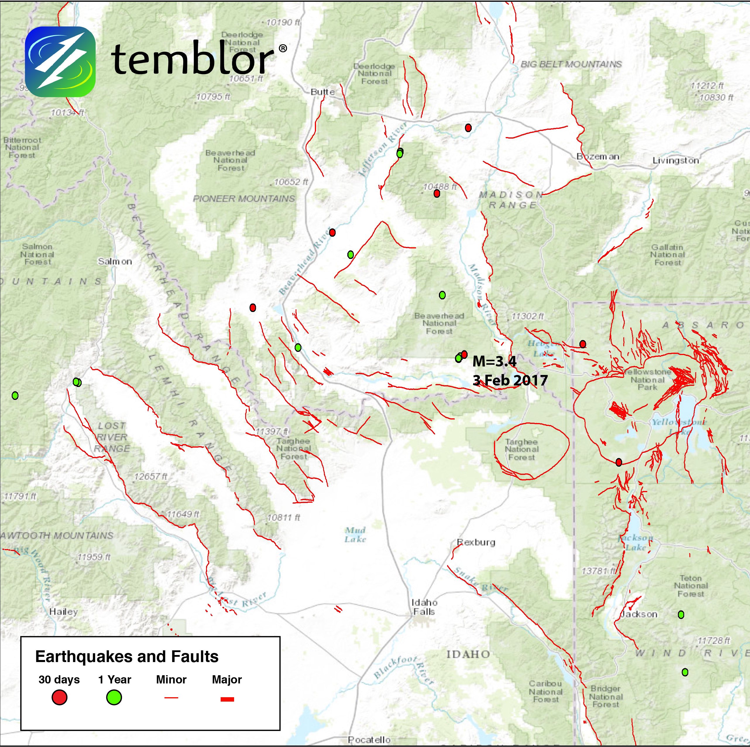
Over the last year, this region has only seen 19 M=3+ earthquakes. However, 7 of these have occurred in the last month, including a M=3.4 just a few hours ago. None of these quakes caused any damage and few were felt. Nonetheless, the rate of earthquakes increased by a large factor. While this increase in seismic activity is not cause for concern, it does highlight the fact that seismic hazards are widespread.
The seismic activity in this area is caused by a variety of factors. To some degree, rising magma and the movement of hot groundwater beneath Yellowstone can cause earthquakes. However, large earthquakes are not common in Yellowstone. This is because hot temperatures beneath the surface cause the bedrock to behave more ductile, meaning it is less likely to rupture. Having said that, in 1975 an earthquake with an approximate magnitude of 6.5 shook the region. Yellowstone is also unique as it is highly sensitive to more distant earthquakes, since the volcanic and hydrothermal systems can slightly destabilize resulting in small earthquakes and hydrothermal eruptions.

The more common cause of earthquakes in this region is from the gradual extension of the Basin and Range in the western United States. This type of extension, which creates normal faults, caused the 1959 M=7.3 Hebgen Lake earthquake that killed 28 people and resulted in millions of dollars worth of damage. The Basin and Range Province encompasses large portions of Washington, Oregon, Idaho, Montana, Nevada, and Utah, and is characterized by a series of mountain ranges. The extension in this region has been going on for the last 17 million years, and the most active faults are in southeastern Idaho and western Wyoming, which frequently generate small magnitude earthquakes. Overall, even though the area does not see many large earthquakes, the seismic hazard is real and must be remembered.

Sources
USGS
Idaho State University
- Earthquake science illuminates landslide behavior - June 13, 2025
- Destruction and Transformation: Lessons learned from the 2015 Gorkha, Nepal, earthquake - April 25, 2025
- Knock, knock, knocking on your door – the Julian earthquake in southern California issues reminder to be prepared - April 24, 2025