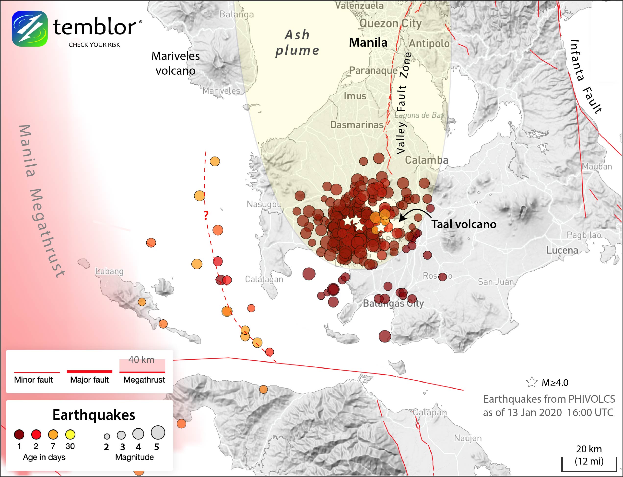
Map showing seismicity for the past 30 days in the region around Taal, as of Jan. 13, 2020. Earthquakes are from the PHIVOLCS earthquake catalog. The vast majority of these quakes have happened in the past few days, and tend to be less than magnitude-4.0. Quakes larger than magnitude-4.0 are marked by stars. The ash plume is based on satellite imagery taken after the eruption commenced on Sunday, Jan. 12, 2020. Credit: Ross Stein, Temblor
Alka Tripathy-Lang is a freelance science writer based in Chandler, Arizona, and holds a Ph.D. in geoscience.
Latest posts by Alka Tripathy-Lang, Ph.D. (see all)
- Living through the Loma Prieta earthquake - October 21, 2021
- The Great Quake Debate: an interview with seismologist and author Susan Hough - August 27, 2020
- Salton Sea Swarm quiets down - August 12, 2020