By David Jacobson, Temblor

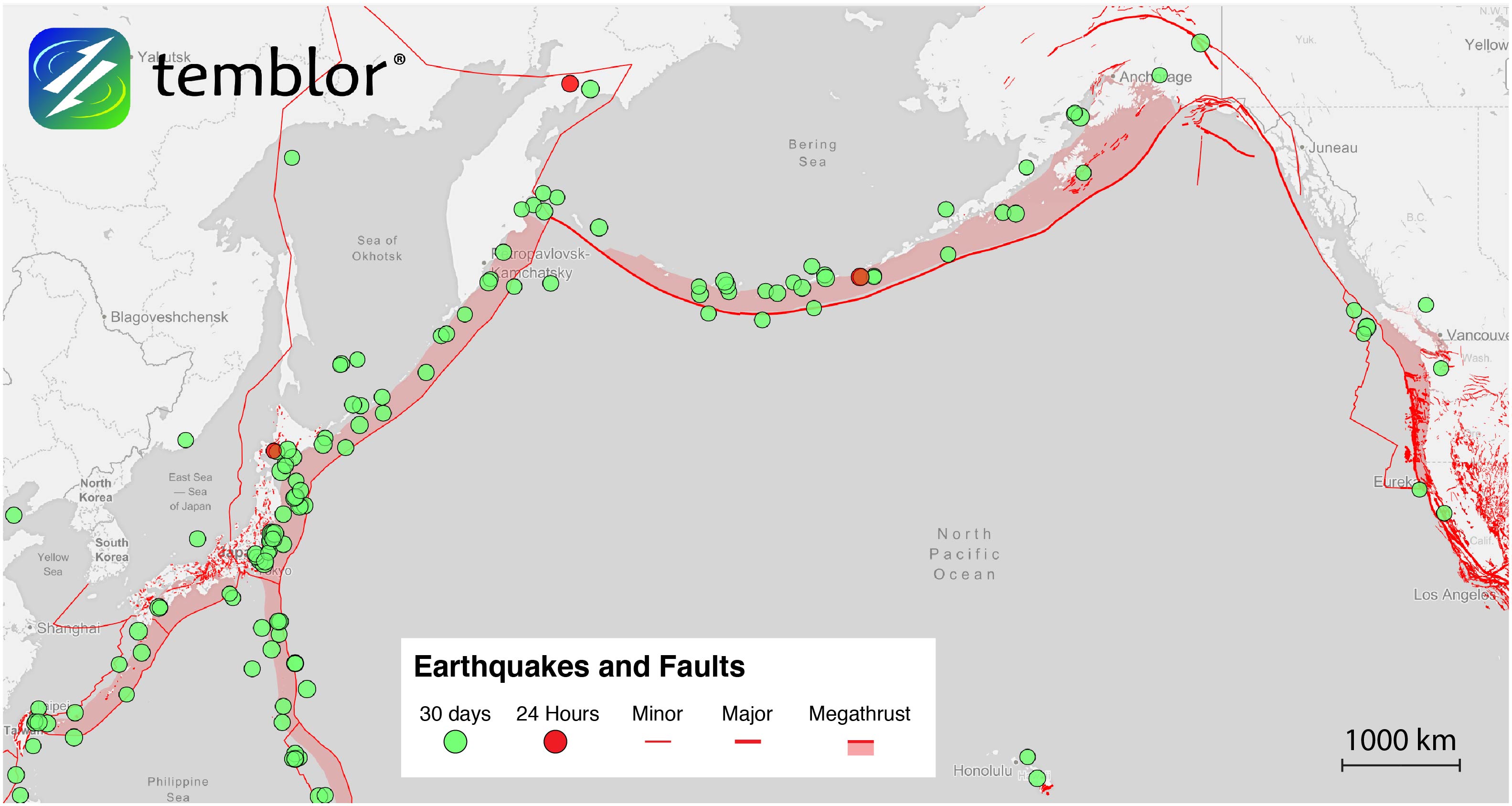
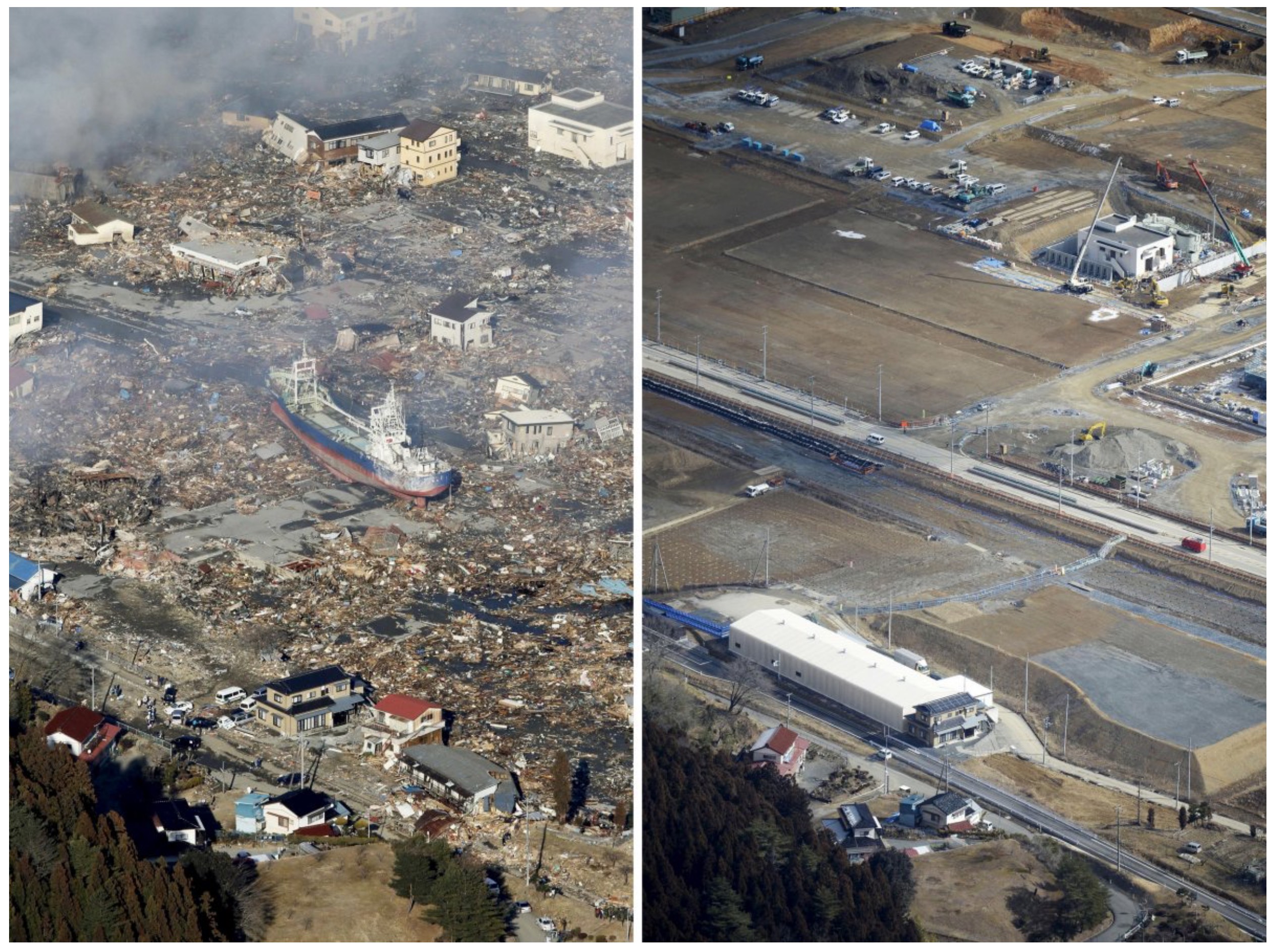
Subduction zone earthquakes are the largest on earth. Their effects can be dramatic, both in the shaking they cause, and the tsunamis they can create. This impact has been on display several times in recorded history, and was remembered two days ago (March 11) on the six-year anniversary of the devastating M=9.0 Tohoku earthquake, which killed over 15,000 people. Because of the severe impacts these quakes can have on society, researchers at the University of Bristol and the University College of London have developed a computer model to simulate the entire chain of events caused by these earthquakes.
By developing such a tool, the researchers hope to both limit lives lost and property damage in large offshore earthquakes. These types of quakes can occur on subduction zones all over the world, including in Japan, the Pacific Northwest (U.S. and Canada), Chile, New Zealand, Mexico and Indonesia, and can be viewed in Temblor as ‘megathrusts.’ In order to develop this model, numerous hazards had to be taken into account, including shaking, tsunamis, aftershocks, and landslides.
While this project, titled CRUST (Cascading Risk and Uncertainty of Earthquake Shaking and Tsunami) is not without limitations, it is the first model of its kind to combine these hazards into a single tool. Additionally, this simulation tool can be used all over the world. Such an approach was taken as areas currently at risk from subduction zone earthquakes rely on numerous independent models, which differ from location to location. In turn, this can limit their usability.
One of the aims of this tool is to generate more comprehensive hazard maps associated with subduction zone earthquakes. In turn, these maps could be used by governments and emergency services to help boost community resilience to these devastating events. Furthermore, over the course of the project, which began in 2014, the researchers have gained a greater understanding of how certain hazards “cascade” onto one another.
In addition to what the team has already been working on, the next step is for them to integrate potential losses from these large offshore earthquakes. In doing so, they would be quantifying both the hazards and the losses to create a more predictive tool. While this is a lofty goal, accomplishing it has great benefits. Only time will tell if they are able to do this, and if their model becomes widely accepted and used.
References
EurekAlert
Phys.org
- Earthquake science illuminates landslide behavior - June 13, 2025
- Destruction and Transformation: Lessons learned from the 2015 Gorkha, Nepal, earthquake - April 25, 2025
- Knock, knock, knocking on your door – the Julian earthquake in southern California issues reminder to be prepared - April 24, 2025