By David Jacobson, Temblor
See earthquakes in Papua New Guinea

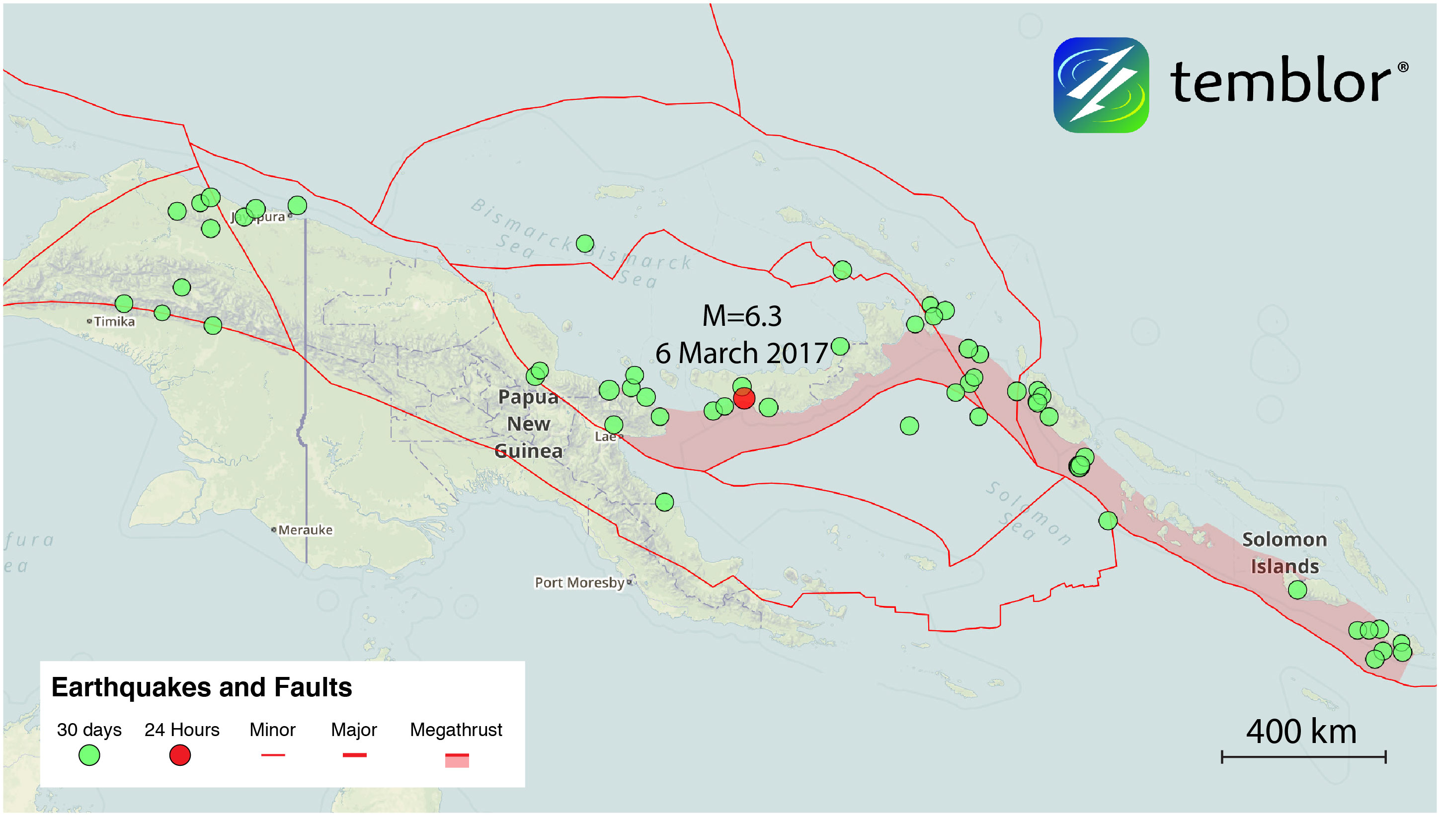
Yesterday, a M=6.3 earthquake shook the southwestern Pacific country of Papua New Guinea. No reports of damage have come in, and the quake did not trigger a tsunami warning. While the area in the immediate vicinity of the quake is sparsely populated, it was felt in the capital city of Port Moresby, approximately 450 kilometers away.
Based on the depth (50 km) and focal mechanism of this earthquake, it either occurred on or right above the subduction zone. These subduction zones/megathrusts can be viewed in Temblor. Using the Slab 1.0 model developed by Gavin Hayes at the USGS, the subduction zone in this location is approximately 60 km below the surface. However, the shallow-dipping surface on which yesterday’s quake occurred on suggests the subduction zone may have been involved.

This region near Papua New Guinea is very seismically active, having experienced 13 M=7.5 earthquakes since 1900. Additionally, according to the Global Earthquake Activity Rate (GEAR) Model, which is available in Temblor, a M=7.5+ earthquake is likely in your lifetime for this region. So, a while a M=6.3 is small in comparison, it is definitely a reminder of the region’s seismicity.
Reference
USGS
- Earthquake science illuminates landslide behavior - June 13, 2025
- Destruction and Transformation: Lessons learned from the 2015 Gorkha, Nepal, earthquake - April 25, 2025
- Knock, knock, knocking on your door – the Julian earthquake in southern California issues reminder to be prepared - April 24, 2025
