By David Jacobson, Temblor
Check your seismic hazard rank

At 3:55 a.m. this morning, a M=4.0 earthquake shook the Santa Cruz Mountains section of the San Andreas Fault. The epicenter of the quake was 20 km west of the city of Hollister, and shaking was felt in Santa Cruz. On the USGS website, over 400 people reported feeling the quake, which registered light shaking at the epicenter. The USGS does not expect there will be any damage from the earthquake. So far, at 10 a.m. this morning, 9 aftershocks have followed the mainshock, which was strike-slip in nature. The largest of these aftershocks was a M=2.6.
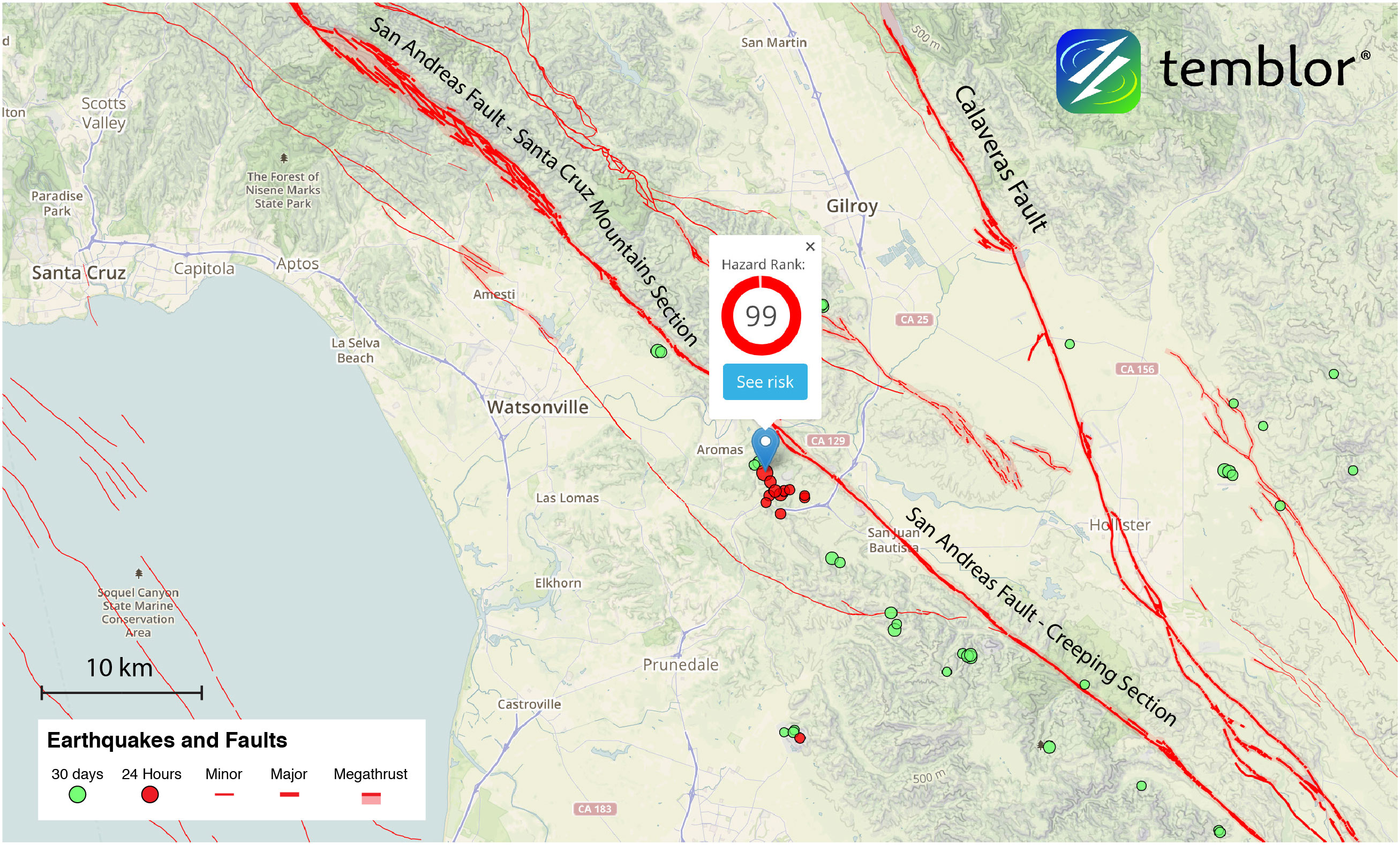
This morning’s earthquake occurred in an area which has a Temblor Hazard Rank of 99, meaning the likelihood of experiencing strong ground shaking is extremely high. South of the Santa Cruz Mountains section of the San Andreas Fault lies the creeping section. Creeping faults are where there is very slow, continuous motion. Additionally, large earthquakes do not tend to occur along creeping faults because not enough stress can build up. Thanks to research done by Ingrid Johanson and Roland Burgmann at UC Berkeley, we know that approximately 5 km north of today’s rupture the San Andreas Fault is locked, while 5 km to the south, it is creeping at 15-20 mm/yr. Because today’s quake occurred at a transitional point between these sections of the San Andreas Fault means that stress continually builds up, and is frequently released in earthquakes. In fact, this morning’s earthquake was located almost exactly at the southern tip of the 1906 rupture.
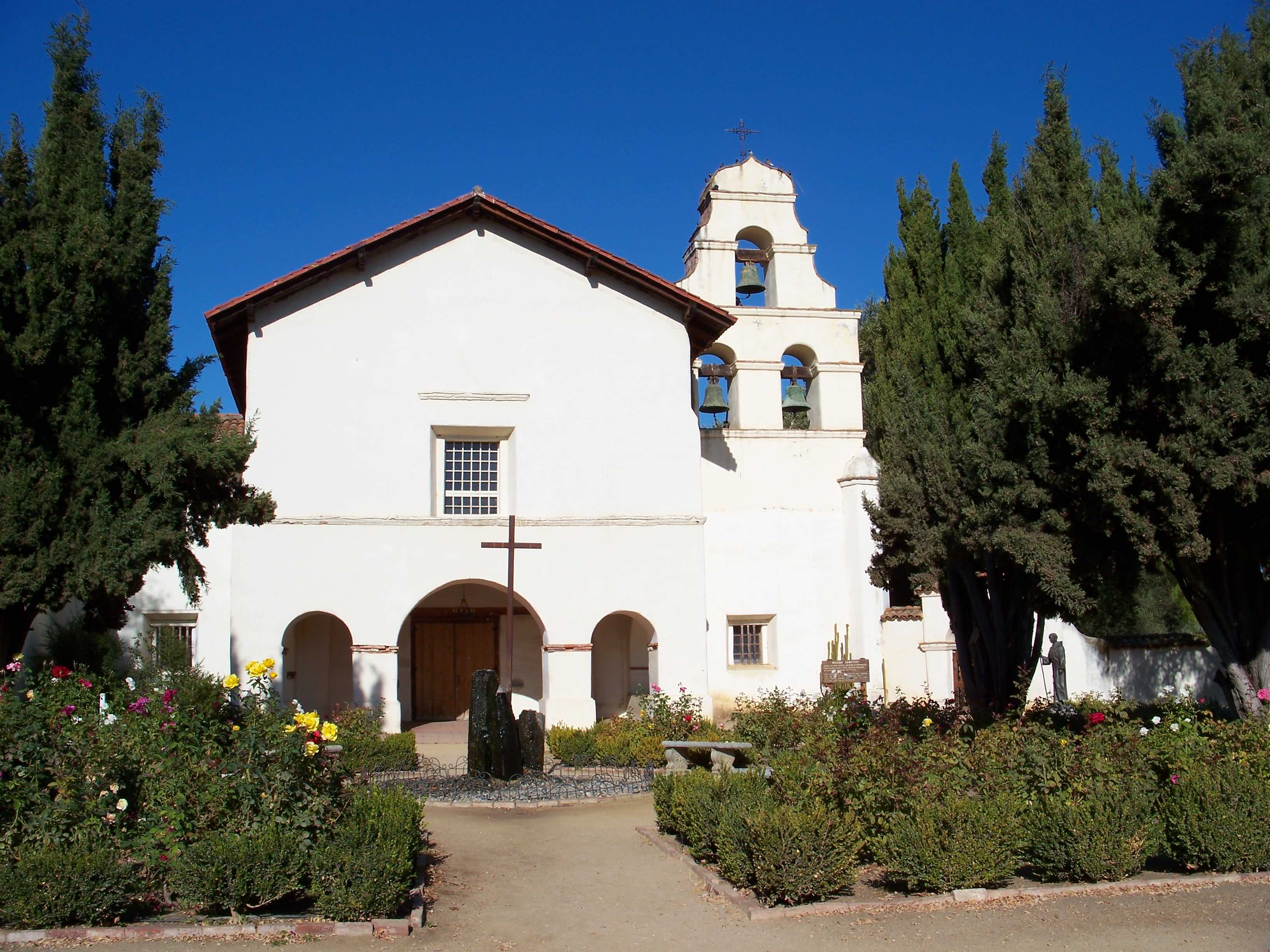
In addition to the 1906 San Francisco earthquake, which devastated much of the region, the area has seen other large earthquakes. In both 1890 and 1899, M=6+ earthquakes shook the region, and thanks to the long history of Mission San Juan Batista, which sits right on the San Andreas Fault, we also know that there was a M=5.5 earthquake in 1800. This makes it one of the California sites with the longest earthquake records.
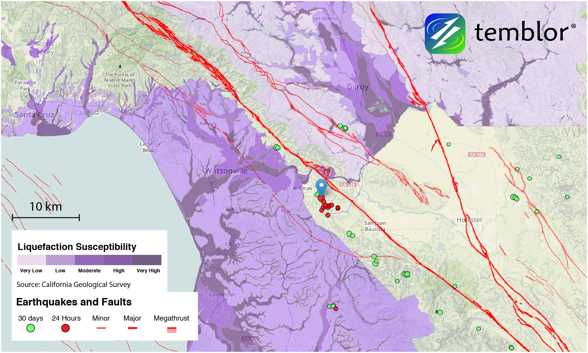
In addition to the great shaking hazard in the region, there is also a significant potential for liquefaction in a large quake. In the Temblor map below, it is clear that the nearby towns of Watsonville and Gilroy could see significant damage from liquefaction. It should be noted that no liquefaction data is available for San Juan Batista. Should more aftershocks continue, we will be sure to update this post.
References
USGS
Karen R. Felzer and Tianqing Cao (2008), UCERF3 Appendix H: WGCEP Historical California Earthquake Catalog, USGS Open File Report 2007-1437H CGS Special Report 203H
SCEC Contribution #1138H, Version 1.0
A. Johanson and R. Burgmann, Creep and quakes on the northern transition zone of the San Andreas fault from GPS and InSAR data, GEOPHYSICAL RESEARCH LETTERS, VOL. 32, L14306, doi:10.1029/2005GL023150, 2005
- Earthquake science illuminates landslide behavior - June 13, 2025
- Destruction and Transformation: Lessons learned from the 2015 Gorkha, Nepal, earthquake - April 25, 2025
- Knock, knock, knocking on your door – the Julian earthquake in southern California issues reminder to be prepared - April 24, 2025