By rapidly deploying real time seismic instruments, French researchers improved their understanding of the seismic crisis at Mayotte, an island in the Indian Ocean.
By Davitia James, Temblor Earthquake News Extern (@davitiaa)
Citation: James, D., 2022, Listening closely to Mayotte’s new underwater volcano, Temblor, http://doi.org/10.32858/temblor.250
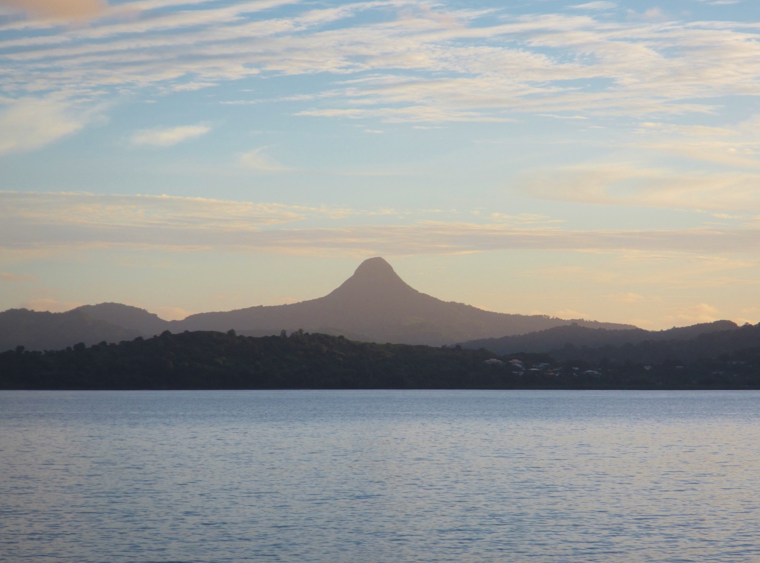
On May 10, 2018, after a century of near quiet, the island of Mayotte woke abruptly, seismically speaking, to a flurry of earthquakes. The initial minor jolts preceded a magnitude-5.9 quake that struck five days later — the strongest recorded earthquake felt on the Indian Ocean isle. Shaking from subsequent earthquakes continued for months, sparking concern across the French territory.
Shortly after activity began, multiple French research institutes and universities responded to requests for help from Mayotte’s geologic survey. Together, they created the Mayotte Volcanological and Seismological Monitoring Network.
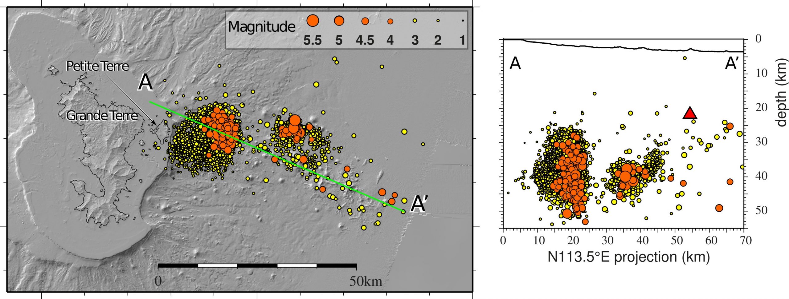
The following year, observations of both surface changes and curious tremors revealed that an underwater volcanic eruption caused the seismic crisis. In new research published in Geophysical Journal International, scientists describe how seismometers were rapidly installed both on the island and offshore to better monitor the activity. The team of researchers identified two seismic clusters — one further away from the island, related to rocks breaking as magma moved closer to the surface early in the eruption, and one closer to land, caused by the magma shifting beneath the island, making it sink.

Building a seismic network
After seismicity ramped up in May 2018, satellite data and ground motion models showed the east side of Mayotte was deflating, or decreasing in elevation, signaling that magma has moved away from the area in question. Then, in November, a volcanic tremor originating near Mayotte was recorded across the globe. These kinds of tremors are different from short, abrupt earthquakes. Also called harmonic tremor, they produce a prolonged release of energy, caused by magma migrating underground. The November, 2018 tremor indicated that magma was flowing somewhere near the islands. The event was peculiar because the seismic waves were even lower-frequency than a typical tremor. In fact, the seismic record of the 25-minute tremor was almost missed entirely because it was so low-frequency and slow.
In February 2019, scientists installed ten seismic stations around the island — four on land and six in the water. The latter, called ocean bottom seismometers, surrounded the most seismically active offshore area. During “pickathons” the team sorted incoming seismic data for several hours at a time in shifts says Jean-Marie Saurel, a seismologist at Institut de Physique du Globe de Paris (IPGP) and lead author of the new publication. The researchers were able to relocate thousands of signals identified by the seismic instruments.
Observations from a May 2019 research cruise gave the final clues to the origins of the earthquakes. An active, underwater volcano was rumbling about 31 miles (50 kilometers) offshore of Mayotte and about 1.8 miles (3 kilometers) below the surface.
The Mayotte model
To accurately trace the path of seismic waves, seismologists need a detailed velocity model of the layers below, says Saurel. He likens these models of the Earth’s crust to an onion, with different layers of varying thickness and composition. Changes in material and thickness affect the speed of the seismic waves traveling through a given layer. After the waves from an earthquake arrive at stations nearby or around the globe, seismologists need to know how quickly they travelled to determine exactly where they came from. A good velocity model is a key part of locating where an earthquake originated.
Before the spike in seismicity, only one regional velocity model existed for Mayotte, created from data acquired about 125 miles (200 kilometers) away during the 1980s, says Saurel. Instead of using this model that likely doesn’t reflect Mayotte’s complexities, he says, “at the beginning of the crisis, we used a model, where we assume the layers are all the same,” and average the velocity information all around the earth. Data from the new seismic network helped scientists update the 80’s-era Mayotte model. A more accurate model means more accurate earthquake locations.
Magma on the move
With a clearer look at earthquake locations, a pattern emerged. Most of the seismic activity clustered near Mayotte, with the earthquakes decreasing in magnitude towards the shore. This near-shore cluster was likely caused by magma moving away from the island, causing the land surface to dip downward and eastward, as seen in satellite data.
However, about 10% of the observed seismicity struck further eastward, away from the island and closer to the newly formed underwater volcano immediately southeast of it. The earthquake activity in this cluster peaked during August 2018. Scientists suspect that this cluster is linked to magma forcing its way through the rocks as the new volcano formed.
The magma chamber that feeds this volcano is 15 kilometers (nine miles) closer to the island than the volcano edifice on the ocean floor, says Pascal Bernard, a seismologist at IPGP who was not involved with this research. In addition to the bizarre worldwide tremor in November of 2018, a puzzling pulsating seismic signal was noted months before the volcano was found, he says, that continues still. It is a strong, lengthy signal that has softened over time, almost like an exhale. It is now attributed to the magma chamber regularly dilating and collapsing every 15 seconds over the span of about an hour, though the exact causes of this are still unclear, he says.
More stations for Mayotte
Because the volcano off the coast of Mayotte came as a surprise, scientists have much to learn. Saurel says the collaborations across French institutions allowed the team to pool funding and achieve more than had they been acting individually. Still, one ocean-bottom seismometer costs approximately $100,000, limiting the number the team can deploy.
Over the next several years the team plans to deploy more stations and keep up research campaigns in the ocean, as well as to continue strategizing with officials for the best ways to protect the island population. The future ocean bottom observatory, with seafloor instruments connected to land by cables, will offer an early warning of seismic and volcanic activity, says Bernard, and allow safe response during the evolution of a new, unpredictable volcano that is too far offshore to be monitored by land-based instruments alone.
References
Saurel, J. M., et al., (2022). Mayotte seismic crisis: building knowledge in near real-time by combining land and ocean-bottom seismometers, first results. Geophysical Journal International, 228(2), 1281-1293.
Further Reading
Lemoine, A., et al., (2020). The 2018–2019 seismo-volcanic crisis east of Mayotte, Comoros islands: seismicity and ground deformation markers of an exceptional submarine eruption. Geophysical Journal International.
Cesca, S., et al., (2020). Drainage of a deep magma reservoir near Mayotte inferred from seismicity and deformation. Nature geoscience, 13(1), 87-93.
- Venezuela’s doublet leaned toward Caracas - June 30, 2026
- Is Southern California’s Cajon Pass an ‘earthquake gate’ ready to open? - June 29, 2026
- Philippines magnitude 7.8 shock may have loaded the central Cotabato subduction zone - June 11, 2026