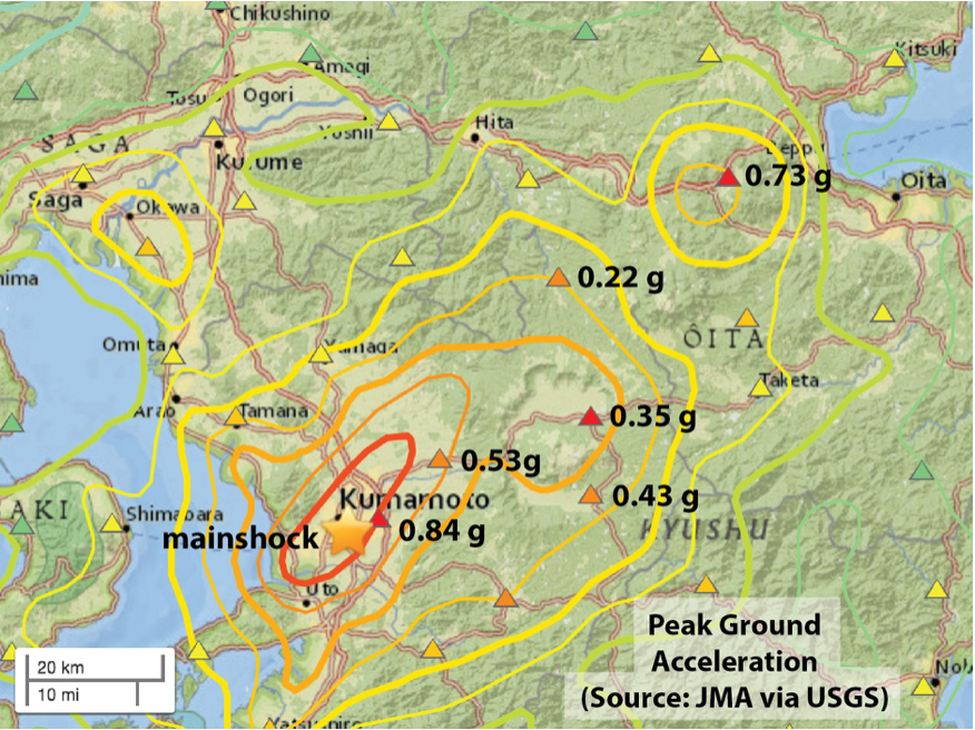
Preliminary map of observed (triangles) and inferred (contours) shaking from the Mw=7.0 event, from the USGS. The contours blend a model and data. The shaking appears to be much stronger to the northeast, suggesting how the 40 km long fault ruptured (or, unzipped).
Latest posts by Temblor (see all)
- Venezuela’s doublet leaned toward Caracas - June 30, 2026
- Is Southern California’s Cajon Pass an ‘earthquake gate’ ready to open? - June 29, 2026
- Philippines magnitude 7.8 shock may have loaded the central Cotabato subduction zone - June 11, 2026