By David Jacobson, Temblor

Even though the rain has stopped for now, the flooding in California continues to wreak havoc on residents across the state, and has taken the lives of at least 8 people. As more rain fell last night, approximately 14,000 residents fled their flooded homes in San Jose. Additionally, mandatory evacuations were in place for several thousand residents in what is described as the worst flooding event 100 years. To make matters worse, the 101 Freeway, which serves as a main commuter line from the South Bay to San Francisco, was shut this morning due to rising waters, disrupting the morning commute.
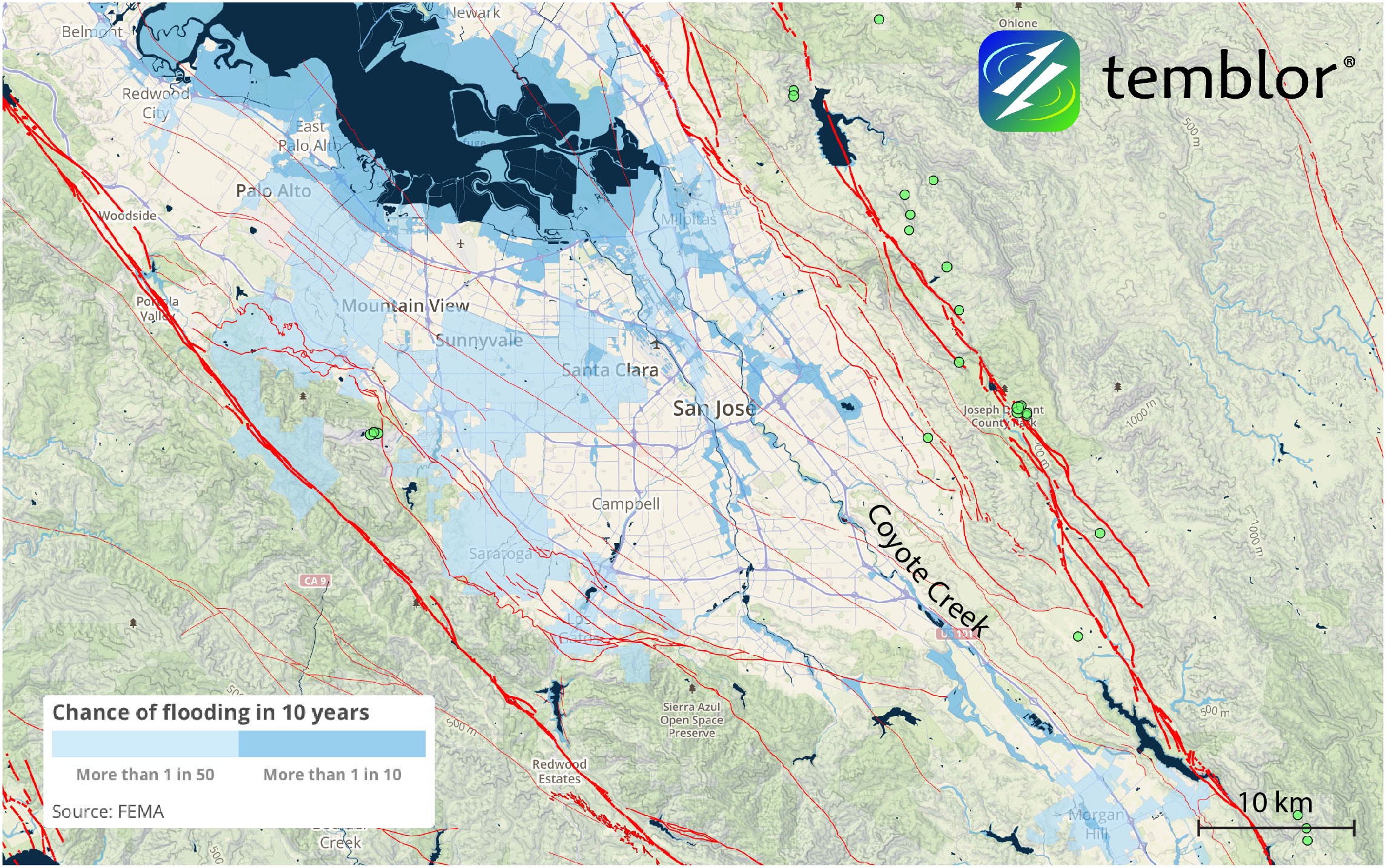
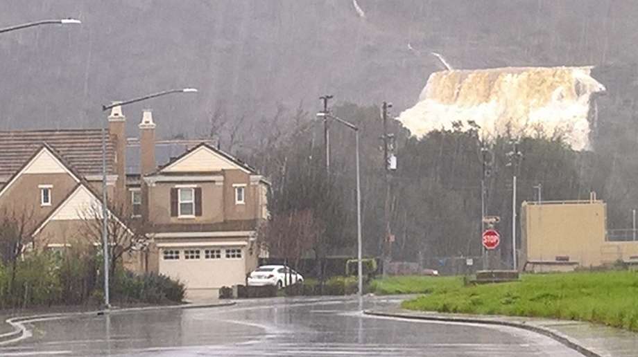
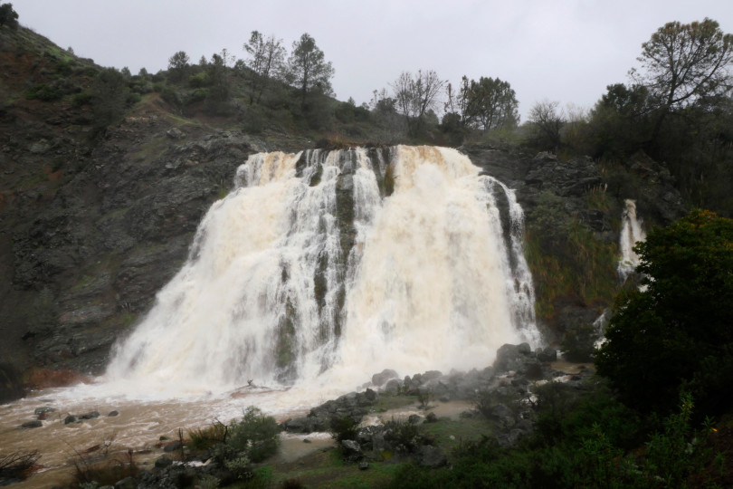
The culprit for much of the flooding in Silicon Valley, is Coyote Creek. In addition to runoff from the harsh storms over the last week, Coyote Creek is an outlet for Anderson Lake, a reservoir that for the first time in 11 years, reached capacity. This forced the use of the Anderson Dam spillway, which accentuated flooding problems. It should be noted that normally Anderson Lake is not permitted to be at more than 68% capacity due to the seismic threat in the area. For more information on that, click here.
In addition to the mandatory evacuation zone in San Jose, which at its largest is 1.5 miles long and one mile wide, there is also a voluntary evacuation zone which covers a seven mile stretch along Coyote Creek. These evacuations occurred as the creek reached a record 4 feet above flood stage, sending chest-high water through neighborhoods. For 220 people this meant being rescued by boat, and in some cases people who had waded through floodwaters were sprayed with soap and water to clean off engine fuel, garbage, and sewage which has contaminated some of the floodwater.

At this stage, local officials are unsure when residents will be allowed back to their homes, as flood warnings are in place until Saturday. While San Jose residents were warned about flooding, Mayor Sam Liccardo conceded that this scale of flooding was not anticipated. As we reported yesterday, the majority of areas flooded are located in zones where the likelihood is 10% in any given decade. Should more information come in on these floods, or should conditions worsen, we will continue providing updates.
References
SFGate
LA Times
San Francisco Chronicle
- Earthquake science illuminates landslide behavior - June 13, 2025
- Destruction and Transformation: Lessons learned from the 2015 Gorkha, Nepal, earthquake - April 25, 2025
- Knock, knock, knocking on your door – the Julian earthquake in southern California issues reminder to be prepared - April 24, 2025