By David Jacobson, Temblor
See if you are in a flood zone
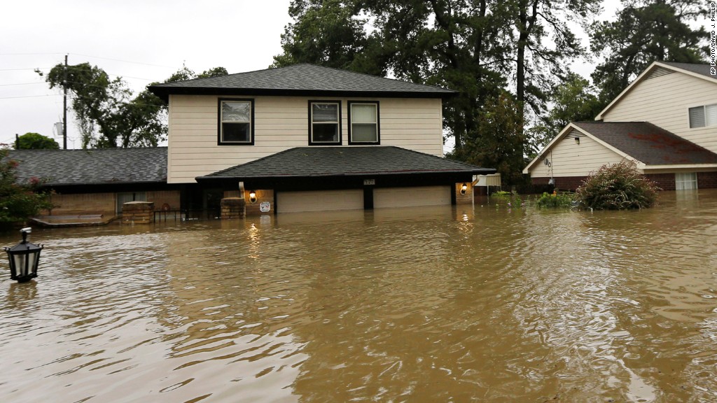
As the remnants of Hurricane Harvey move across the Midwest, it leaves a destructive wake across southeast Texas, including in Houston, the country’s fourth largest city. In some places, over 50 inches of rain fell in a matter of days, exceeding the annual rainfall expected in some locations. The result of this is extremely widespread flooding, leaving houses underwater and dozens of fatalities reported so far. As we reported on Wednesday, numerous losses will have to be paid completely out of pocket, as only 15% of people in Harris County, home to the city of Houston, carry flood insurance. Government regulations stipulate that homeowners are only required to carry flood insurance if they live in a FEMA-designated “100 year flood zone” (1 chance in 10 of flooding per decade) and have a government mortgage.
In a New York Times video published yesterday, they showed before and after images of flooded areas outside of Houston. We thought we’d take a look at how the actual flooding compares to the FEMA flood maps. It should be stated that the images shown by the New York Times are from areas close to rivers and bayous, meaning they are prone to flooding. Additionally, the New York Times images may not show peak water inundation.


As the images above show, flooding is extremely extensive, and once floodwaters recede, the damage will likely take years to repair. In three of the four maps above, the majority of the flooding is limited to zones where FEMA suggests there is at least 1 chance in 10 of flooding in a decade. In the last figure, there is extensive flooding in FEMA’s 1 chance in 50 in a decade zone. Therefore, based on this limited spot-checking, in these locations, the maps appear to do well. Having said that, we know that in Houston, areas that have never experienced flooding, are now under feet of water. Some people have been quick to attribute this to urban planning and the destruction of native wetlands. However, the reality is that no city is prepared to receive 50 inches of rain. This storm was extraordinary, dumping over 19 trillion gallons of water on Texas in a matter of days. Nonetheless, given the scope of this tragedy, what will hopefully come out of it is that people can better protect themselves from natural disasters like this through insurance or retrofitting. If more people take these measures, cities will recover faster, meaning as a country we will be better off on the backend of disasters like Hurricane Harvey.
References
New York Times
FEMA
CNN
- Beware quiet segments of the Philippine Fault - May 16, 2025
-
ډیری عوامل افغاني ټولنې د زلزلې پر وړاندې زیانمنوي
- August 11, 2022 - What’s happening this week in Humboldt County, California: The squeeze - February 6, 2019