By David Jacobson, Temblor
Click here to protect yourself from natural disasters
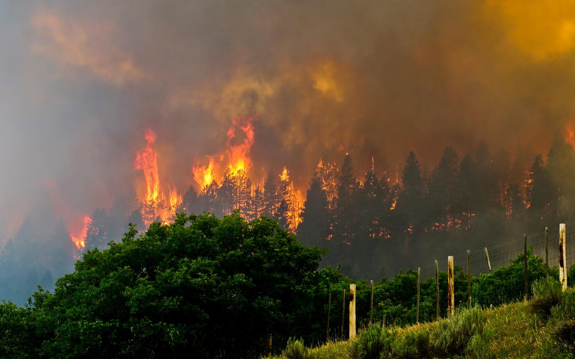
A fire rages across southwestern Colorado
Since June 1, the 416 Fire just north of Durango, Colorado has burned over 25,000 acres, and forced the evacuation of more than 2,000 residents. Fortunately, the fire has not consumed any structures yet, as it is primarily burning in the San Juan National Forest and on private land. The fire is now the fifth largest in wildfire in the state’s history, and it is only 15% contained. Numerous problems have arisen while trying to contain this fire including the steep slopes, lack of access to the area, and extreme weather conditions. The map below shows the fire suppression difficulty around the 416 Fire, courtesy of the West Wild Wildfire Risk Assessment.

More incidents this year
The name “416” for this fire represents the number of incidents the Columbine Ranger District has responded to in the San Juan National Forest this year. While the national forest covers 1.8 million acres, according to NPR, this number of incidents is well ahead of the average yearly pace. It should be noted that an incident can refer to a red flag warning, a false alarm, or a fire. Nonetheless, such a large number of incidents as well as current conditions have forced the closure of the park.

While the current conditions in the park are extreme, due to several fires, it also remains at a Stage III fire restriction because of extreme droughts the region has seen. According to forest service officials, the park will remain closed until, “the forest receives sufficient moisture to improve conditions.” How long this will take is yet to be seen, though scattered showers and thunderstorms are in the forecast for the rest of the week, until drier conditions return next week. Therefore, the park could remain closed for some time.
Colorado is not the only state that has experienced recent major droughts. For example, in neighboring Arizona, parts of the state saw as little is 11 millimeters (0.44 inches) of rain all winter. Additional states that have been impacted include New Mexico, and Utah. All of this means that the fire threat increases, and that once a fire begins, much of the vegetation is dry, and can act like kindling. As of right now, across both Arizona and Colorado, there are 10 wildfires actively burning.

Recognize your fire risk
Such increased fire risk across much of the southwest can clearly be seen in maps produced by the National Interagency Fire Center. Every month, they come out with wildland fire potential outlook maps. The map for June is shown below and clearly highlights the fire risk in the states that have recently experienced significant drought. Therefore, if you live in one of these zones, it may be in your best interest to assess if there are ways you could reduce your fire risk.

References
Wildfire Today
NPR
Inciweb
9 News (NBC Affiliate)
West Wide Wildfire Risk Assessment
- Beware quiet segments of the Philippine Fault - May 16, 2025
-
ډیری عوامل افغاني ټولنې د زلزلې پر وړاندې زیانمنوي
- August 11, 2022 - What’s happening this week in Humboldt County, California: The squeeze - February 6, 2019