By David Jacobson, Temblor
See earthquakes in New Zealand

It has been just over four months since the M=7.8 Kaikoura, New Zealand earthquake rattled the country, leaving the landscape scarred, homes destroyed, and cows stranded. Since the quake, approximately 50 people from both New Zealand and overseas institutions have been working to measure exactly what happened. At a presentation a couple days ago, their message was clear, this quake is probably the most complex ever recorded.
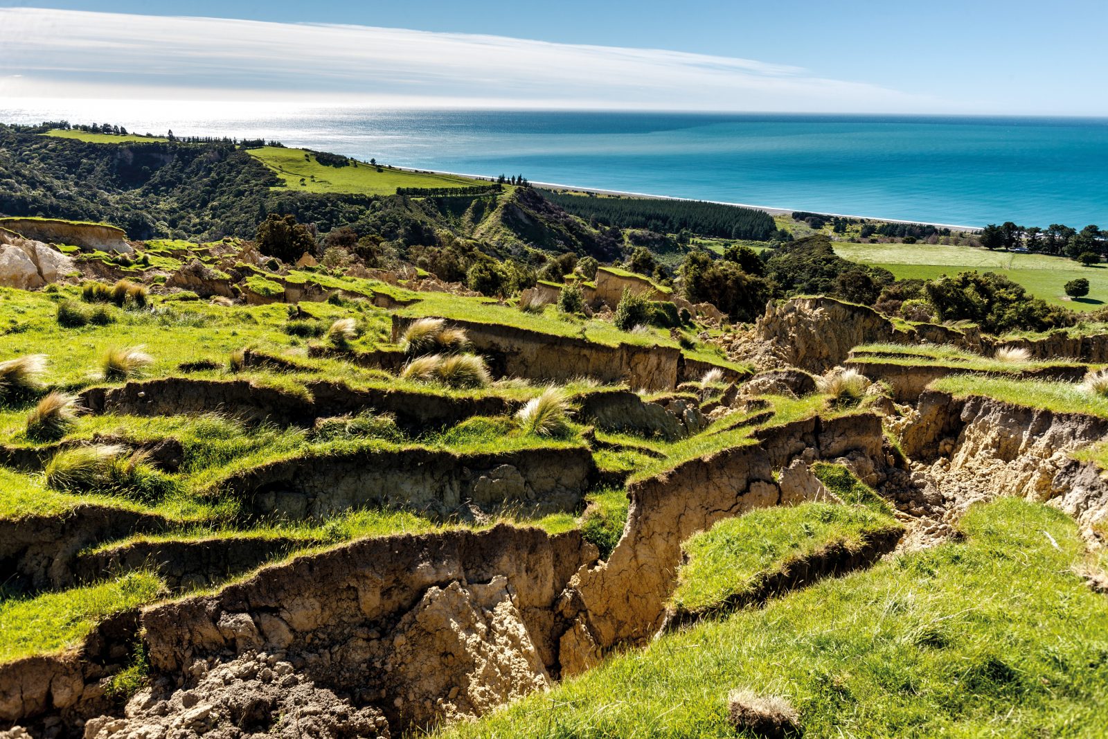
In the immediate aftermath of the quake, scientists at GNS Science in New Zealand knew that something was different. They were recording vastly different magnitudes (From M=6.6 to M=7.8), and there went from being no tsunami warning, to one being issued, to minimal wave action in short succession. Now, the culprit of this confusion appears to be known, 21 different faults over 180 kilometers ruptured in the November 14, 2016 quake.

According to GNS scientist Kate Clark, initial estimates suggested that five faults ruptured from south to north in the Kaikoura earthquake. In an interview, Clark said, “we were all a bit bewildered, confused, and also amazed…It was kind of our first clue that this was probably going to be quite a complicated and unusual earthquake.” She was right, as one month later, in December, the number of fault ruptures discovered had risen to nine. Now, with the help of modern technology, Clark says that 21 different faults ruptured, some of which, were not known prior to the earthquake. Another astounding number is that of the 21 faults that ruptured, 14 of them saw ground displacements greater than 1 meter. The most significant of these was along the Kekerengu Fault, where up to 12 meters (39 feet) of horizontal displacement was measured. For comparison, in the 1906 M=7.9 San Francisco earthquake, the maximum displacement was 21 feet near Tomales Bay.

One of the reasons why scientists believe the Kaikoura quake was so complex is because of where it occurred. New Zealand sits on the boundary between the Australian and Pacific plates, meaning seismicity is already significant. However, around Kaikoura, that plate boundary is evolving as to the north, there is the Hikurangi Subduction Zone, and to the south, the Alpine Fault, which is similar to the San Andreas. Because of this, there is both significant compression and shearing. In turn, fault ruptures in this region can be quite complex. Having said that, no one could have predicted this event.

References
GNS Science
Radio New Zealand
Stuff.co.nz
USGS
-
ډیری عوامل افغاني ټولنې د زلزلې پر وړاندې زیانمنوي
- August 11, 2022 - What’s happening this week in Humboldt County, California: The squeeze - February 6, 2019
- Finding of the unexpected tsunami due to the strike-slip fault at central Sulawesi, Indonesia on 28 September 2018, from the preliminary field survey at Palu - October 15, 2018