By David Jacobson, Temblor
See earthquakes in the Philippines

At 5:21 a.m. local time, a M=5.8 earthquake shook the southern Philippines, just four days after the northern part of the country experienced a M=5.9. According to the Philippine Institute of Volcanology and Seismology (PHIVOLCS), at least 30 houses were damaged, and power outages were experienced in Wao, 13 km west of the epicenter. Additionally, further west of the epicenter in Lanao del Sur, water pipes ruptured and residents fled into the streets to avoid falling objects. PHIVOLCS also warned that landslides may have occurred near the epicenter and added that local officials were advised to look for damage to public and private infrastructure.
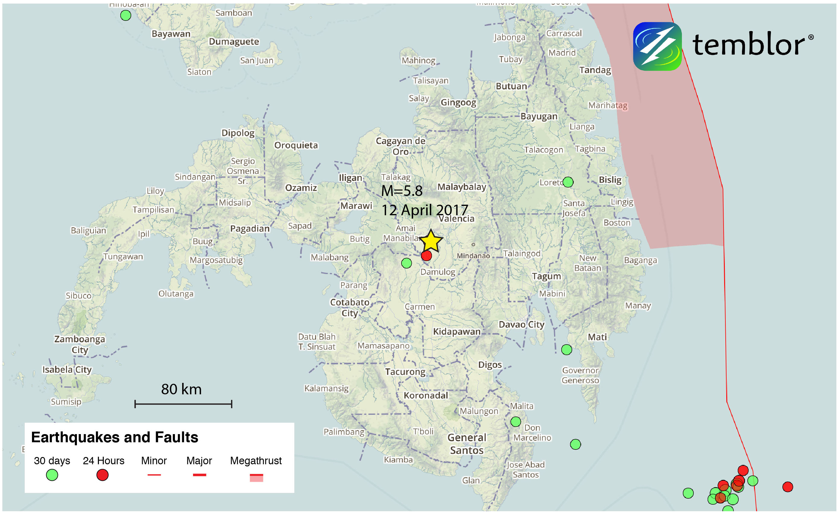
According to data from the USGS, very strong shaking would have been experienced near the epicenter, with moderate damage expected. Fortunately, no reports of casualties have come in, and based on USGS PAGER data, fatalities are unlikely. This quake occurred at a depth of 8 km, and was pure strike-slip in nature. While PHIVOLCS does not have any mapped faults in the immediate vicinity of the earthquake, they do report that it occurred on a northwest-trending fault, which means the slip was left-lateral. This orientation matches the majority of faults in the region.
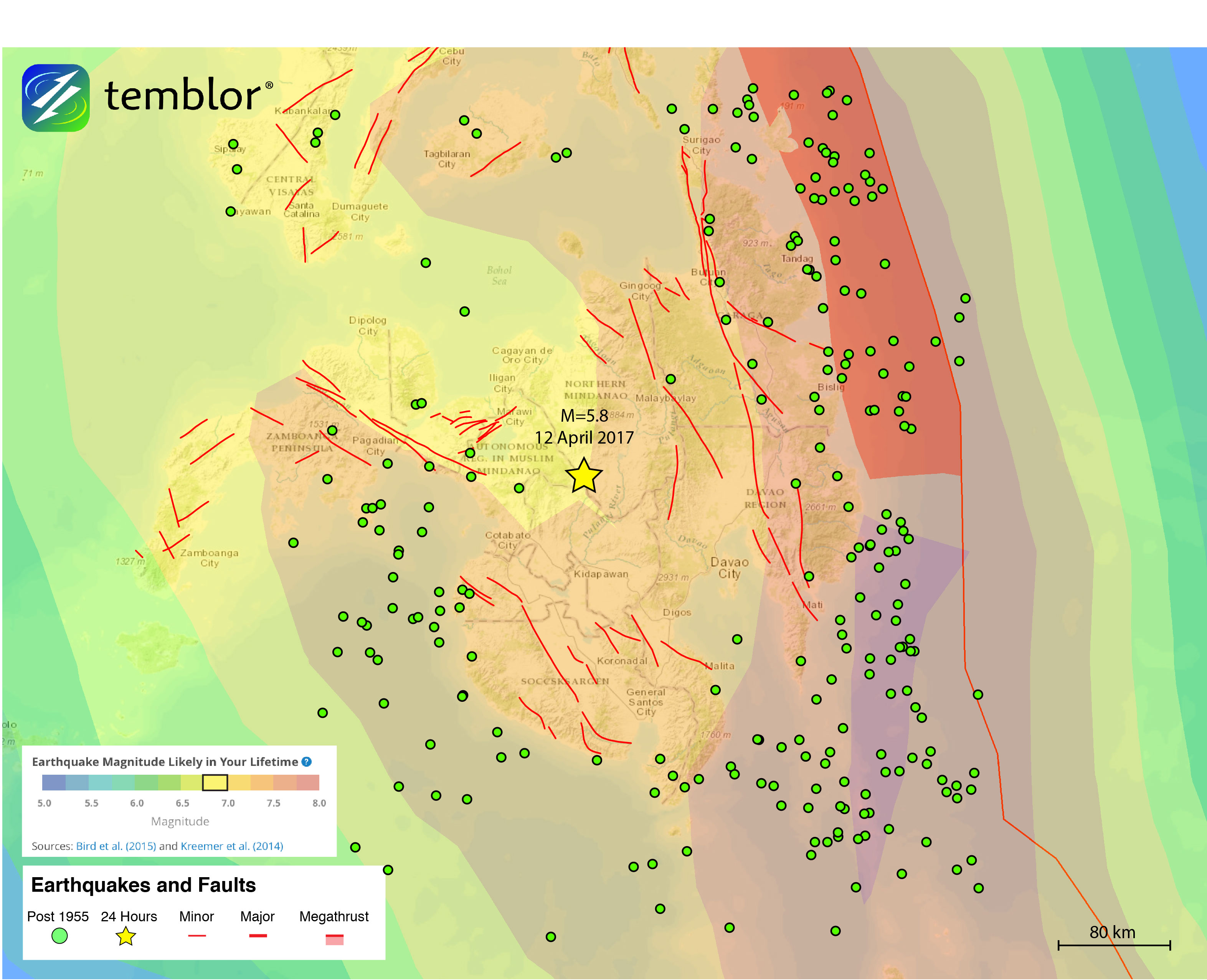
According to the Global Earthquake Activity Rate (GEAR) model, which is available in Temblor, this earthquake is not surprising, as a M=6.75+ earthquake is likely in your lifetime. The GEAR model uses global strain rates and historical seismicity since 1977 to forecast what the likely earthquake magnitude in your lifetime will be anywhere on earth. Even though GEAR suggests that a large magnitude earthquake will occur in this part of the Philippines, one has not occurred recently. In the figure below, M=5.8+ earthquakes are shown since a M=7.4 shook the country on March 31, 1955. What this shows is that while the central part of the island of Mindanao has not seen large magnitude earthquakes, the western and eastern coasts have. Based on their depth, these quakes are likely subduction zone driven, while in the central portion of the island, the strike-slip faults dominate and do not rupture frequently in large earthquakes.
References
USGS
PHIVOLCS
G-EVER (Philippines Faults)
Gulfnews.com
- Beware quiet segments of the Philippine Fault - May 16, 2025
-
ډیری عوامل افغاني ټولنې د زلزلې پر وړاندې زیانمنوي
- August 11, 2022 - What’s happening this week in Humboldt County, California: The squeeze - February 6, 2019