
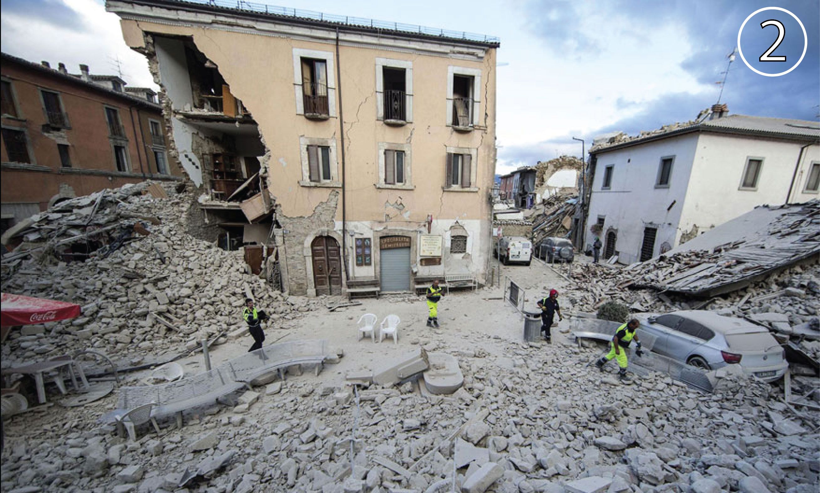
Last week’s M=6.2 Italy earthquake left many parts of the medieval city of Amatrice in ruin. In the old part of the city, most buildings were made of unreinforced masonry, leaving them susceptible to collapse [Guidoboni and Valensise, 2015]. Amatrice was all but destroyed in three large shocks over 19 days in 1703, and so the part of the town that was highly damaged on 24 August 2016 was composed of buildings largely constructed about 300 years ago. In contrast, the newer construction in the east side of the town came through the M=6.2 quake relatively unscathed.
The damage map above includes data provided to Temblor by NASA detailing damage. NASA’s damage assessment comes from ground surface changes analyzed using radar satellite imagery taken before (27 Jan 2016) and after (24 Aug 2016) the earthquake. The images are differenced with a method termed interferometric satellite synthetic aperture radar (InSAR). The image therefore maps changes in the precise locations of buildings, and closely correlates with visual inspection on the ground (For more information about the imaging technique, click here ). The numbers in the figure above correspond to the locations of the images below.


Sources:
Dr. Sang-Ho Yun, NASA JPL, Leader of the ARIA program, who graciously provided the damage maps to his colleagues and the public.
Guidoboni, Emmanuela, and Gianluca Valensise (2015), On the complexity of earthquake sequences:A historical seismology perspective based on the L’Aquila seismicity (Abruzzo, Central Italy), 1315-1915, Earthquakes and Structures, 8, 153-184, doi: 10.12989/eas.2015.8.1.153
- Beware quiet segments of the Philippine Fault - May 16, 2025
-
ډیری عوامل افغاني ټولنې د زلزلې پر وړاندې زیانمنوي
- August 11, 2022 - What’s happening this week in Humboldt County, California: The squeeze - February 6, 2019