By David Jacobson, Temblor

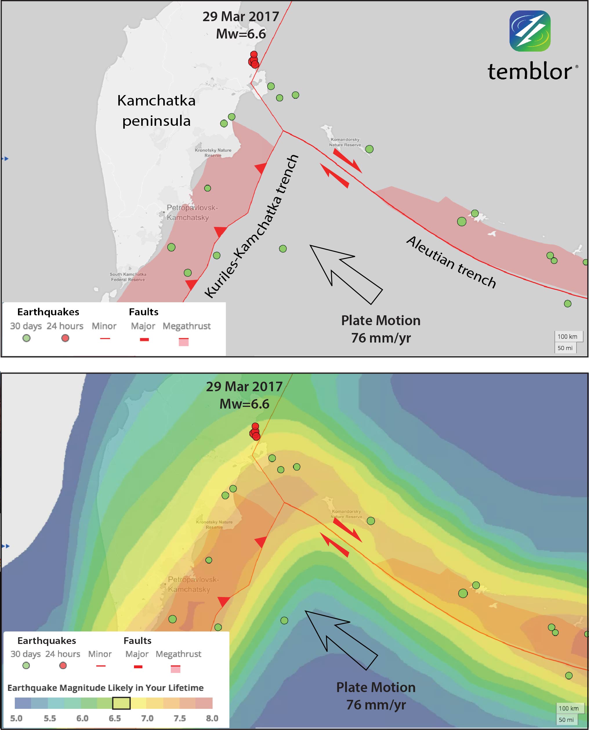
At 5:09 p.m. local time on March 29, a M=6.6 earthquake struck Eastern Russia along the Kamchatka Peninsula. Fortunately, this region is sparsely populated and only 1 person registered feeling the quake on the USGS website. According to the USGS, the quake, which occurred at a depth of 22 km, resulted in severe shaking at the epicenter, and a tsunami warning was briefly issued. So far there are no reports of damage.
Much of the Kamchatka Peninsula sits along the Kuril-Kamchatka Trench, where the Pacific Plate subducts beneath the North American Plate. This arc extends for approximately 2,100 km from Northern Japan to the Aleutian Islands. In addition to large earthquakes, this subduction has formed numerous active volcanoes.
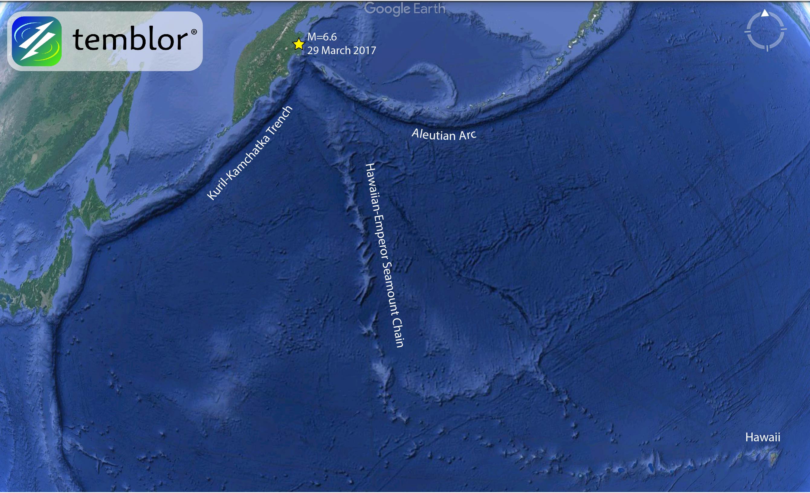
At the northern end of the trench, relatively close to the M=6.6 quake, subduction is impacted by the Aleutian Arc. Due to the curvature of the arc, and the relative plate motion, the westernmost Aleutians actually mark a transform boundary rather than an additional subduction zone. Because of this interaction, the Kuril-Kamchatka Arc is one of the most seismically active regions on earth, where earthquakes of almost any mechanism are possible. Today’s M=6.6 was nearly pure thrust in nature.
In addition to the varying plate motion, subduction is also impacted by the entrainment of the Meiji Seamount, the oldest seamount in the Hawaiian-Emperor Seamount Chain. This chain stretches for nearly 6,000 kilometers from the westernmost tip of the Aleutian Islands to Hawaii. Because these seamounts are more buoyant than the surrounding oceanic crust, they can indent the island arc, a phenomenon which has been noted around the world, including along the subduction zone offshore of Tokyo.
According to the Global Earthquake Activity Rate (GEAR) model, which uses global strain rates and past seismicity, an earthquake of M=6.5-6.75 is likely in your lifetime for this location. Therefore, while this earthquake was sizable, it should not come as a surprise.
Reference
USGS
-
ډیری عوامل افغاني ټولنې د زلزلې پر وړاندې زیانمنوي
- August 11, 2022 - What’s happening this week in Humboldt County, California: The squeeze - February 6, 2019
- Finding of the unexpected tsunami due to the strike-slip fault at central Sulawesi, Indonesia on 28 September 2018, from the preliminary field survey at Palu - October 15, 2018