By David Jacobson, Temblor
See earthquakes in the Philippines

At just past 4 p.m. local time, a M=6.5 earthquake struck the eastern Philippines, along the highly active Philippine Fault Zone. Based on early reports, at least two people are confirmed to have been killed, while at least 100 others have been injured. Many of these people were injured when a building collapsed in Kananga, approximately 10 km from the epicenter. According to the USGS, severe shaking was felt close to the epicenter, meaning there is the potential for moderate to heavy damage. Furthermore the quake occurred at the shallow depth of 6.5 km. As a general rule, shallower earthquakes tend to cause more damage. So far, in our catalog, there is only one recorded aftershock, which registered as a M=4.6. These earthquakes struck the the Leyte province, which was also devastated in 2013 by Typhoon Haiyan, which killed over 6,000 people and caused over $2 billion in damage.
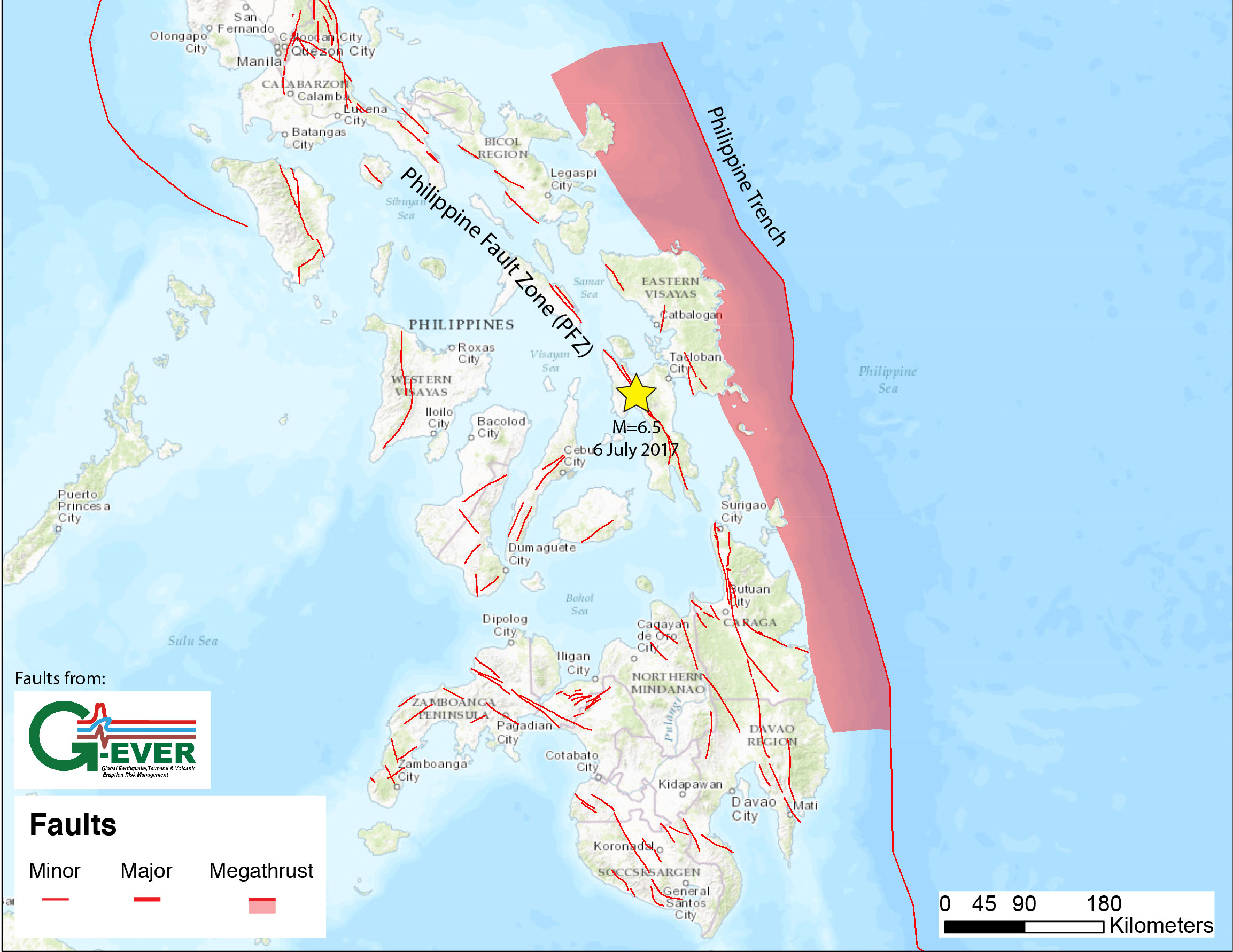
The Philippine Fault Zone is a 1,200 km-long tectonic feature stretching through the entire Philippine archipelago. Due to the young geomorphic features along the fault, it is considered comparable to the San Andreas Fault in California. The Philippine Fault is a left-lateral strike-slip fault, perfectly consistent with the focal mechanism of today’s M=6.5 earthquake. Numerous sections of this fault have ruptured historically, including in 1973 (M=7.0), 1990 (M=7.7) and 2003 (M=6.2). Additionally, the central portion of the Philippine Fault Zone, along which today’s quake occurred, has seen many historic quakes (See figure below). Because of this, the seismic hazard along this fault is extremely high, and within the Philippines, they are actively researching the fault to help with hazard mitigation. In addition to the seismic hazard associated with this fault system, the country is also susceptible to experiencing earthquakes along subduction zones which flank the country.
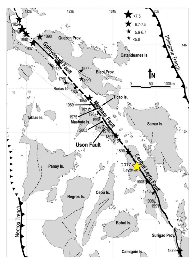
More specifically, the portion of the Philippine Fault Zone that ruptured today is known as the Central Leyte Fault, named after the province it cuts through. This section last rupture in 1998 and is normally characterized by aseismic creep, and medium magnitude earthquakes, that are often preceded by foreshocks. However, in today’s quake, no foreshocks are seen in the catalog. When these characteristics are compared to the section to the north, which is locked and often exhibits large ground rupture in earthquakes, the entire central Philippine Fault Zone can be viewed as a transition zone with both slow slip and creep activity.
Despite the magnitude of this earthquake, it should not be viewed as surprising. Based on the Global Earthquake Activity Rate (GEAR) model, which is available in Temblor, a M=7.0+ earthquake is likely for this region. This model, which uses global strain rates and seismicity since 1977, forecasts the likely earthquake magnitude in your lifetime anywhere on earth. To view the model, click here. Should there be any large aftershocks, or if new reports come in, we will update this post.

References
USGS
European-Mediterranean Seismological Centre (EMSC)
Philippine Institute of Volcanology and Seismology (PHIVOLCS)
Global Earthquake and Volcanic Eruption Risk Management (G-EVER)
G.M. Besana and M. Ando, The central Philippine Fault Zone: Location of great earthquakes, slow events, and creep activity, Earth Planets Space, 57, 987-994, 2005
- Beware quiet segments of the Philippine Fault - May 16, 2025
-
ډیری عوامل افغاني ټولنې د زلزلې پر وړاندې زیانمنوي
- August 11, 2022 - What’s happening this week in Humboldt County, California: The squeeze - February 6, 2019