By David Jacobson, Temblor

Yesterday, at 12:49 p.m. local time, a M=6.0 earthquake shook northern Peru, and was felt throughout the region, including in nearby Colombia and Ecuador. According to the USGS, the earthquake occurred at a shallow depth of 11 km, and registered severe shaking near the epicenter. Fortunately, this region is not densely populated, meaning not many people were exposed to great shaking. Having said that, in the city of Iquitos 250 km away, which is home to nearly 500,000 people and is a tourist hotspot because of it’s proximity to the Amazon, moderate shaking was felt. Additionally, in Ecuador’s capital city of Quito, people fled from their buildings, and in Guyaquil, Ecuador’s largest city with a population of 3.5 million, light shaking would have been felt. Therefore, despite its remoteness, this earthquake was felt by millions of people.
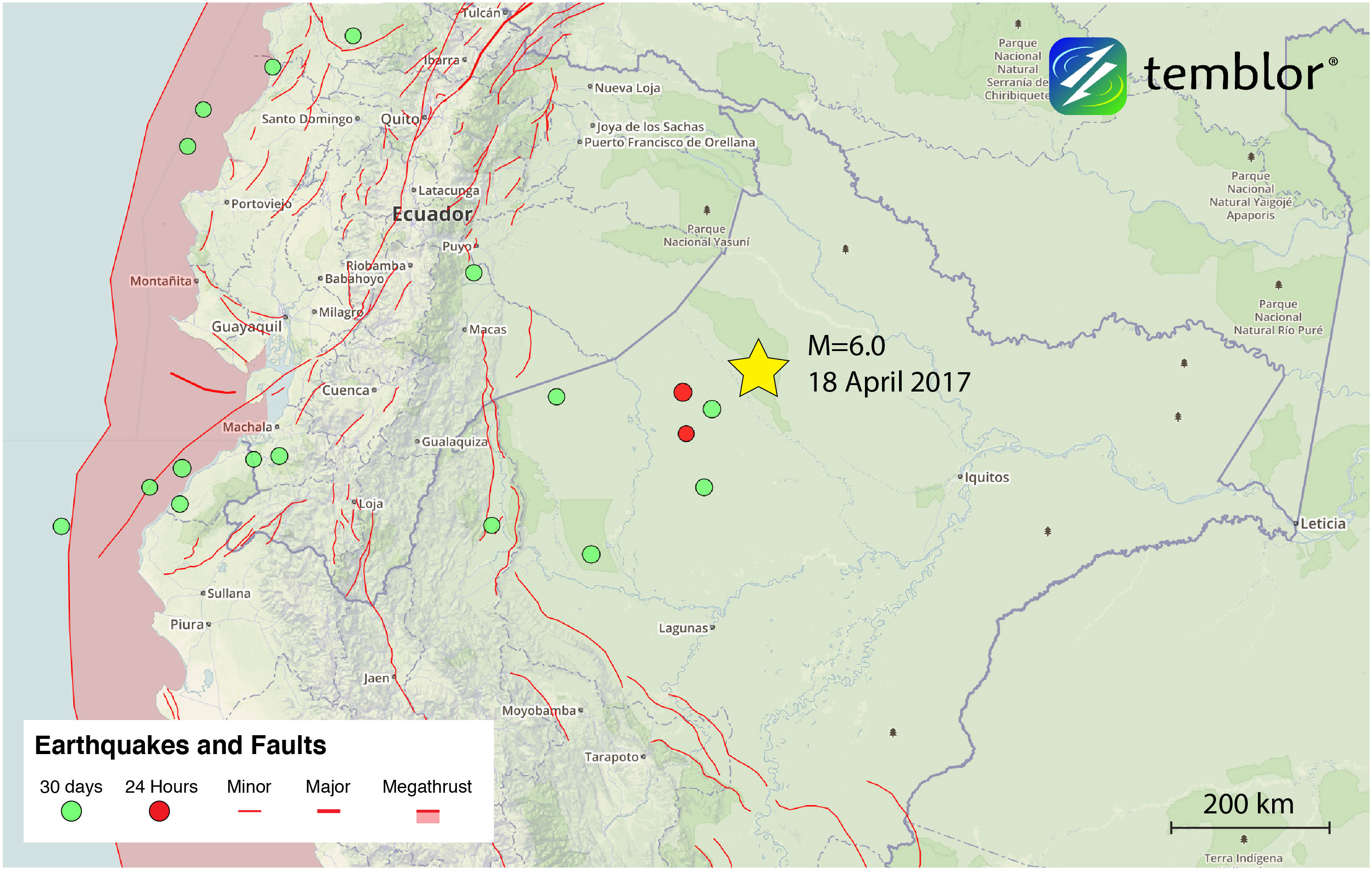
Based on the focal mechanism on the USGS website, this earthquake occurred on a thrust fault, meaning compressional forces were the cause. However, it is far from any mapped faults in both the Active Tectonics of the Andes (ATA) database (which is available in Temblor), and the South American Risk Assessment database. Additionally, based on aerial imagery, there does not appear to be any evidence of surface deformation, suggesting this earthquake occurred on a blind thrust fault, meaning the fault does not cut the Earth’s surface. Because there is no visible evidence of deformation suggests that the fault on which yesterday’s earthquake occurred is either slipping very slowly, or is a young feature. Furthermore, it is possible that high erosion rates in the area have removed any surface faulting features.
Despite there being no surface deformation visible, based on Google Earth elevation profiles, there does appear to be a localized bulge approximately 25 m (75 ft) high near the epicenter of yesterday’s quake (See below). While this bulge was not caused by the quake, it would be characteristic of a blind thrust fault dipping at approximately 45 degrees. Therefore, all signs point to that being the cause of yesterday’s earthquake.

Because of the subtlety of this feature it is no surprise that there is no mapped fault in the area. This is one of the limitations of active fault maps, which rely on clear fault traces. Despite this, the Global Earthquake Activity Rate (GEAR) model, which uses global strain rates and seismicity since 1977, shows this region as an area capable of experiencing M=5+ earthquakes. So, while the magnitude of yesterday’s earthquake makes it a rare event, the region is seismically active. To check what the likely earthquake magnitude in your lifetime anywhere on earth, click here.

Reference
USGS
GEM Foundation
- Beware quiet segments of the Philippine Fault - May 16, 2025
-
ډیری عوامل افغاني ټولنې د زلزلې پر وړاندې زیانمنوي
- August 11, 2022 - What’s happening this week in Humboldt County, California: The squeeze - February 6, 2019