By David Jacobson, Temblor
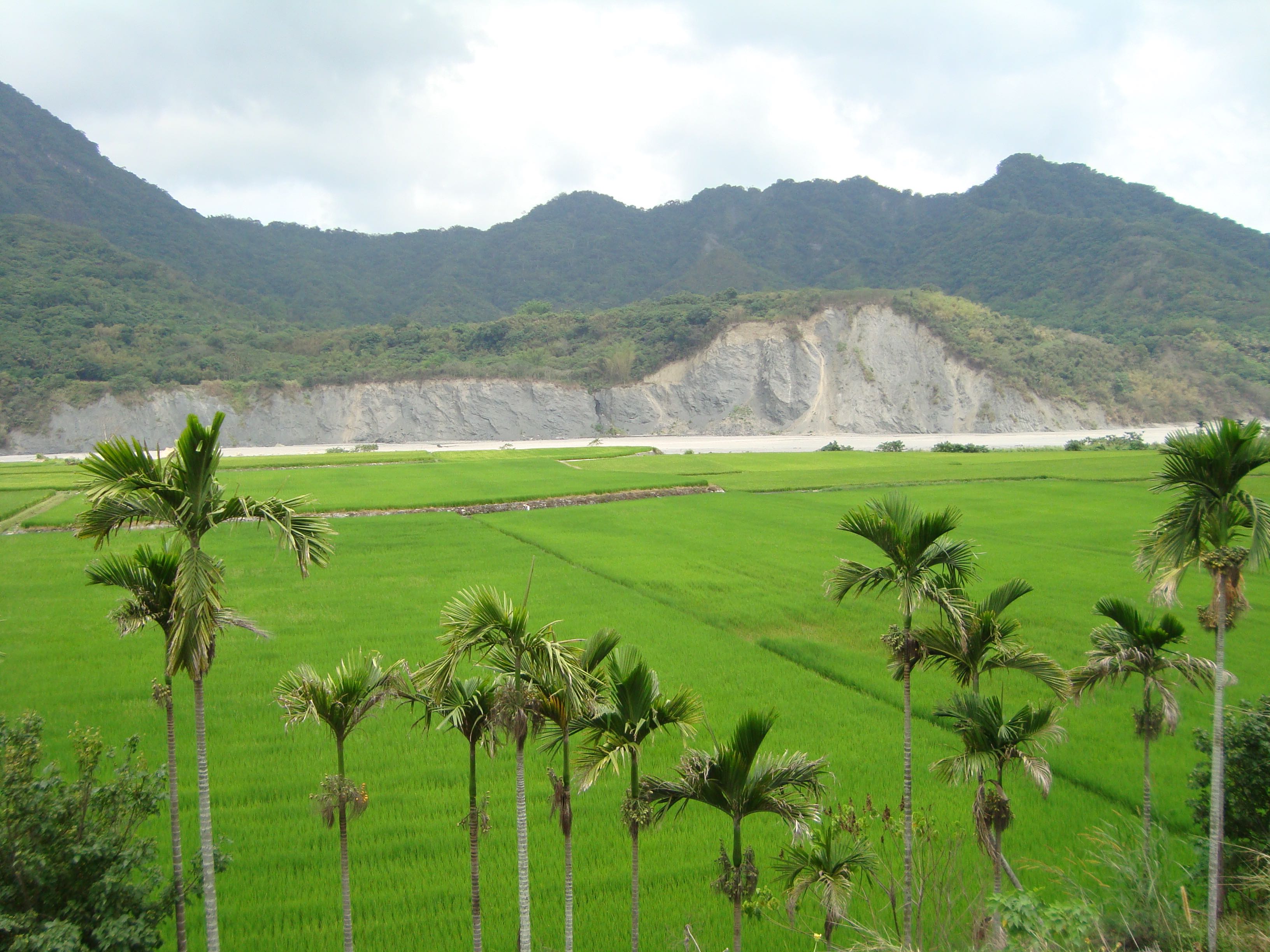
At 7:12 a.m. on Tuesday May 16, 2017, a M=5.3 earthquake shook eastern Taiwan, and was widely felt throughout the small country. According to the USGS, the quake occurred at a depth of 17 km, while the EMS Catalog reported it at 25 km depth. Fortunately, this portion of Taiwan is not densely populated, as the majority of the cities lie on the country’s western coast. Nonetheless, shaking was felt in the capital city of Taipei, which is home to nearly 3 million people. However, damage would have been unlikely even had the quake occurred near a populated center, as Taiwan is one of the more earthquake-prepared countries on earth.

Based on the focal mechanism from the USGS website, this quake was a compressional event. This is not surprising as approximately 50 mm/yr of convergence between the Philippine Sea plate and Eurasian plate is accommodated in eastern Taiwan. This means this portion of the country is gradually getting compressed, which in turn, causes frequent thrust fault earthquakes (12 M=7.0+ quakes have occurred since 1683).
In eastern Taiwan, the most seismically active fault is the Longitudinal Valley Fault (LVF), which slips at 20-30 mm/yr, dips at approximately 54° to the east, and marks the collision boundary between the Philippine Sea and Eurasian plates. Additionally, up to 30% of the earthquakes in Taiwan every year take place on or near this fault. The LVF is also unique because the southern portion creeps at a rate of 5-28 mm/yr, while the northern portion is locked. This means that in the south, there is very slow continuous movement, while in the north, slip only occurs in earthquakes. While not a black and white rule, creeping faults tend to not rupture in large earthquakes. The creeping aspect of the LVF makes it similar to California’s Hayward Fault, which runs through Oakland and the rest of the San Francisco East Bay.
From the focal mechanism published by the USGS, coupled with the depth and location of the quake, we assume today’s event either occurred on the LVF or on an associated structure. While the eastward dip in the focal mechanism (67°) is steeper than the dip of the LVF, the thrust and left-lateral components of slip match the predominant motions of the fault.
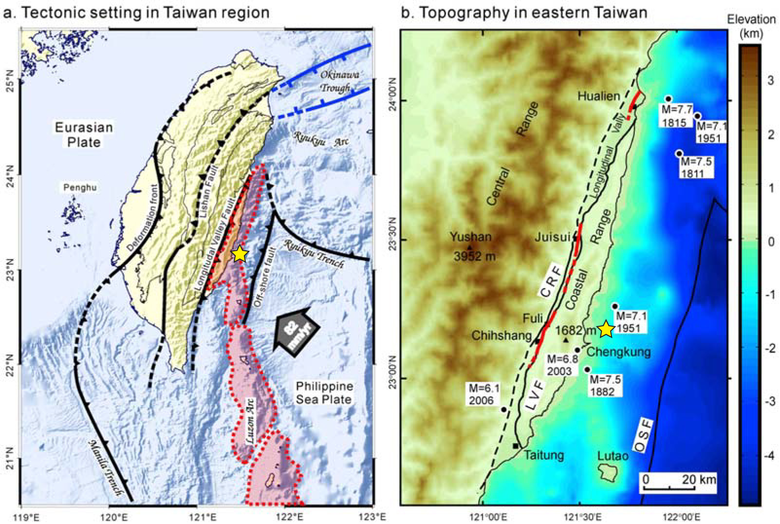
Because of the high strain rates off the eastern coast of Taiwan, the area is susceptible to large earthquakes. In 1951, a series of earthquakes along the Longitudinal Valley Fault hit the region, including a M=7.1, which is shown in the figures above. These quakes caused significant damage, and killed more than 80 people. More recently, there was a M=6.8 earthquake in 2003, which ruptured the Chihshang Fault, a segment of the LVF. By using the Global Earthquake Activity Rate (GEAR) model, which is available in Temblor, we can determine if today’s earthquake or the ones in 1951 and 2033 should be considered surprising. This model uses global strain rates and seismicity since 1977 to determine what the likely earthquake magnitude in your lifetime is for any location on earth. From the image below, you can see that that magnitude is M=7.75+. Therefore, today’s earthquake, and the ones in 1951 and 2003, should not be considered surprising and instead provide an opportunity to learn about one of the most seismically active places on earth.

References
USGS
EMS Catalog
Huang, W.-J., K. M. Johnson, J. Fukuda, and S.-B. Yu (2010), Insights into active tectonics of eastern Taiwan from analyses of geodetic and geologic data, J. Geophys. Res., 115, B03413, doi:10.1029/2008JB006208
J. Bruce H. Shyu, Ling-Ho Chung, Yue-Gau Chen, Jian-Cheng Lee, Kerry Sieh, Re-evaluation of the surface ruptures of the November 1951 earthquake series in eastern Taiwan, and its neotectonic implications, Journal of Asian Earth Sciences 31 (2007) 317–331
Ya-Ju Hsu, Shui-Beih Yu and Horng-Yue Chen, Coseismic and postseismic deformation associated with the 2003 Chengkung, Taiwan, earthquake, Geophys. J. Int. (2009) 176, 420–430, doi: 10.1111/j.1365-246X.2008.04009.x
- Beware quiet segments of the Philippine Fault - May 16, 2025
-
ډیری عوامل افغاني ټولنې د زلزلې پر وړاندې زیانمنوي
- August 11, 2022 - What’s happening this week in Humboldt County, California: The squeeze - February 6, 2019