By David Jacobson, Volkan Sevilgen Temblor
Click here to protect yourself from natural disasters

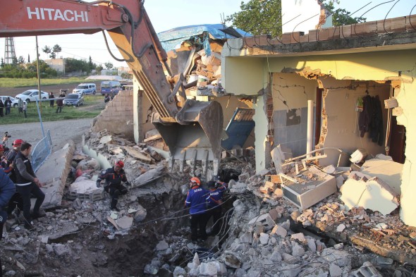
At 3:34 a.m. local time today, a M=5.2 struck southeastern Turkey, leaving dozens injured and destroying multiple buildings in the small town of Samsat. According to reports out of Turkey, all of the injuries, of which there are 35, are minor, and were caused when people fled their homes during the shaking. Since the mainshock, there have been 38 recorded aftershocks (According to Kandilli Observatory), the largest of which was a M=3.6.

Based on the focal mechanism, produced by the USGS, we know that today’s earthquake was strike-slip in nature, and struck at a depth of 10 km. While in Temblor we show no mapped active faults, some publications show a Samsat Fault, oriented northwest-southeast, in the area of today’s event. Therefore, if today’s quake occurred on this fault, the sense of slip would be right-lateral.

While much of Turkey is susceptible to moderate-large magnitude earthquakes, this region has historically seen almost no damaging quakes. Having said that, today’s quake comes a little more than a year after a M=5.6 shook the region, and left buildings crumbling and five people injured. That earthquake’s epicenter was just six kilometers to the west of today’s event, and was also strike-slip in nature. Therefore, it is possible that the quakes struck on the same regional structure.

Also of interest in this area is the Ataturk Dam, one of the largest earth-rock dams on earth. While today’s earthquake did not cause any damage to the dam, the dam itself, and changing water levels in the reservoir have been speculated to trigger earthquakes. Such induced seismicity became evident shortly after the dam was opened. Haluk Eyidoğan, Veli Geçgel ve Zümer Pabuççu showed that in 1994, when the dam reached near full capacity, small magnitude earthquakes began occurring at an astonishingly high rate, especially given the low seismicity of the region. Then, over the 2007 and 2008 summers, the water level in the dam fell dramatically due to insufficient rainfall. This culminated with a M=5.0 earthquake on September 3, 2008. Therefore, they concluded that the rapid water loss changed the compressional stress of the region, resulting in the release of energy in the form of a M=5.0 earthquake.
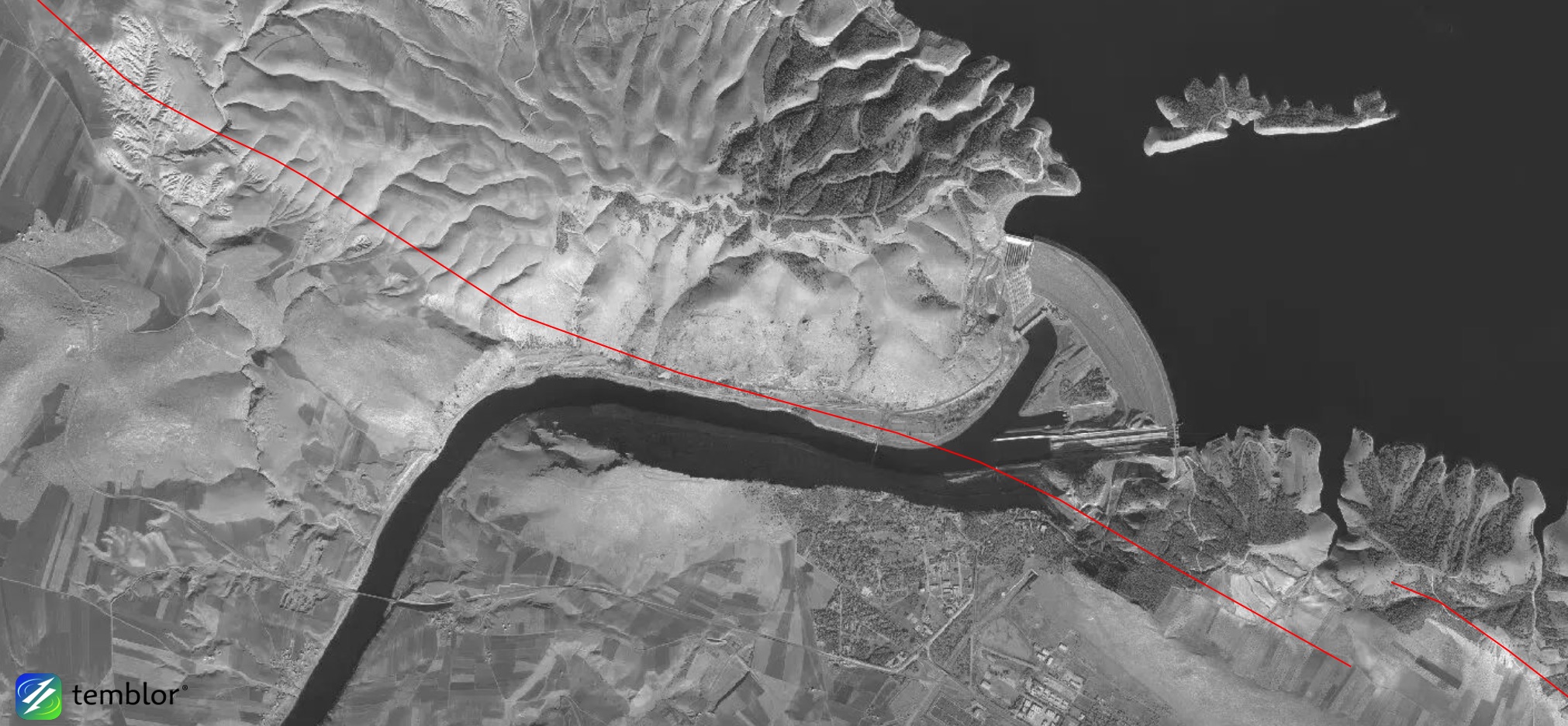
While we are not saying that today’s M=5.2 earthquake was induced, because the region has seen induced seismicity associated with the Ataturk Dam, it must at least be considered as a possible cause. Additionally, it should be pointed out that in the last year, water levels at the Ataturk Dam have dropped significantly.
Even though the region has not seen large magnitude earthquakes historically, it does not mean a larger, more damaging earthquake could not occur. Based on the Global Earthquake Activity Rate (GEAR) model, which is available in Temblor, the area around today’s M=5.2 earthquake is susceptible to M=6+ quakes. This model uses global strain rates and the last 40 years of seismicity to forecast the likely earthquake magnitude in your lifetime anywhere on earth. Based on the damage sustained in the region in much smaller earthquakes, a M=6+ quake could be devastating to the region. Therefore, today’s event should be a wakeup call to the region that they too live in an earthquake-prone area.

References
USGS
EMSC
Kandilli Observatory
AFAD
ABC News
Correlation between water level decrease in Ataturk Dam and Mw 5.0 earthquake on September 3, 2008,
Haluk Eyidoğan, Veli Geçgel ve Zümer Pabuççu
Hurriyet Daily News
- Beware quiet segments of the Philippine Fault - May 16, 2025
-
ډیری عوامل افغاني ټولنې د زلزلې پر وړاندې زیانمنوي
- August 11, 2022 - What’s happening this week in Humboldt County, California: The squeeze - February 6, 2019