By David Jacobson, Temblor

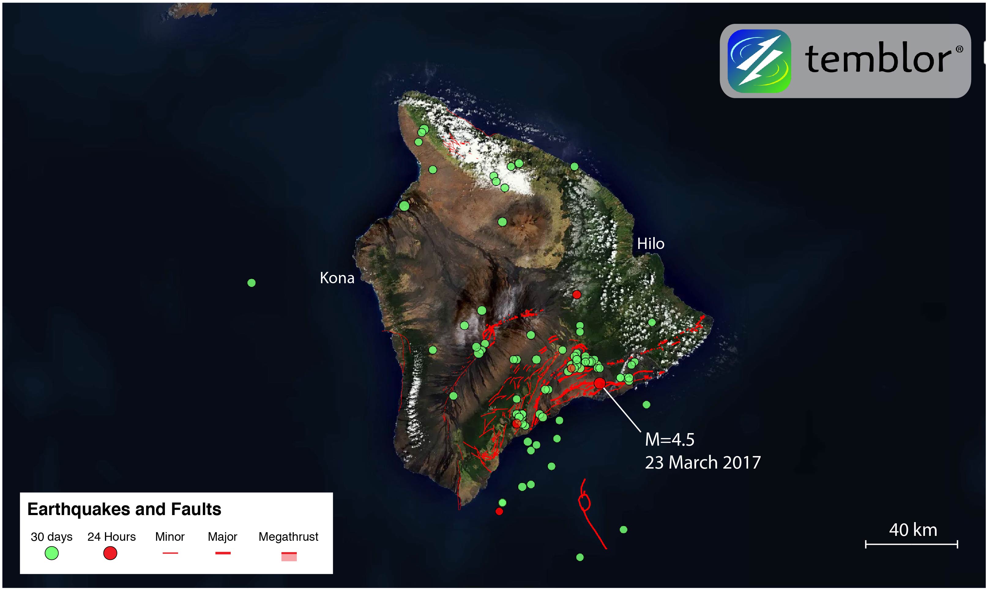
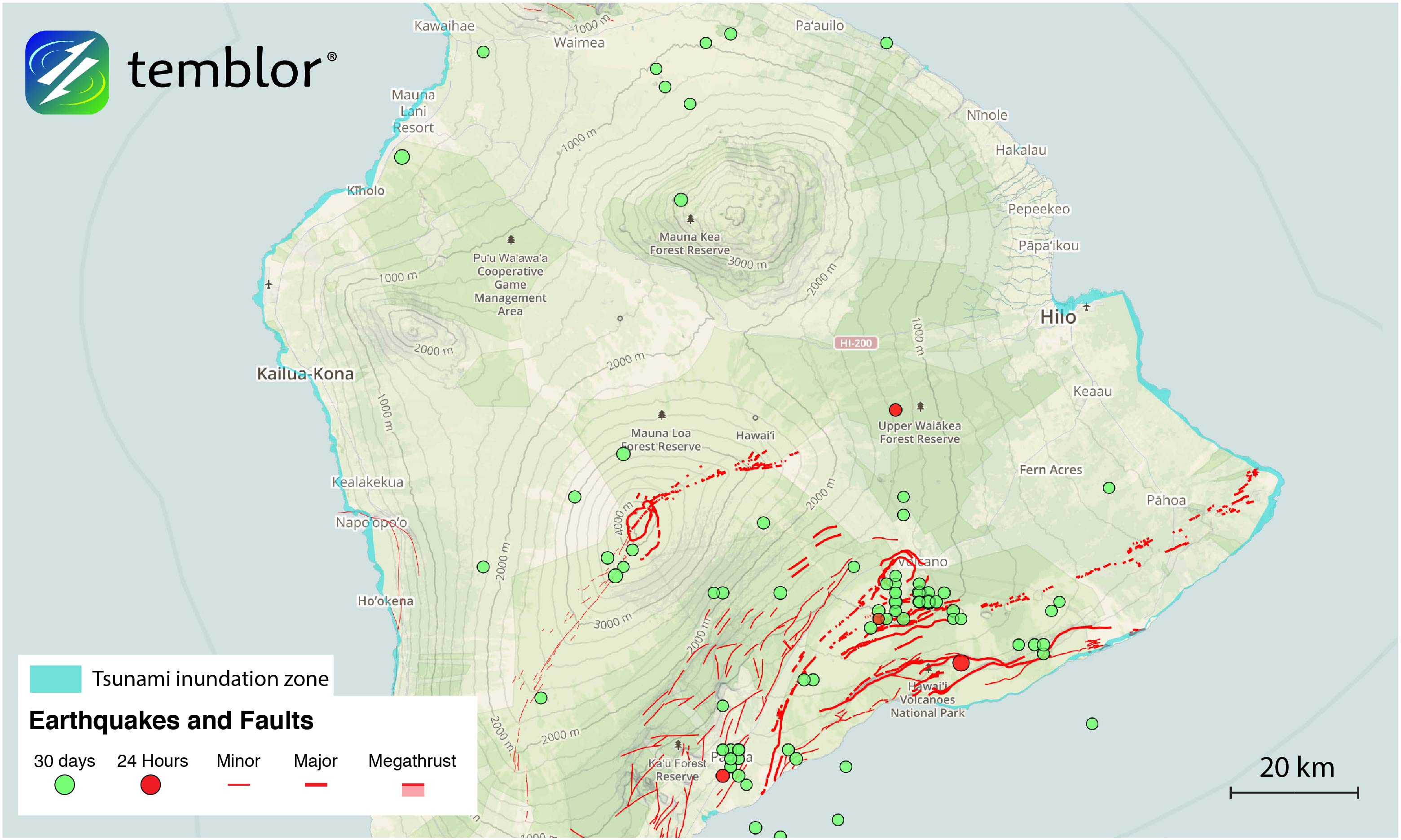
Yesterday afternoon, a M=4.5 earthquake along the Hilina fault system shook the Big Island of Hawaii, underneath Hawaii Volcanoes National Park. The quake registered moderate shaking near the epicenter, and was felt as far away as the capital city of Hilo, 50 km away. While most people think of volcanoes when they think of Hawaii, the state has experienced large earthquakes, and seen their devastating impacts. Additionally, the volcanism and tectonism are closely linked. Because of this, we thought we’d highlight Hawaiian tectonics.
The Hawaiian Islands are the product of what geologists call a “hot spot.” This is where a rising column of magma reaches the earth’s surface, resulting in volcanic eruptions. They are often used to explain volcanism not associated with plate boundaries. As a tectonic plate moves over a hot spot, new islands can be created. For the Hawaiian Archipelago, this has resulted in a chain of 132 islands, seamounts, reefs, atolls, shallow banks, and shoals over a distance of 3,000 kilometers. However, many people only know about the eight main islands that make up the state.

Hawaii experiences both small and large earthquakes. The majority of smaller quakes are associated with magma as it moves beneath the surface. Many of these are too small to be felt, and can only be picked up by seismometers. These are often referred to as “volcanic earthquakes.”
However, the larger earthquakes are not directly caused by the flow of magma. As the Hawaiian Islands formed through successive eruptions, the amount of rock at the surface has steadily increased, meaning the weight of the islands is immense. In turn, the region as a whole has subsided, resulting in the formation of normal faults. It is normal faults like this that caused the November 29, 1975 M=7.2 Kalapana earthquake, which is the largest instrumentally recorded earthquake in Hawaii’s history. It should be noted that a M=7.9 earthquake occurred in 1868, though this magnitude is inferred based on felt area.

Effects from these larger magnitude earthquakes have been significant. Tsunamis up to 15 m high have been generated, shaking has collapsed structures, and people have lost their lives. Therefore, it is not just volcanic eruptions that Hawaiians have to worry about. In addition to locally-sourced hazards, Hawaii can also be affected by distal earthquakes. In 1960, the M=9.5 Valdivia, Chile earthquake over 10,000 km away, generated a tsunami which devastated Hilo and killed 61 people.
What all of this shows is that not only volcanism but earthquakes as well have helped shape the Hawaiian Islands. Therefore, the thousands of earthquakes that occur yearly in Hawaii, will hopefully no longer be a surprise.
References
Hawaiian Volcano Observatory
USGS
University of Hawaii
Kuo-Fong Ma, Hiroo Kanamori, and Kenji Satake, Mechanism of the 1975 Kalapana, Hawaii, earthquake inferred from tsunami data, Journal of Geophysical Research, Vol. 104, No. B6, Pages 13,153-13,167, June 10, 1999.
- Beware quiet segments of the Philippine Fault - May 16, 2025
-
ډیری عوامل افغاني ټولنې د زلزلې پر وړاندې زیانمنوي
- August 11, 2022 - What’s happening this week in Humboldt County, California: The squeeze - February 6, 2019