By David Jacobson, Temblor

Yesterday, (August 3) a sudden downpour north of Los Angeles caused flashed flooding in Acton, a small, unincorporated part in Los Angeles County that is home to a little over 7,000 people. The flash flooding also brought with it a substantial amount of mud which washed out roads, caused Metrolink delays, damaged homes and roadways, and forced rescue teams to evacuate at least one resident. Local officials have already sent out bulldozers to clear the mud, which could take days or weeks to clean up.

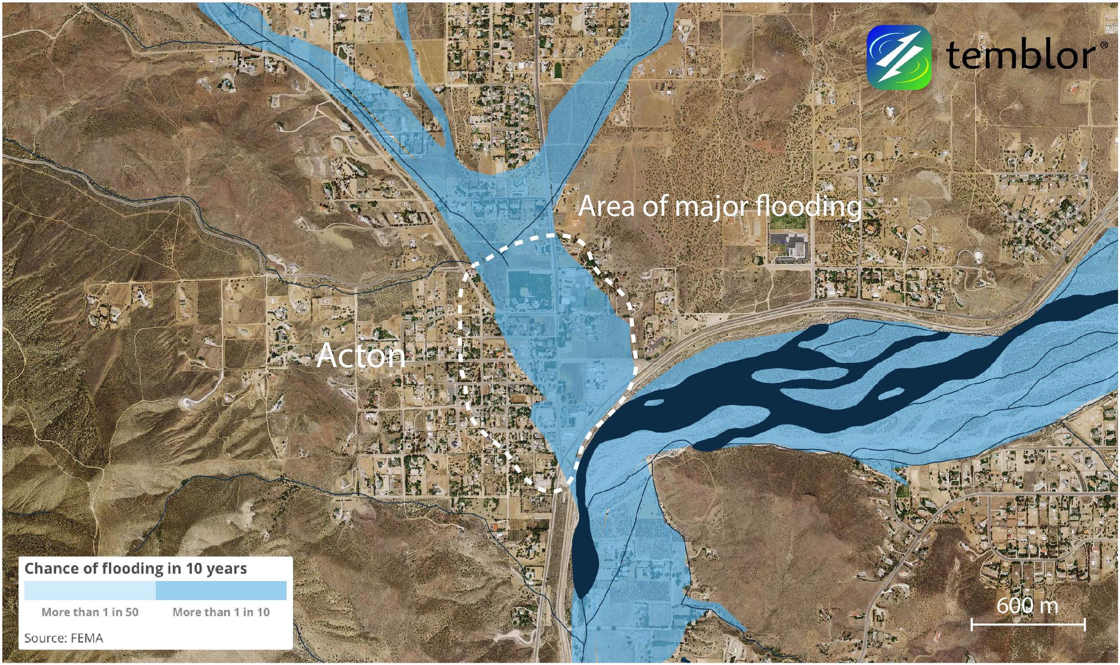
In the Temblor map above, we show the FEMA flood map for Acton, California. What can be seen is that much of the small town is within a 1% chance per year flood zone (more than 1 in 10 chance of it happening in a decade). This means that if someone is within this zone and has a mortgage, they must carry flood insurance. If not, flood insurance is optional. While no 0.2% chance per year flood zones (more than 1 in 50 chance in a decade) are shown in this map, it does not mean that they do not exist. It is just likely that these zones have not been mapped.

From these maps one can see that the FEMA flood maps do a relatively good job highlighting where flooding is most likely, illustrating the importance of knowing whether you are in or close to a flood zone. To find out if you are in or close to a flood zone, click here. If you are in a flood zone, taking action through insurance can protect you from unnecessary losses.
References
FEMA
LA Times
ABC News
- Deep earthquake beneath Taiwan reveals the hidden power of the Ryukyu Subduction Zone - January 7, 2026
- Magnitude 7 Yukon-Alaska earthquake strikes on the recently discovered Connector Fault - December 8, 2025
- Upgrading Tsunami Warning Systems for Faster and More Accurate Alerts - September 26, 2025
