Scientists surveying the seabed off New Zealand’s east coast have uncovered undersea mountains that help explain mysterious slow-motion earthquakes.
By Erin Martin-Jones, Ph.D., Department of Earth Sciences, University of Cambridge (@Catherine_MMJ)
Citation: Martin-Jones, E., 2021, Submarine mountains can subdue earthquakes, Temblor, http://doi.org/10.32858/temblor.199
Earth’s tectonic plates are constantly jostling for space — colliding and diving under one another in a dance that sculpts dramatic mountain chains, fuels volcanic eruptions and delivers earth-shattering tremors. But sometimes these forces can have more subtle impacts. Take, for instance, silent earthquakes or “slow-slip events,” which can move at slow-motion speeds, stretching their ruptures over weeks to months. Often, no one feels a thing, and these events go undetected even by seismometers.
So why do some faults slip suddenly and set off deadly earthquakes, while others slide slowly and stealthily? A new study suggests that off the coast of New Zealand, where thousands of small quakes occur each year, excess water locked within undersea mountains, or “seamounts,” can promote the silent sliding linked to slow-motion earthquakes.

The Hikurangi Margin Subduction Zone
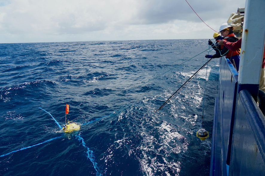
To understand slow-slip earthquakes off New Zealand’s eastern coast, a team of researchers led by Christine Chesley of Columbia University’s Lamont-Doherty Earth Observatory first had to figure out a way to peer into the depths of a subduction zone.
The team used electromagnetic methods to essentially take an MRI scan of the seabed along the Hikurangi Margin, where the Pacific Plate dives beneath the Australian Plate. That subduction motion along the margin is partly responsible for the more than 15,000 earthquakes in the region each year. Most are so small that they go unnoticed, but between 150 and 200 are large enough to be felt.
This subduction zone poses a significant earthquake and tsunami hazard to coastal communities in New Zealand, but the largest earthquakes only seem to occur toward the south of the margin — and scientists want to know why. “One of the fascinating things about this area, and why so many have studied it, is the puzzling variation in earthquake hazards over a very small area,” Chesley says.
Although large earthquakes haven’t struck the North Island in roughly the last 200 years, evidence of ancient quakes is written in the rocks along the coastline, which have been jolted upward by past seismic events.
Diving beneath the hidden depths of silent earthquakes
In December 2018, the research team began a month-long deep-sea cruise, collecting profiles of the seafloor in the northern part of the subduction zone margin, which is studded with large seamounts. “Although other studies have suggested that seamounts may contribute to small, rather than large and destructive earthquakes, it’s been unclear exactly how those mountains interact with the seafloor as they are subducted,” says Chesley.
Chesley’s eye was drawn to two seamounts: the Tūranganui Knoll, located about 110 kilometers southeast of the east coast city of Gisborne, and an unnamed one that is closer to the margin and is currently being subducted. A cluster of tiny earthquakes related to a 2014 slow-slip event occurred around the second seamount, which first began subducting about a million years ago.

Peeling back the layers of a seamount
Chesley’s team’s electric conductivity survey revealed that each seamount was made up of layers of varying porosity, which held water and conducted electricity differently. Each had a solid core surrounded by a layer of loose, cindery material that acts a bit like a sponge. In fact, the team found that seamounts lock away three to five times more water than typical oceanic crust. This water can act as a lubricant to help tectonic plates glide into Earth’s interior without setting off a large earthquake.
“It makes a lot of sense, knowing how they form, but we really weren’t expecting them to be such heterogeneous masses of rock,” says Chesley. She noted that the nuance in material can really affect how the subducting plate moves and expels water when it is subducted.
Because both seamounts had a similar structure, the researchers think that even actively subducting seamounts retain their structural strength — so much so that they can damage the overriding plate, causing tiny faults that dissipate the energy and result in slow-slip events.
New methods
This study is the first to use electromagnetic methods to map out water trapped in rocks beneath the seafloor offshore, says Susan Ellis, a geophysicist at GNS Science, who was not involved in the study. “Mapping the structure of the seafloor is extremely challenging and has only recently become viable. This research is at the cutting edge of new geophysical imaging methods,” Ellis says.

“These results are very exciting … they show just how subducting topography can impact water content,” she adds. That, in turn, reveals the type of slipping. “Understanding why slow-slip events occur is critical for estimating New Zealand’s earthquake and tsunami hazard.”
Factoring underwater oddities into hazard models
“Seamounts are very common on the seafloor, but hazard models currently don’t consider how they contribute to slow-slip events,” says Chesley. “Now we know that we need to take seafloor topography into account — otherwise we’re not getting the full picture.”
But Chesley and her team note that slow-slip earthquakes aren’t always subdued. In 1947, two unusual tsunamis were both associated with slow-slip behavior. And because they weren’t preceded by shaking, there was little warning.

“Future work in other locations of the margin, and in other subduction zones with and without seamounts, will help us understand whether there are any other factors that also contribute to slow-slip events,” says Ellis. Or that contribute to a larger event, for that matter.
References
Chesley, C., Naif, S., Key, K., & Bassett, D. (2021). Fluid-rich subducting topography generates anomalous forearc porosity. Nature, 595(7866), 255-260. doi.org/10.1038/s41586-021-03619-8
Sun, T., Saffer, D. and Ellis, S., 2020. Mechanical and hydrological effects of seamount subduction on megathrust stress and slip. Nature Geoscience, 13(3), pp.249-255. doi.org/10.1038/s41561-020-0566-5
Wallace, L.M., Webb, S.C., Ito, Y., Mochizuki, K., Hino, R., Henrys, S., Schwartz, S.Y. and Sheehan, A.F., 2016. Slow slip near the trench at the Hikurangi subduction zone, New Zealand. Science, 352(6286), pp.701-704. doi.org/10.1126/science.aaf2349
Wang, K., & Bilek, S. L. (2011). Do subducting seamounts generate or stop large earthquakes? Geology, 39(9), 819-822. doi.org/10.1130/G31856.1
- Venezuela’s doublet leaned toward Caracas - June 30, 2026
- Is Southern California’s Cajon Pass an ‘earthquake gate’ ready to open? - June 29, 2026
- Philippines magnitude 7.8 shock may have loaded the central Cotabato subduction zone - June 11, 2026