Location matters: Seismologists studying historical casualty estimates after large earthquakes suggest future rescue efforts should look for rural-area victims.
By Melissa L. Weber, MA (@Melwriter)
Citation: Weber, M., 2020, Rural areas may suffer disproportionately in quakes, Temblor, http://doi.org/10.32858/temblor.113
Following an earthquake, rescue efforts based on preliminary counts of human casualties — dead and injured — typically focus on urban areas, primarily because that is where population density is the highest. But a recent analysis suggests that in some countries, many more casualties occur in rural settings. Scientists studying casualty estimates hope to encourage officials to send rescuers to rural areas based on the projections of injuries following an earthquake.
There are a number of reasons to consider this disaster recovery strategy, says Max Wyss, a seismologist and emeritus professor at the University of Alaska, Fairbanks, author of the analysis in Seismological Research Letters (SRL). First, in many regions, rural populations suffer more than urban centers because they typically wait longer for rescuers to arrive and often experience more building collapse than in the cities. Second, the number of casualties following an earthquake is often underestimated in rural areas in part because of infrastructure and communications damage. This slows rescue groups from sending personnel and equipment. For any rescue effort, time is critical. People rarely survive more than five to six days if they are trapped in a collapsed building following an earthquake (Macintyre et al., 2006).
Where do casualties happen?
Wyss examined historical earthquake data using casualty models created by QLARM (Quake Loss Assessment for Response and Mitigation). This modeling instrument uses world data on population and construction to calculate losses such as building damage, injuries and fatalities caused by strong shaking during earthquakes. They verified that projections using QLARM algorithms provided accurate estimates of real casualties.
Wyss and his team then looked at data from 53 future projected earthquakes in 17 countries. He cautions that the list of future earthquakes is biased by what he and his coauthors consider “likely earthquakes.” They calculated the theoretical casualties in rural areas, which were defined as communities with fewer than 35,000 people. Eight countries with earthquakes classified large and deadly were modeled to have rural casualty values of 85%, which means that only 15% of deaths were located in cities. Only a few cities were located near these events, while thousands of villages were located close to the ruptures.

Wyss says that rural populations may need support first, because people may live and work in structures that are not properly reinforced. This conclusion is supported by Roger G. Bilham, a research scientist with Cooperative Institute for Research in Environmental Sciences at the University of Colorado Boulder. Bilham says the problem is building construction, not so much whether the buildings are in rural or urban settings. Industrialized nations typically see fewer collapses due to code enforcement.
“In the developing nations, codes may exist but can be circumvented by corruption, ignorance or poverty, especially away from large cities,” Bilham says. For example, in areas that struggle to provide affordable housing, shortcuts in construction may be taken, which can lead to greater damage.
Location matters
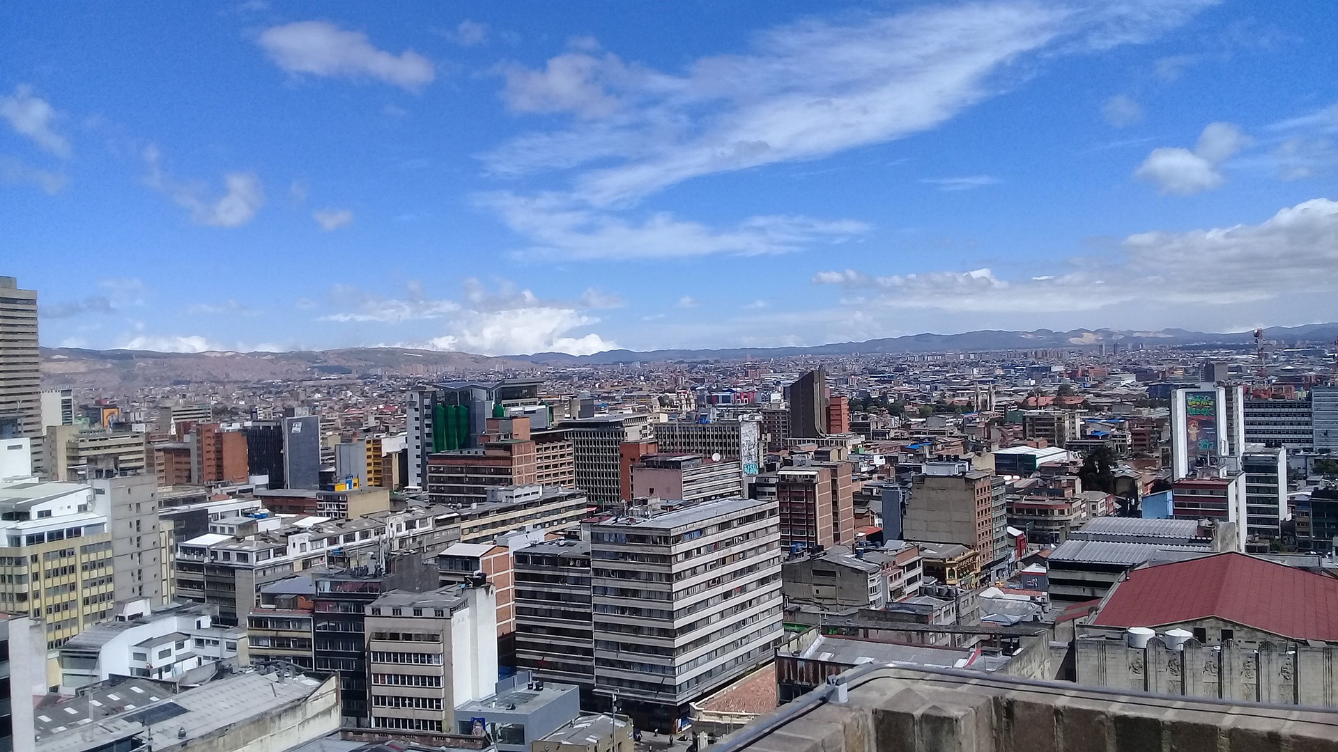
Bilham and Wyss agree that while the analysis offers a compelling reason to send rescue teams immediately to rural areas, countries and quakes must be evaluated individually. The location of the earthquake relative to a large dense population, or an earthquake beneath a megacity will obviously cause greater damage in the urban area. For example, Wyss is currently working on a study focusing on eight hypothetical earthquakes in Colombia. The model Wyss is using in this forthcoming study shows the opposite of his earlier analysis — the new one indicates that Colombia’s residents would need assistance in predominantly urban areas.
“The people in rural areas usually suffer most [because they wait longer for help],” Wyss says. “But for each country, you need to look at their situation, the size of expected earthquakes and the number of estimated casualties in both urban and rural areas.”
Pay attention to the estimates
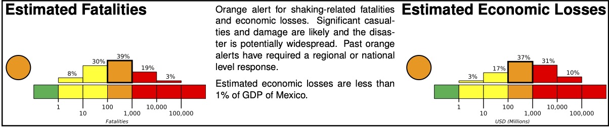
Wyss says that the most important and effective way to save people would be for local governments and rescue organizations to heed the casualty estimates given by seismologists immediately following a quake. For example, QLARM provides earthquake loss alerts within about 30 minutes of potentially damaging earthquakes worldwide, in collaboration with the Swiss Seismological Service. Other tools are in use by several international and national organizations to provide casualty estimates following earthquakes.
He wants to encourage reporters to consider giving estimates from QLARM and PAGER, the warning system provided by the US Geological Survey. PAGER (Prompt Assessment of Global Earthquakes for Response) is an automated system that provides estimates of severity of the impact of significant earthquakes around the world. These estimates provide information for first responders and government officials about the potential scope of the disaster. For example, if local officials report only a few people are injured, but QLARM is suggesting up to 1,000 people may be hurt, rescuers can look in other areas for victims. Greater awareness of potential injuries may encourage more aggressive actions to rescue victims throughout the affected region.
For large earthquakes, the magnitude may not be immediately known, and the depth of rupture is often poorly known, which also make a difference.
“After about six minutes, I get an estimate and a reported magnitude,” Wyss says. “If the reported magnitude is 7.5 with a casualty estimate of 30,000, but local experts thought it was actually a magnitude of 8, I could recalculate the estimates and say we expect on average 60,000 casualties. In this case, the uncertainty would be 30,000 people.”
Wyss says the most important first step following an earthquake is summoning rescue workers to the scene. Overestimating casualties shouldn’t be a failure; saving more victims should be the goal. If the science community estimates thousands of casualties, and local city officials report just a few injuries, the question could become: Where are the injured? Maybe in rural areas, he says.
Concerned about your earthquake risk? Check it at Temblor.
Further reading
Bilham, R., (2019) Aggravated Earthquake Risk in South Asia: Engineering versus Human Nature, Ch.5, 103-141, in Earthquake Hazard, Risk and Disasters, ed M. Wyss, Elsevier 2019
Bilham R., and V. Gaur (2013), Buildings as Weapons of Mass Destruction: Earthquake risk in South Asia, Science, 341, 618-619
Macintyre, A. G., Barbera, J. A., & Smith, E. R. (2006). Surviving collasped structure entrapment after earthquakes: A” time-to-rescue” analysis. Prehospital and disaster medicine, 21(1), 4.
Wyss, Max, (2018) Rural Populations Suffer Most in Great Earthquakes, Sesmo. Res. Let. Volume 89, Number 6 November/December 2018
Wyss, Max (2017) Comment: Report estimated quake death tolls to save lives, Nature Vol 545 11 May 2017
- Venezuela’s doublet leaned toward Caracas - June 30, 2026
- Is Southern California’s Cajon Pass an ‘earthquake gate’ ready to open? - June 29, 2026
- Philippines magnitude 7.8 shock may have loaded the central Cotabato subduction zone - June 11, 2026