Ground motion recordings over the last decade reveal how ground shaking attenuates and becomes amplified beneath Utah’s urban corridor.
By Lauren Koenig, Ph.D. Candidate, Michigan State University (@Lauren_A_Koenig)
Citation: Koenig, L., 2021, Recent earthquake activity unlocks mysteries of the Wasatch Fault, Temblor, http://doi.org/10.32858/temblor.184
The Wasatch Fault Zone that runs down central Utah has been relatively quiet over the last millennia. So, when the Salt Lake City area was hit with the magnitude-5.7 Magna earthquake in 2020, Morgan Moschetti, a geophysicist with the U.S. Geological Survey’s Geologic Hazards Science Center, saw an opportunity. With more than 2,300 aftershocks, this pivotal earthquake provided a trove of data that could help researchers better understand the geologic hazards of one of the world’s longest and most active faults of its kind. Moschetti’s work uncovers new details about how earthquake ground motions from the Wasatch Fault move through the region when quakes strike. He and his team found that ground shaking caused by earthquakes does not conform to the predictions of standard models, which means that hazard models may need to be updated for the Wasatch Front.
A fault runs through it
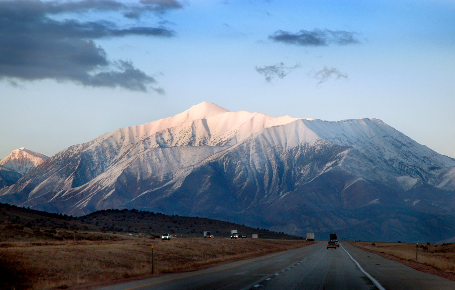
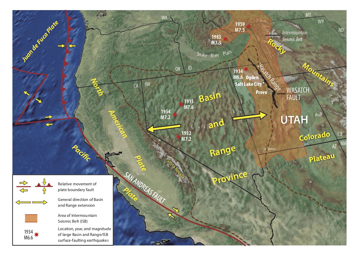
The Wasatch Fault Zone runs about 240 miles (390 kilometers) from Central Utah to Northern Idaho and has been divided into 10 individual fault segments. The region is classified as a “normal” fault zone, meaning that one side drops down relative to the other — in this case, the western side drops down relative to the eastern side. Most of Utah’s population lives on the western side of the fault zone, where deep sedimentary basins amplify seismic waves.

The fault zone can produce earthquakes upward of magnitude-7.5 and is one of the highest sources of seismic risk within the contiguous United States. “It’s kind of a fascinating area because geologically there is evidence for large earthquakes in relatively recent time periods, but there’s relatively little earthquake activity there now,” says Moschetti. Since the next big earthquake is forecast to strike within 50 years, new information about the Wasatch Fault is essential for mitigating seismic damage in this highly populated area.
Wasatch Fault ground shaking attenuates faster than predicted
Moschetti and his team compiled a database of ground motion recordings from 59 earthquakes since 2010 — nearly half of which came from the Magna earthquake sequence — and identified regional features affecting earthquake hazards. They published their findings in a new study in Seismological Research Letters showing that the ripples of ground waves produced by small- and moderate-sized earthquakes attenuate, or become weakened, more quickly than standard models would predict for the Wasatch Fault. These standard models are based on earthquake records from places like California. But in Utah, according to Moschetti’s findings, the amplitude of ground shaking dies down more quickly as the waves travel away from the source of the ruptures in a process called near-source attenuation.
“There are many things that can lead to higher-than-expected rates of attenuation,” says James Holt, a seismologist with the University of Utah Seismograph Stations (UUSS) who was not involved in this study. “The combined effects of the fault structure, physical source characteristics, and local source conditions — like geologic structure — have a significant impact on how seismic energy propagates close to the rupture.”
These complexities, combined with a lack of seismic data close to the source, makes it challenging for scientists to pinpoint the finer details of the radiated seismic energy, such as the attenuation process. The enormous amount of data produced by the 2020 Magna earthquake, however, may allow researchers to develop a specific ground motion model for the Wasatch Fault or tweak standard models to account for near-source attenuation.
“This is an important contribution because many ground-motion model datasets simply don’t have near-source data,” says Holt. “Improving the accuracy of ground-motion models in this critical near-source region … will certainly serve to improve downstream hazard calculations and reduce seismic risk in densely populated urban areas like Salt Lake City.”
While these results can inform how scientists assess earthquake hazards in the region, Moschetti says it is unclear if these same effects would be observed for larger and potentially damaging earthquakes. “These observations should not affect how anyone thinks about the preparation for magnitude-7+ earthquakes in Utah,” says Moschetti.
Adding to hazard assessments
While researchers have known that seismic waves are strongly amplified in deep sedimentary basins like those in the Salt Lake Valley, Moschetti’s work also uncovers novel details about the relationship between basin depth and ground motion, which is useful for site-specific hazard assessments, Holt says. The team found that waves amplify most strongly at the deepest part of the basin just west of Salt Lake City and become more variable at the basin’s edge closer to downtown. “If you have a really important [building or other human-made structure], you’d be interested in knowing what the local geologic structure beneath your feet would do to augment the local seismic energy that comes in,” Holt says.

About every 300 years, an earthquake is generated by one of the central segments in the Wasatch Fault Zone, but earthquakes in several segments are “overdue.” Because this fault is a known hazard, it’s one of the most closely monitored faults in the world, with a network of seismic instruments collecting data at all times. The relatively minor Magna earthquake was a rare chance to catch the fault in the act.
The 2020 earthquake’s proximity to an urban area is also especially valuable for the seismic hazard community. “We can use the new ground-motion information to develop better building codes,” said Katherine Whidden, a research scientist with UUSS who was not involved in the study. “New information about the Wasatch Fault and the Salt Lake Valley makes us all safer.”
References
Moschetti, M. P., Churchwell, D., Thompson, E. M., Rekoske, J. M., Wolin, E., & Boyd, O. S. (2021). Seismic Wave Propagation and Basin Amplification in the Wasatch Front, Utah. Seismological Research Letters. https://doi.org/10.1785/0220200449
Utah Seismic Safety Commission (2008). Putting down roots in earthquake country—Your handbook for earthquakes in Utah. Salt Lake City, Utah: Utah Geological Survey. Retrieved from https://www.utah.gov/beready/documents/roots_earthquake_low.pdf
Wald, L. (2015). How Big and How Frequent Are Earthquakes on the Wasatch Fault? Retrieved from https://www.usgs.gov/natural-hazards/earthquake-hazards/science/how-big-and-how-frequent-are-earthquakes-wasatch-fault?qt-science_center_objects=0#
Wong, I. G., Lund, W. R., Duross, C., Thomas, P., Arabasz, W., Crone, A. J., … & Rowman, S. (2016). Earthquake probabilities for the Wasatch Front region in Utah, Idaho, and Wyoming. Utah Geological Survey.
- Venezuela’s doublet leaned toward Caracas - June 30, 2026
- Is Southern California’s Cajon Pass an ‘earthquake gate’ ready to open? - June 29, 2026
- Philippines magnitude 7.8 shock may have loaded the central Cotabato subduction zone - June 11, 2026