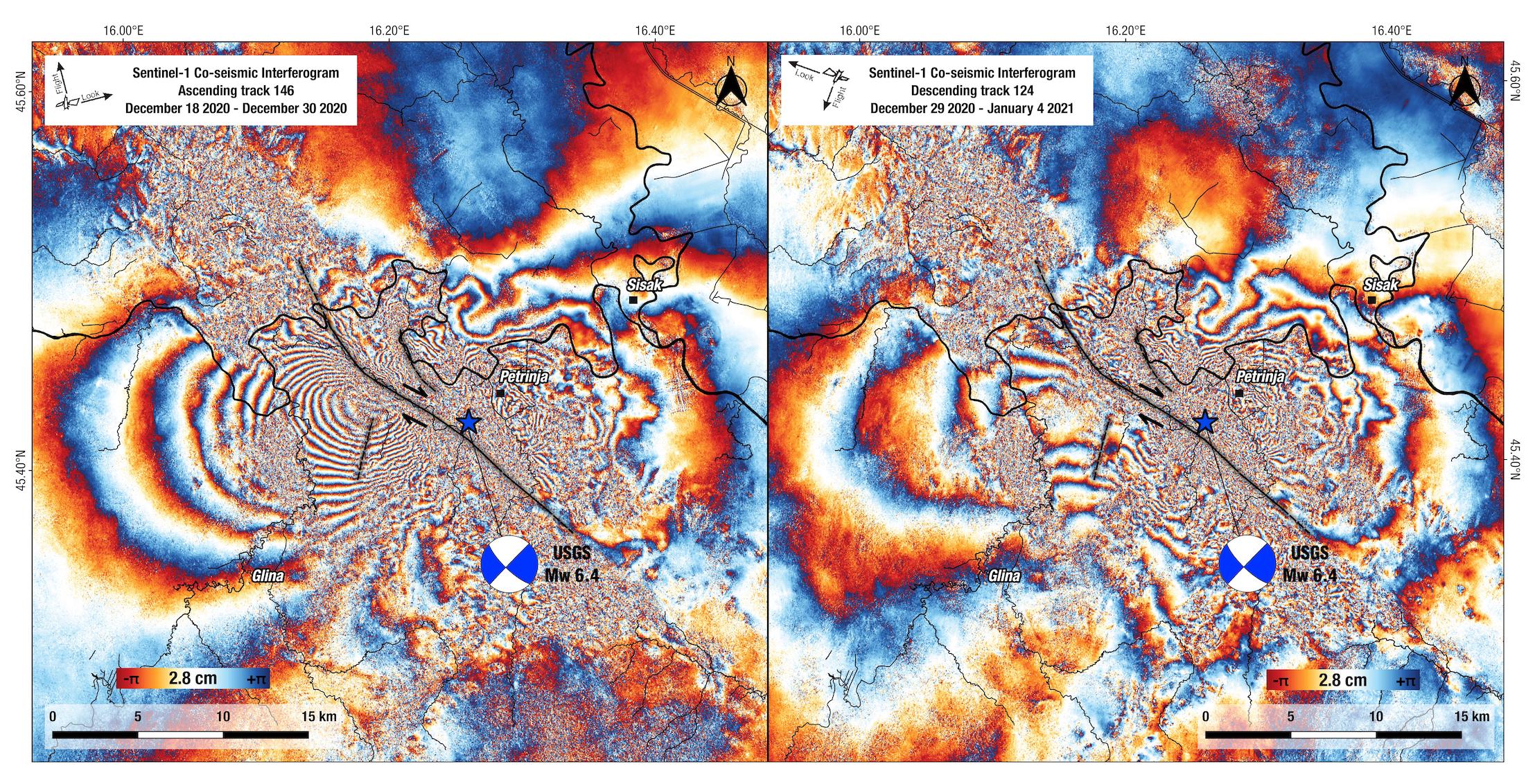
Figure 3. The coseismic interferogram (wrapped phase; cropped swath) over Petrijna, Croatia. Black arrows indicate the satellite azimuth direction and the line‐of‐sight (l.o.s.) look direction. Left panel shows the image pair Dec. 18-Dec.30, 2020 (ascending orbit). Right panel: Dec. 29-Jan. 04, 2021 (descending orbit).
Latest posts by Jen Schmidt (see all)
- M 6.6 earthquake offshore Crete - May 2, 2020