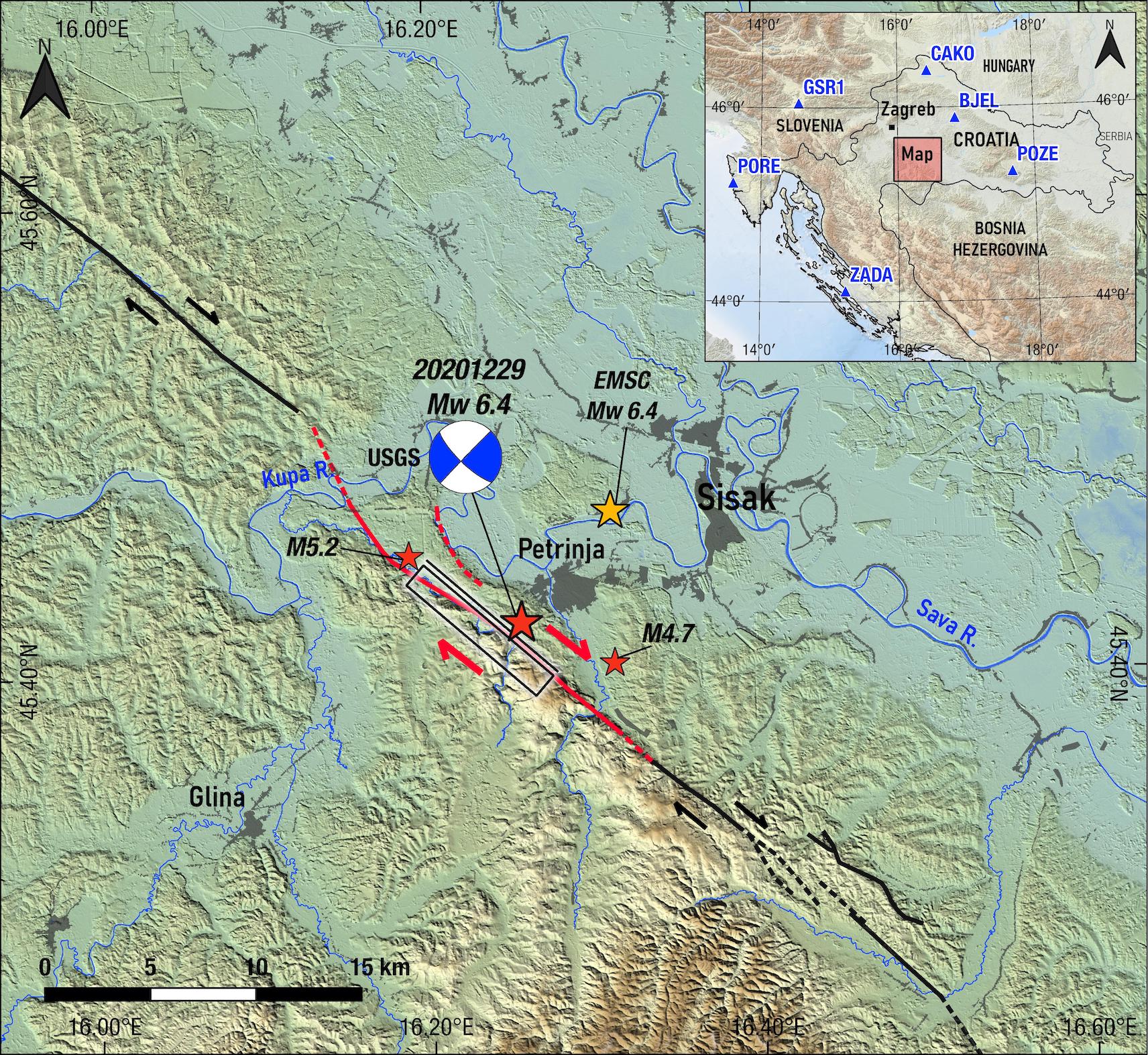
Figure 1. Location map showing shaded topography, the seismic fault (black rectangle & red line; this study), the USGS focal mechanism and the epicenter of the Petrijna December 29, 2020, earthquake (Mw=6.4). Red arrows indicate sense of relative motion across fault. Inset box indicates location of earthquake area within Croatia together with the location of EUREF/EPN/CROPOS stations (blue triangles).
Latest posts by Jen Schmidt (see all)
- M 6.6 earthquake offshore Crete - May 2, 2020