Chile’s prehistoric megathrust earthquakes can inform hazard models for the natural disaster insurance industry.
By Madeline Dahm, science writer (@MadelineDahm)
Citation: Dahm, M., 2021, Megamodels: Chile’s insurance sector sharpens up, Temblor, http://doi.org/10.32858/temblor.172

In 1960, Chile experienced an earthquake that shook the region for nearly ten minutes. The Valdivia earthquake, as it was eventually named, triggered a tsunami with waves more than 38 feet (12 meters) tall that devastated parts of the Chilean coast. As host to the most powerful quake ever recorded — estimated between magnitude 9.4 and 9.6 — South America, and Chile in particular, is what earthquake experts often refer to as a “natural laboratory” for seismology.
In new research presented at the European Geosciences Union (EGU) annual meeting today, Jochen Woessner, a seismologist at RMS Inc., and his colleagues debuted a new model that estimates earthquake risk to buildings in Chile, Ecuador, Colombia and Peru. Using a wealth of newly available data for this seismically active region, the team created a model of earthquake recurrence interval.
How to make the world’s largest earthquakes
When two tectonic plates converge and the denser one dives under the other, geologists call this boundary a subduction zone. Sometimes, friction can lock the subduction zone in place, resulting in pressure building up as the plates continue to move toward each other over time. Megathrust earthquakes — the strongest in the world — occur when this pressure releases by sudden, catastrophic rupturing of the formerly stuck brittle rocks. The Valdivia earthquake ranks among the great megathrust earthquakes, estimated to have been even more powerful than the more recent 2004 Sumatra-Andaman earthquake and the 2011 Tohoku earthquake in Japan.
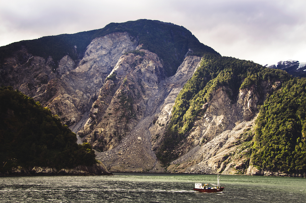
Many people in Chile, Peru, Ecuador and Colombia live with great seismic risk because of their proximity to the active Andean subduction zone, where the Nazca Plate plunges below the South American plate. Five of the 20 largest earthquakes in recorded history have occurred along this plate boundary. With the right scientific knowledge, policy oversight and insurance strategies, risks could be mitigated to a certain degree. However, modern seismic data collected during the past 100 years is insufficient to assess long-term earthquake hazards because megathrusts in this region tend to occur approximately every 300 years, says Katleen Wils, a paleoseismologist at Ghent University. Seismic data alone does not go back far enough in time. Scientists need a detailed record of earthquakes dating back to prehistoric times.

Missing pieces of the earthquake
Although creating risk-assessment models for the insurance industry is not novel in itself, Woessner’s team at RMS utilizes a dataset that is. In a 2020 study led by Wils, a doctoral student at the time of publication, she and her coauthors provided missing pieces in the puzzle of Chile’s recent and ancient seismic history.
Wils combined all available seismic data from the southern Chilean coast with a new dataset from the southernmost tip of the country, creating a more complete record of the region’s earthquake history. Wils and her coauthors identified ancient earthquakes in the paleoseismic record — the ledger of earthquakes tracked in rocks and soils prior to modern seismic instrumentation. The magnitudes of many past quakes appeared similar to the great magnitude of the 1960 earthquake, with smaller events scattered throughout the record.
Wils demonstrated that these massive and incredibly destructive megathrust earthquakes tend to occur every 321 years — give or take 116 years — along this segment of the plate boundary. This may come as a relief for those living in the region. However, the smaller earthquakes that occur between megathrusts pack a punch as well.
Juan Carlos de la Llera, Dean and Professor of Structural and Geotechnical Engineering at Pontificia Catholic University of Chile, explained that substantial earthquakes in Chile occur at least once every 25 to 30 years. Even in the last 15 years alone, three devastating earthquakes of magnitude-8.2 or higher have struck the Chilean regions near Maule, Iquique and Illapel, causing irreparable damage and loss of life.

Using the past to predict the future
Woessner and his team at RMS update their seismic risk models every few years for different regions around the world. As new data emerges, these models more accurately reflect the current state of knowledge. The latest RMS model for western South America — thanks in part to Wils’s new study — now has the most complete and current dataset available, covering South America’s entire seismically active western coastline.
The RMS model calculates the potential annual occurrence of earthquakes greater than or equal to magnitude-5.0 along the subduction zone. These occurrence rates form the basic ingredient for estimating future financial losses. Woessner and his coauthors focused on both damage and monetary losses that a single-family dwelling would incur in the event of a magnitude-5.0 or greater earthquake. “Our group thus transfers the latest scientific knowledge and research into a product that enables insurance companies to define insurance rates [for earthquakes],” said Woessner.
“On average, the cost of earthquakes and other natural hazards for Chile is about 1.2% of the annual GDP of the country,” said de la Llera. The combination of Wils’s paleoseismic data and Woessner’s new model means that policy makers and insurance providers will have an up-to-date and localized picture of the risk that earthquakes big and small pose to the buildings and infrastructure in Chile.
References
Woessner, J., Velasquez, J., Nyst, M., Fitzenz, D., & Eads, L. (2021). Recurrence of megathrust events: Impact on hazard and risk in South America (No. EGU21-7112). Copernicus Meetings.
Wils, K., Van Daele, M., Kissel, C., Moernaut, J., Schmidt, S., Siani, G., & Lastras, G. (2020). Seismo‐Turbidites in Aysén Fjord (Southern Chile) Reveal a Complex Pattern of Rupture Modes Along the 1960 Megathrust Earthquake Segment. Journal of Geophysical Research: Solid Earth, 125(9), e2020JB019405.
- Venezuela’s doublet leaned toward Caracas - June 30, 2026
- Is Southern California’s Cajon Pass an ‘earthquake gate’ ready to open? - June 29, 2026
- Philippines magnitude 7.8 shock may have loaded the central Cotabato subduction zone - June 11, 2026