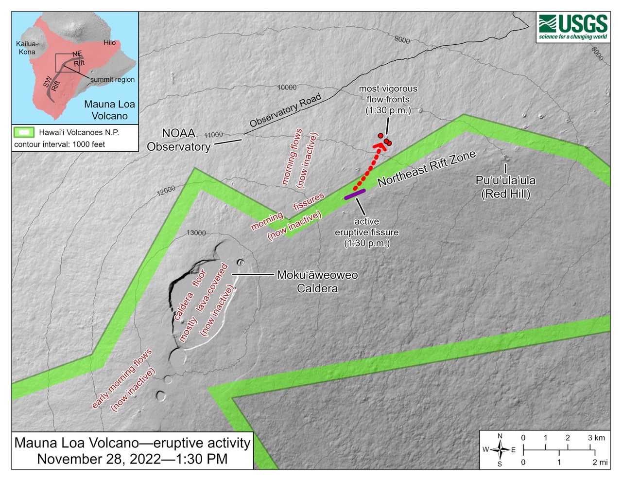
This map of the region surrounding Mauna Loa’s Moku’āweoweo Caldera shows the location of eruptive activity within the summit caldera and along the Northeast Rift Zone as of 1:30 p.m. (23:30 GMT) on Nov. 28, 2022. The eruption began overnight with a fissure eruption on the caldera floor, and lava began spilling out the southwest side of the caldera. In the morning, fissures at the upper part of the Northeast Rift Zone began to erupt, but by the afternoon only Fissure 3 remained active (purple line). The red arrow and dots mark the location of the lava flow, as of 1:30 p.m. on Nov. 28, 2022. Credit: USGS.
Latest posts by Krystal Vasquez (see all)