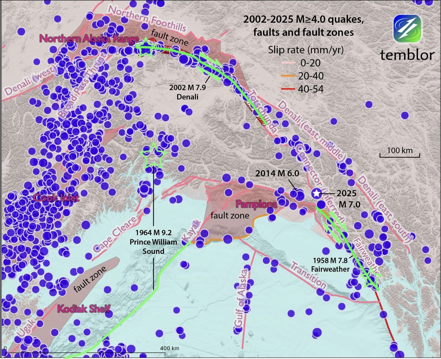
Figure 2. The magnitude 7.0 shock struck near the southern end of the 200-kilometer-long gap between the 1958 Fairweather mainshock rupture and the 2002 Denali earthquake (bold green lines with green outlined stars at the epicenters). Until recently, no fault had been traced between these two faults. Seismicity since the 2002 Denali earthquake (green rupture to the north) illuminates its own aftershocks. For the rupture zone of the1958 magnitude 7.8 Fairweather earthquake, the current seismicity is much quieter. A far more prominent band of seismicity is associated with the Alaska subduction zone, which produced the 1964 magnitude 9.2 Prince William Sound megathrust earthquake. Because the fault is inclined relative to the surface, the green fault trace is far south of its epicenter and the bulk of its seismicity. The brown polygons are fault zones (labeled), which are diffuse regions of concentrated seismicity without discrete identified faults; the Pamplona fault zone, closest to the 2025 magnitude 7.0 shock, was investigated by Doser et al. (1997). Credit: Temblor, CC BY-NC-ND 4.0
- Living through the Loma Prieta earthquake - October 21, 2021
- The Great Quake Debate: an interview with seismologist and author Susan Hough - August 27, 2020
- Salton Sea Swarm quiets down - August 12, 2020