The quake struck less than an hour after a national earthquake drill. Mexico is prone to strong earthquakes.
By Temblor Earthquake News Editors
Update Sept 22, 1:49 a.m.: Mexico was rocked by a strong earthquake for the second time in three days. A magnitude-6.9 aftershock struck coastal Mexico at 1:16 a.m. local time, according to the Servicio Sismológico Nacional, Mexico’s national seismic agency. The earthquake, which struck roughly 35 kilometers (22 miles) east of Monday’s epicenter, activated the earthquake early warning alert in Mexico City. No tsunami alert has been issued by U.S. Tsunami Warning System.
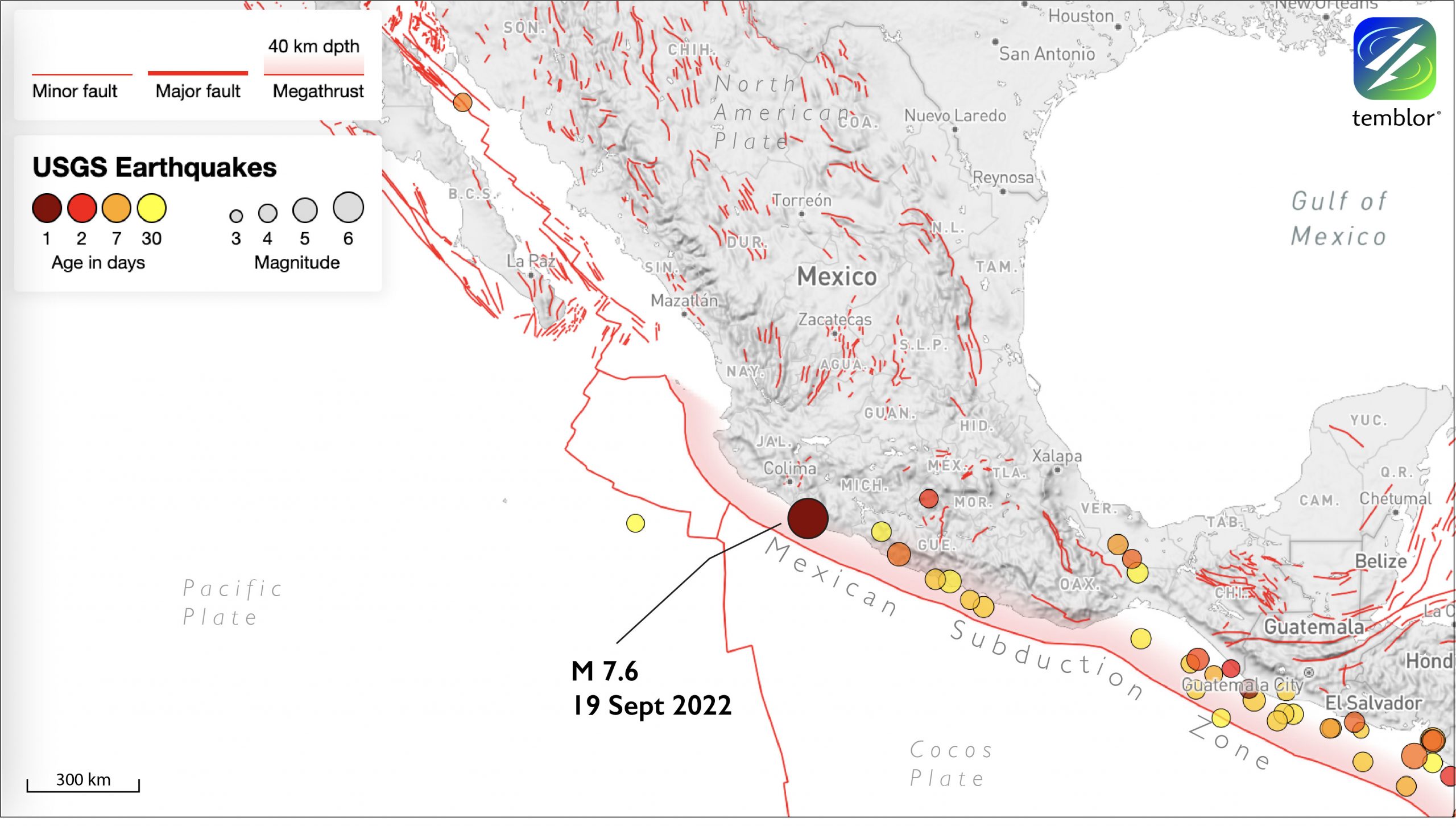
A magnitude-7.6 quake struck along the western coast of Central Mexico at 1:05 p.m. local time on Monday. Photos of damage are filtering in.
Coincidently, the quake fell on the anniversary of two other large earthquakes in the region: the 2017 Puebla earthquake and the 1985 Mexico City earthquake. It also came less than an hour after the country performed a memorial earthquake drill. Though many people may find the coincidence rather curious — that three intense earthquakes shook this region on September 19 of various years — there is no scientific significance to the date.
The likelihood of such a large earthquake striking is “totally independent of the month or the date,” says Hector Gonzales-Huizar, a seismologist at the Centro de Investigación Científica y de Educación Superior de Ensenada, Baja California. “Similar earthquakes have occurred in Mexico during different dates of the year.”
There is a 50% probability that among 23 people, 2 will share a birthday. When you have many earthquakes, some will be on the same day. With many places in the world with bad quakes, you expect one of the places to have several big quakes on one day. Random statistics are cool.
— Dr. Lucy Jones (@DrLucyJones) September 19, 2022

The temblor likely occurred on a thrust fault, according to U.S. Geological survey calculations. Given the estimated depth of the event, which was relatively shallow at 23.5 kilometers (14.6 miles), it could have struck along the megathrust that separates the subducting Cocos tectonic plate from the North American Plate. Seismologists examining the event will provide more detail on the exact location of the quake in the coming days.
Earthquakes of this magnitude are not uncommon along Mexico’s tectonically active west coast.

Tsunami waves are possible along coastal regions near the epicenter, according to the U.S. Tsunami Warning system. No threat is expected for areas farther out. Small tsunami waves are impacting coastal Mexico, and surges will likely continue for several hours. Any populations in the region should avoid the coast during that time.
This is a developing story. Check back for updates.
- Venezuela’s doublet leaned toward Caracas - June 30, 2026
- Is Southern California’s Cajon Pass an ‘earthquake gate’ ready to open? - June 29, 2026
- Philippines magnitude 7.8 shock may have loaded the central Cotabato subduction zone - June 11, 2026