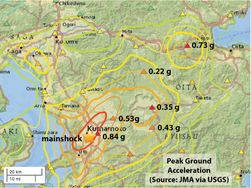
Preliminary map of observed (triangles) and inferred (contours) shaking from the Mw=7.0 event, from the USGS. The contours blend a model and data. The shaking appears to be much stronger to the northeast, suggesting how the 40 km long fault ruptured (or, unzipped).
Latest posts by Temblor (see all)
- Earthquake science illuminates landslide behavior - June 13, 2025
- Destruction and Transformation: Lessons learned from the 2015 Gorkha, Nepal, earthquake - April 25, 2025
- Knock, knock, knocking on your door – the Julian earthquake in southern California issues reminder to be prepared - April 24, 2025