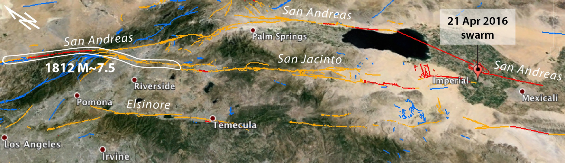
In this Google Earth image, the sites where the San Andreas and San Jacinto systems diverge (north of Riverside) and converge (south of Imperial) are seen. Julian Lozos’ interpretation of the 1812 rupture is also shown. This event collapsed or highly damaged Missions San Juan Capistrano and San Gabriel, and caused minor damage at Missions San Fernando and San Buenaventura. The image is 325 km (175 mi) across.
Latest posts by Temblor (see all)
- Structures can be both earthquake-resilient and sustainable - July 19, 2024
- Earthquakes rattle Palawan, Philippines: Is the region as stable as we thought? - July 3, 2024
- Seismic retrofit rates highlight inequitable efforts - June 20, 2024