Data collected in downtown Salt Lake City reveal active faults that interact at depth. The finding may mean the faults pose a greater hazard than previously thought.
By Kaelie Contreras, The Pennsylvania State University, Temblor Earthquake News Extern
Citation: Contreras, K., 2021, Faults connect beneath Salt Lake City, may increase hazard, Temblor, http://doi.org/10.32858/temblor.204
In March of 2020, a moderate magnitude-5.7 earthquake struck near Magna, Utah, jolting the population that lives across much of the Wasatch Front — the western side of the Wasatch Mountains. After the earthquake, scientists observed several earthquake-induced phenomena concentrated in regions of water-rich, unconsolidated sediment. For example, liquefaction — when water-saturated soil loses its strength and acts as quick sand — occurred mostly near the shores of the Great Salt Lake. Sand boils, which occur when underground water pressure increases and pushes sand up to the surface, appeared as a result of liquefaction. Older unreinforced masonry buildings — those built of bricks or concrete blocks — suffered severe damage on the order of $100 million USD.
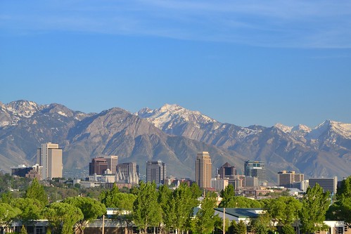
As a city bounded by mountain ranges to the east and west, Salt Lake City lies above a segment of the Wasatch Fault Zone and is underlain by unconsolidated sediment, exposing it to these earthquake-related hazards. According to a recently published study in The Seismic Record, two individual faults of the Salt Lake City segment (the Warm Springs fault and East Bench fault) are connected to one another directly under downtown Salt Lake City, further increasing its susceptibility to earthquake damage.

X-ray underneath the downtown corridor
Before the Magna earthquake, lead author Lee Liberty, a research professor at Boise State University, wondered whether distant faults or those beneath downtown Salt Lake City caused sand boils, liquefaction, and other evidence of past soft sediment deformation found throughout the region.
To answer this question, Liberty and a team of scientists used an active source approach, which is like taking an x-ray of the earth’s structure. The “active source” part of this approach involved Liberty and his team, along with the help of off-duty police officers, tapping the ground with a 440-pound (200-kilogram) weight to create mini-shakes that sent seismic waves into the shallow subsurface. Behind a vehicle, they dragged a fire hose containing ground sensors that detected the seismic waves that bounced back to the surface, off geologic structures in the ground beneath downtown Salt Lake City.

“There are active faults that seem to lie within a broad distributed zone throughout downtown,” says Liberty. The team’s findings indicate that “there is potential for ground displacements beneath the downtown corridor where high-rise buildings either have been or will be constructed in the future,” he says. The faults of particular concern, the aforementioned Warm Springs and East Bench faults, appear to connect underground directly beneath downtown Salt Lake City, suggesting that if the Warm Springs fault moves, it could activate the East Bench fault, and vice versa.
What the study seems to be showing, says Emily Kleber, a geoscientist with the Geologic Hazards Program at the Utah Geological Survey, is that “earthquake energy does not stop between these two faults.” In other words, downtown Salt Lake City appears to sit above faults that could breach the surface, should energy from an earthquake activate either of them.
New answers, more questions
In terms of hazard to both existing and new buildings, Ivan Wong, a senior principal seismologist for Lettis Consultants International says that although Liberty’s study indicates a zone of deformation between the two faults, the behavior of secondary faults that may accompany the main faults in the downtown area is unknown. These secondary faults that branch off the main faults have the potential to slip during a large earthquake, and if they reach the surface, says Wong, they could cause significant damages downtown.
“It’s such an important issue for engineering, and also to know what we’re up against,” explains Kleber, “to model what could happen if we do have a big earthquake.”
In the future, Liberty hopes to revisit downtown Salt Lake to acquire additional seismic data from more closely spaced profiles to understand the interaction between the two faults at a higher resolution, determine how far the fault zones extend, and estimate how fast individual faults — both primary and secondary — move. This clearer picture of what’s happening in the subsurface would help scientists to better forecast when and where future earthquakes may occur and determine the potential for disaster.
References
Liberty, L. M., St. Clair, J., & McKean, A. P. (2021). A Broad, Distributed Active Fault Zone Lies beneath Salt Lake City, Utah. The Seismic Record, 1(1), 35-45.
Kleber, E. J., McKean, A. P., Hiscock, A. I., Hylland, M. D., Hardwick, C. L., McDonald, G. N., … & Erickson, B. A. (2021). Geologic Setting, Ground Effects, and Proposed Structural Model for the 18 March 2020 M w 5.7 Magna, Utah, Earthquake. Seismological Society of America, 92(2A), 710-724.
Wasatch Front Unreinforced Masonry Risk Reduction Strategy (2021). FEMA.
- Venezuela’s doublet leaned toward Caracas - June 30, 2026
- Is Southern California’s Cajon Pass an ‘earthquake gate’ ready to open? - June 29, 2026
- Philippines magnitude 7.8 shock may have loaded the central Cotabato subduction zone - June 11, 2026