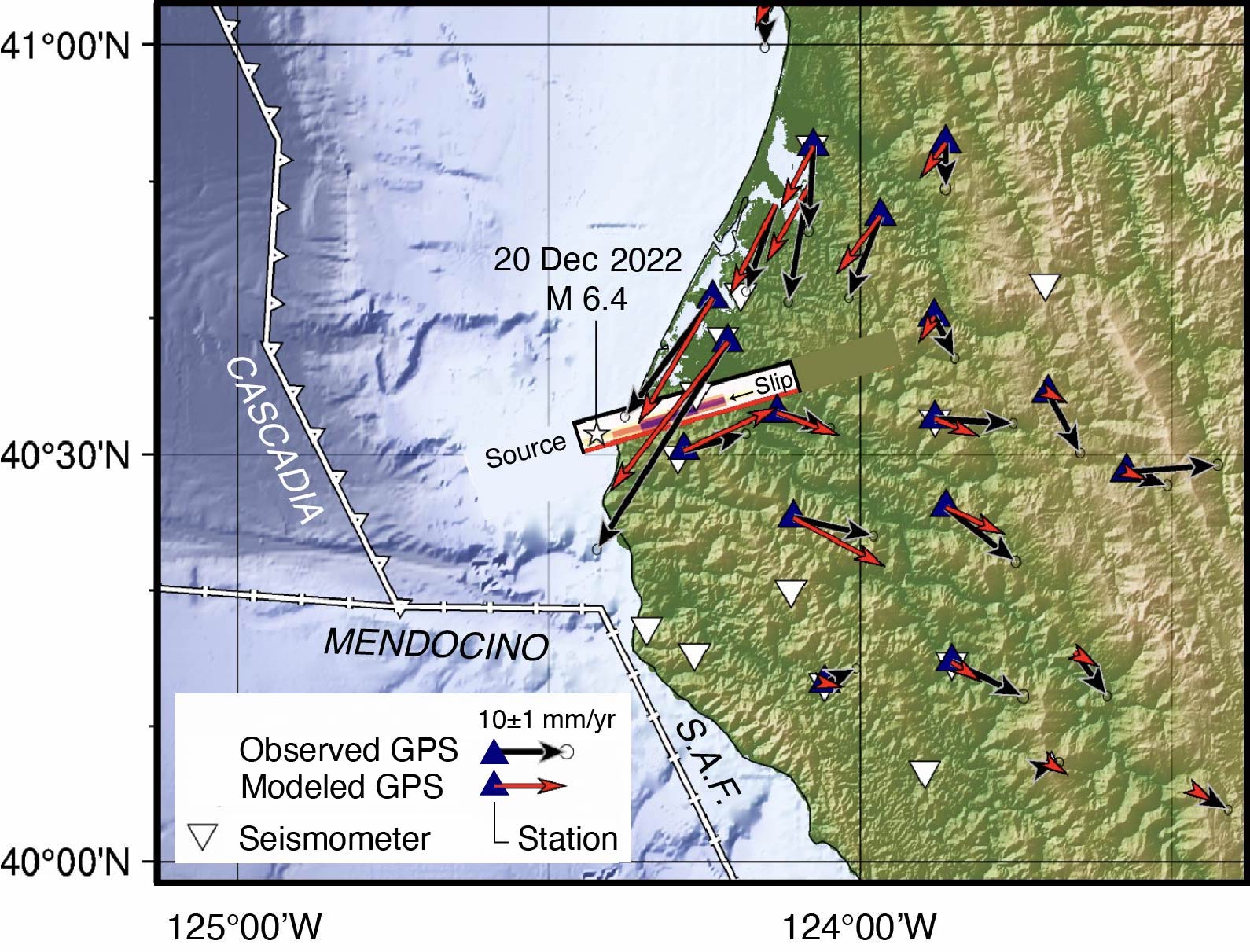
The currently available evidence, including seismic waveforms recorded worldwide, the GPS (‘GNSS’) displacements (shown here as red and black arrows) and the aftershock alignment (shown in the first figure), suggests that the magnitude-6.4 quake struck on an northeast-trending left-lateral strike-slip fault. The slip on that fault is shown here in dark red and orange (USGS Event Page). Note that the rupture is about about 9 miles (15 kilometers) long — much shorter than the length of the white rectangle.
Latest posts by Krystal Vasquez (see all)