Coastal boulders give scientists an idea of past seismicity in a region, which helps them understand the potential for future earthquakes and tsunamis.
By Mizael Ramos Ortiz, B.Sc., Temblor Science Writing Extern (@Miza219)
Citation: Ortiz, M., 2022, Coastal boulders constrain prehistoric tsunamis, Temblor, http://doi.org/10.32858/temblor.251
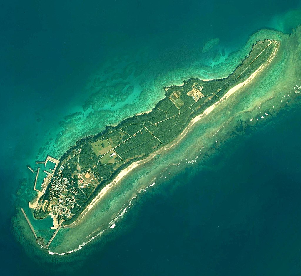
Earthquakes and tsunamis shape history and have done so since well before written and oral records. To go back further in time, scientists must find creative ways to discover details on past seismic events. In a recent study, Kenta Minamidate, a doctoral student at Tohoku University, and his coauthors found a unique way to use boulder deposits along the ocean shores of Kudaka Island in Okinawa Japan to constrain the tsunami history of the area. This information could help researchers create a more complete description of the area’s seismic history — including the largest related tsunamis — which would help people prepare more adequately for future quakes and their associated hazards.
Rocks along the shore
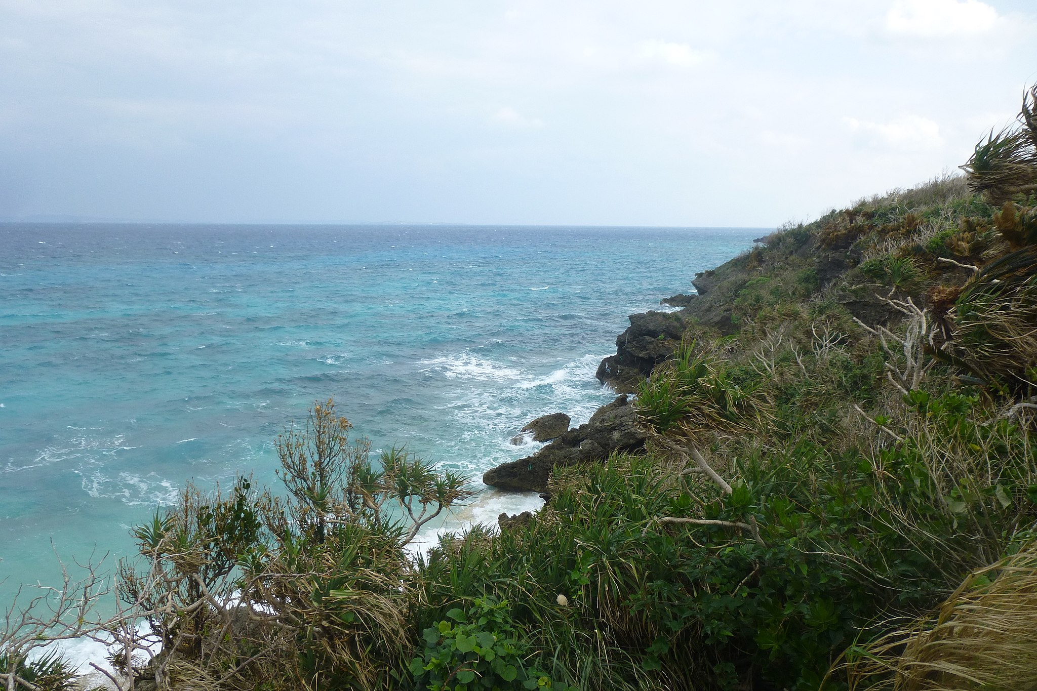
Rocks the size of adult seals or larger amass on oceanfront sands along Kudaka’s Pacific coast. However, these are no ordinary rocks, says Minamidate. “They are like message bottles that have washed ashore.” Such boulders can lay on beaches for centuries, hiding clues as to how they arrived at the shore and what has happened in the area since.
The coastal boulders at Kudaka island were deposited by large typhoon waves, starting about 3,500 years ago, according to prior studies that carefully analyzed the boulders’ sizes, superficial characteristics and positions. Scientists know that no other, stronger event has occurred since. If one had, the boulders would have been moved elsewhere.
Though not deposited by a tsunami, the boulders allowed the researchers to estimate the maximum size of any tsunami waves that had occurred after their placement, in part because no other boulders of similar size were found further inland. Among the multiple possible scenarios for Kudaka Island, Minamidate and his colleagues found that the greatest tsunami since the boulders landed on that beach could not have produced water levels greater than 7.2 feet (2.2 meters), nor have swept the shore at greater than 3.35 miles per hour (1.5 meters per second). Above these limits, the boulders would have been washed farther onshore or out to sea.
Kudaka island resides near Japan’s Ryukyu Trench, where the Philippine plate plunges beneath the Eurasian plate, resulting in periodic megathrust earthquakes that can produce large tsunamis. Since boulder emplacement, no earthquake greater than magnitude-8.2 could have struck the region, according to the researchers’ calculations, and no earthquake could have produced more than 6.2 feet (1.9 meters) of movement, or “slip,” on nearby faults.
The researchers simulated different earthquake scenarios to evaluate their likelihood since the boulders were deposited. In one simulation, the researchers tested whether a large, distant quake could have occurred. If such an event had struck 120 kilometers north of Kudaka Island the slip along the fault required to move the boulders would be about 13 feet (4 meters). Because that amount of slip exceeds the researchers’ calculated limits for the boulders, they reason that no such earthquake has occurred since the boulders took up their residence, at most, 3,500 years ago.
Looking into the future
As a fourteen-year-old who lived through the magnitude-9.1 Great Tohoku earthquake and tsunami that struck Japan in 2011, Minamidate was compelled to conduct research that would help reduce the damages from such disasters. Knowing the largest historic earthquake for a region — particularly one subject to massive subduction zone earthquakes — helps structural engineers design buildings and infrastructure to withstand damage from such a quake and helps emergency managers plan for future quakes. The methodology developed on the Kudaka boulders could be applied in other earthquake prone regions around the world. Minamidate says this study serves his long-standing goal of contributing to earthquake risk assessment and reduction.

However, this method has its limitations. First, Minamidate and his colleagues only examined storm-derived boulders, which need to be on flat terrain to ensure nothing was holding them still, such as a cliff that could brace boulders from moving inland. Also, boulders must have resided on the flat beach for an extended period of time — at least decades — in order to reveal information on past seismic events. Boulders placed by a recent storm can only give details on the most recent events.
Because this analysis relies on computer simulations of what might keep the boulders in place, limitations exist from the selection of the model’s parameters. For example, underestimating the total energy released by a simulated earthquake would underpredict the maximum earthquake magnitude for the region.
Still, this study serves as a valuable “tool in the toolbox”, says Andrew Kennedy, a civil engineer at the University of Notre Dame. Kennedy says that as fundamental limitations are addressed — such as where boulders even exist — future research will continue to improve. Currently, Minamidate is tackling some of these limitations by surveying boulders on the Ryukyu Islands. In the future, scientists may discover past events — one boulder deposit at a time.
References
Minamidate, K., Goto, K., & Kan, H. (2022). Numerical estimation of maximum possible sizes of paleo-earthquakes and tsunamis from storm-derived boulders. Earth and Planetary Science Letters, 579, 117354. https://doi.org/10.1016/j.epsl.2021.117354
- Venezuela’s doublet leaned toward Caracas - June 30, 2026
- Is Southern California’s Cajon Pass an ‘earthquake gate’ ready to open? - June 29, 2026
- Philippines magnitude 7.8 shock may have loaded the central Cotabato subduction zone - June 11, 2026