Fig. 1 Seismotectonic Map of the Philippines 21-08-12 Davao EQ

Figure 1 - Tectonic map of the Philippines showing the active subduction zones, internal active faults and distribution of epicenters of historical earthquakes. The magnitude-7.3 Davao earthquake (indicated by the beachball diagram, also called a focal mechanism) occurred off the coast of Davao, the largest metropolis on Mindanao Island. Location and focal mechanism of the magnitude-7.2 Bohol earthquake of 15 October 2013 also indicted. Credit: modified from Aurelio et al., 2013

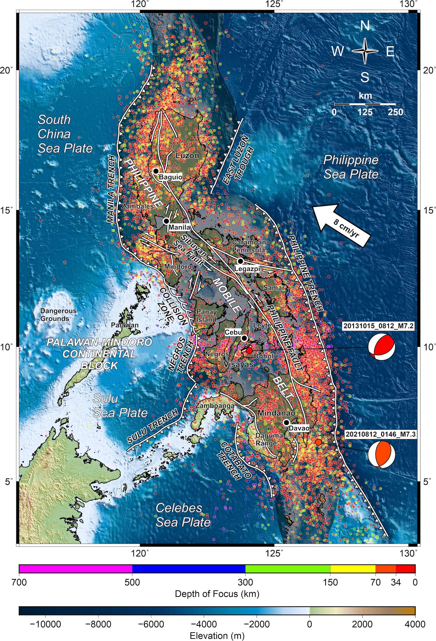
Figure 1 – Tectonic map of the Philippines showing the active subduction zones, internal active faults and distribution of epicenters of historical earthquakes. The magnitude-7.3 Davao earthquake (indicated by the beachball diagram, also called a focal mechanism) occurred off the coast of Davao, the largest metropolis on Mindanao Island. Location and focal mechanism of the magnitude-7.2 Bohol earthquake of 15 October 2013 also indicted. Credit: modified from Aurelio et al., 2013

Latest posts by Krystal Vasquez (see all)