Following the 1999 Chi-Chi earthquake in Taiwan, buildings were found precariously balanced on a slope. New modeling shows how to better plan for such damage.
By Judith Hubbard, Ph.D. (@JudithGeology) and Rishav Mallick, Earth Observatory of Singapore
Citation: Hubbard, J. and Mallick, R., 2021, An overlooked hazard can cause damage weeks after an earthquake strikes, Temblor, http://doi.org/10.32858/temblor.212
When the magnitude-7.6 Chi-Chi earthquake hit Taiwan on Sept. 21, 1999, widespread shaking damaged homes, schools and dams, among other buildings.
The earthquake also highlighted an additional hazard — tilting of the Earth’s surface. Homes roughly 1-2 miles (1.6-3.3 kilometers) from the fault, built on once horizontal ground, were found precariously balanced on a slope in the days after the earthquake (Chen et al., 2007).

This tilting was caused by slip along the underlying fault. Some faults are vertical, but in regions where tectonic plates are colliding, faults typically dip at an angle within the Earth’s crust. When the rocks on either side of the fault move past each other during an earthquake, the rocks above the fault are lifted and tilted.
Tilting is only a small symptom of a much larger process: the growth of folds and ultimately mountains, which occurs over millions of years.
Folding can occur near faults
Geologists know about folding and tilting from the rock record, but they still do not know when it happens. Does the ground suddenly buckle during an earthquake, in the hours to days afterwards as the crust readjusts? Or, do these processes occur during long periods between major earthquakes? We know that the Chi-Chi earthquake caused tilting, but the observations were made days after the event. The tilting could have happened at any point in the days after the earthquake.
We and colleagues recently tried to answer this question.
Ideally, we want to watch folding happen in real time to learn more about the process. Unfortunately, earthquakes are intermittent, and having instruments recording in exactly the right place at the right time when an earthquake strikes is highly improbable.
The next best option is to simulate the process using a model. We first model the long-term folding above a fault that builds the expected topography over the course of hundreds of thousands of years. From this model, we calculate the rate of deformation, or tilting, along and around the fault. We use this information to create a second simulation focused on earthquakes.

Folding happens during, after and between earthquakes
Our calculations show that folding doesn’t only occur during one part of the earthquake cycle. Some folding happens during the earthquake, but tilting continues in the hours to days after the earthquake and slows down with time (Figure 3).
The folding pattern is controlled by the magnitude and orientation of the fault, and by the mechanical properties of the rock layers. Large earthquakes transfer so much stress to the surrounding rocks that the folding must happen quickly; smaller earthquakes, on the other hand, may lead to slower folding that occurs over years.
Continuing hazard after an earthquake
Our study highlights an important and unrecognized earthquake hazard — tilting of the ground surface miles away from the main fault trace, which can continue long after an earthquake.
Our results show that for a large earthquake, tilting could reach one degree within a stretch of land hundreds of meters wide, paralleling the fault for up to about 60 miles (100 kilometers). Awareness of this hazard is important, as reentering buildings while tilting is ongoing, either for reoccupation or for rescue efforts, could be dangerous, especially given that these buildings may have already been weakened by the initial earthquake shaking. Our work provides critical insights into this process that can guide earthquake disaster mitigation plans.
Regions of potential tilt should be highlighted as hazard zones. Scientists have documented such folds in some highly populated regions — such as the Los Angeles basin. These folds have even been used to estimate long-term slip rates on the underlying faults (e.g. Shaw et al., 2002; Leon et al., 2007; Bergen et al., 2017). People in these regions should be aware that they face not just a shaking hazard, but also a tilting hazard that could continue for months to years following an earthquake.
How long to worry?
With our results, we can estimate expected timescales and magnitudes of tilting. For a great earthquake (magnitude greater than 7.0) that ruptures all the way to the surface, almost all the tilting (up to about one degree for a relatively narrow fold zone) will happen within the first day, and by the end of a month the tilting may slow down to imperceptible levels.
Earthquakes of the same magnitude that do not rupture all the way to the surface are likely to cause a similar amount of tilting, but may take months or even years to decay to a negligible rate. The timescale will depend on the orientation and amount of slip along the fault in the earthquake and the rocks in the region, so direct observation during the post-earthquake period will be important for determining when the area is stable.
Engineering assessments of structural stability due to ground tilting suggest that tilting of as little as one degree can collapse foundations. For specialized structures such as satellite towers, values as low as 0.01 degrees can cause problems (Charles and Skinner, 2004). In the aftermath of an earthquake, it is likely that tilting of less than one degree could be dangerous given that buildings may have been damaged by shaking.
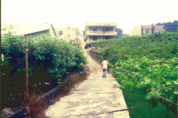
In our models, the amount of total tilt depends on the width over which folding will happen. If the tilted area is a mile wide (1.6 kilometers), tilting might be limited to less than 0.2 degrees. In contrast, if the tilted area is 300 feet wide (90 meters), tilting might reach several degrees. This may explain how the building in Taiwan in the first image tilted so much in the Chi-Chi earthquake. Our models are not able to reproduce such narrowly folded areas due to the computational cost, so these estimates are projected from simulations that considered wider folding zones.

Accurate forecasts of tilting will require observing actual earthquakes and carefully mapping their deformation patterns. However, before an earthquake occurs, scientists can map out the potential tilt zones near faults. Constructing buildings that are resilient to tilting and ensuring that buildings are not reoccupied until after the tilting process has slowed to negligible levels may save lives.
References
Bergen, K. J., Shaw, J. H., Leon, L. A., Dolan, J. F., Pratt, T. L., Ponti, D. J., Morrow, E., Barrera, W., Rhodes, E. J., Murari, M. K., Owen, L. A. (2017). Accelerating slip rates on the Puente Hills Blind-thrust Fault System beneath metropolitan Los Angeles, California. Geology, https://doi.org/10.1130/G38520.1.
Charles, J. A. and Skinner, H. D. (2004), Settlement and tilt of low-rise buildings. Geotechnical Engineering, 157 (2), p. 65-75, https://doig.org/10.1680/geng.2004.157.2.65.
Chen, Y-G., Lai, K.-Y., Lee, Y.-H., Suppe, J., Chen, W.-S., Lin, Y.-N. N., Wang, Y., Hung, J.-H., Kuo, Y.-T. (2007). Coseismic fold scarps and their kinematic behavior in the 1999 Chi-Chi earthquake Taiwan. Journal of Geophysical Research, 112, B03S02, https://doi.org/10.1029/2006JB004388.
Hubbard, J., Barbot, S., Hill, E. M., Tapponnier, P. (2015). Coseismic slip on shallow décollement megathrusts: Implications for seismic and tsunami hazard. Earth-Science Reviews 141, p. 45-55, https://doi.org/10.1016/j.earscirev.2014.11.003.
Leon, L.A., Christofferson, S.A., Dolan, J.F., Shaw, J.H. And Pratt, T., Earthquake-by-earthquake fold growth above the Puente Hills blind thrust fault, Los Angeles, California: Implications for fold kinematics and seismic hazard, J. Geophys. Res., Vol. 112, B03S03, doi:10.1029/2006JB004461, 2007
Mallick, R., Bürgmann, R., Johnson, K., Hubbard, J. (2021). A unified framework for earthquake sequences and the growth of geological structure in fold-thrust belts. Journal of Geophysical Research: Solid Earth, https://doi.org/10.1029/2021JB022045
Shaw, J. H., Plesch, A., Dolan, J. F., Pratt, T. L. (2002). Puente Hills blind-thrust system, Los Angeles, California. Bulletin of the Seismological Society of America, 92 (8), 2946-2960, https://doi.org/10.1785/0120010291.
van Zelst, I., Wollherr, S., Gabriel, A.‐A., Madden, E. H., & van Dinther, Y. (2019). Modeling megathrust earthquakes across scales: one‐way coupling from geodynamics and seismic cycles to dynamic rupture. Journal of Geophysical Research: Solid Earth, 124, 11,414–11,446. https://doi.org/10.1029/2019JB017539
- Venezuela’s doublet leaned toward Caracas - June 30, 2026
- Is Southern California’s Cajon Pass an ‘earthquake gate’ ready to open? - June 29, 2026
- Philippines magnitude 7.8 shock may have loaded the central Cotabato subduction zone - June 11, 2026