Ross Stein and Volkan Sevilgen, Temblor
The earthquake stuck at a relatively shallow depth of 5-7 km (3-4 mi) and was felt over an area about 100 km (60 mi) wide; the closest town is Oliver, 15 km to the west, where it was strongly felt.
One can see from Temblor’s Earthquake Forecast model (based on GEAR) that a M=4.2 shock at this location is not surprising. The map shows that a M~5.5 would have a 1% per year chance of occurring, or a 57% chance in your lifetime. Because smaller quakes are more abundant, a M=4.2 has about a 5% per year chance of occurring.
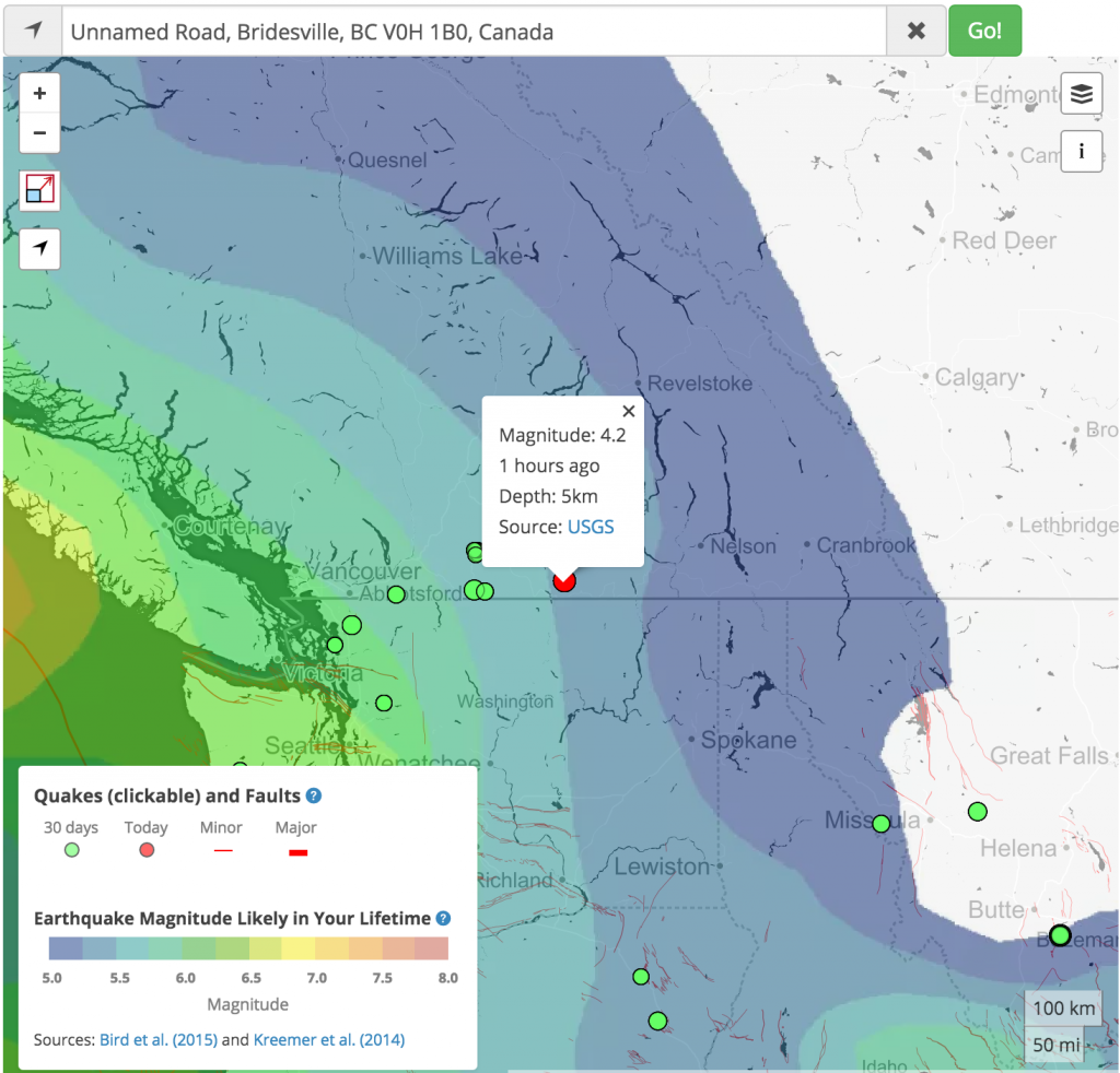

The magnitude seems to us too high, and the depth too great, to be a controlled explosion related to the ski resort. There is no focal mechanism information yet available for the quake, but we anticipate that it will be a thrust event typical of the Canadian Rockies. Natural Resources Canada assigns it a M=4.0 and a depth of 1.0 km, but we believe it would still be too large to be man made.
Data from the U.S. Geological Survey, Pacific Northwest Seismic Network operated by the University of Washington, and the Natural Resources Canada-Geological Survey of Canada
- Earthquake science illuminates landslide behavior - June 13, 2025
- Destruction and Transformation: Lessons learned from the 2015 Gorkha, Nepal, earthquake - April 25, 2025
- Knock, knock, knocking on your door – the Julian earthquake in southern California issues reminder to be prepared - April 24, 2025