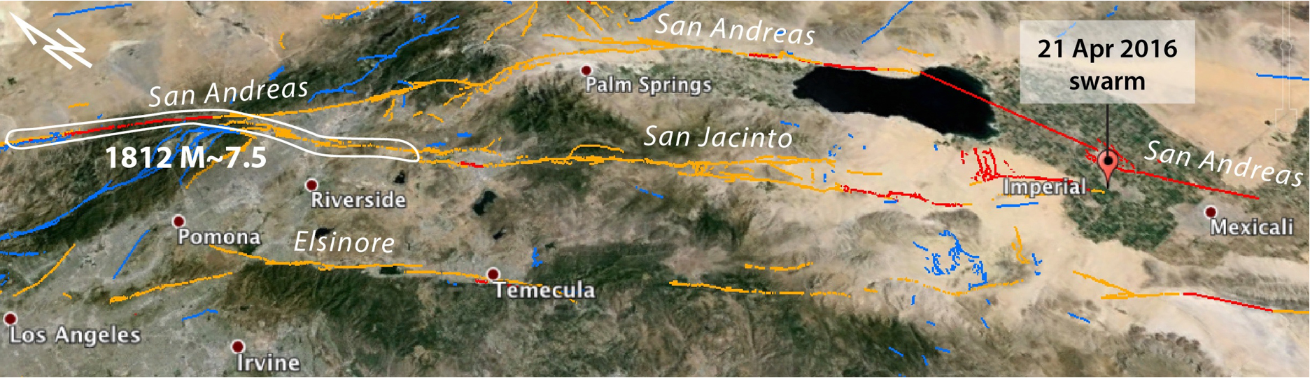
In this Google Earth image, the sites where the San Andreas and San Jacinto systems diverge (north of Riverside) and converge (south of Imperial) are seen. Julian Lozos’ interpretation of the 1812 rupture is also shown. This event collapsed or highly damaged Missions San Juan Capistrano and San Gabriel, and caused minor damage at Missions San Fernando and San Buenaventura. The image is 325 km (175 mi) across.
Latest posts by Temblor (see all)
- The Earthquake that Shook the South - February 26, 2026
- Introducing Coulomb 4.0: Enhanced stress interaction and deformation software for research and teaching - February 20, 2026
- Deep earthquake beneath Taiwan reveals the hidden power of the Ryukyu Subduction Zone - January 7, 2026