By David Jacobson, Temblor

Despite the fact that Tropical Storm Cindy will not make landfall until this evening or tomorrow morning, heavy rainfall has already begun to fall along the Gulf Coast, with 3-6 more inches likely, and up to 12 inches in isolated locations, according to the National Weather Service. For a region that has already seen significant rainfall over the last month, this could lead to increased flood risk because the ground is already saturated. Additionally, the heavy rainfall could lead to dangerous flash flooding throughout Texas, Louisiana, Mississippi, and Alabama. Based on projections, the storm should make landfall near the Texas-Louisiana border. Because this storm is estimated to affect up to 17 million people, we looked at where flooding could occur in a couple of the cities that are likely to be hardest hit.
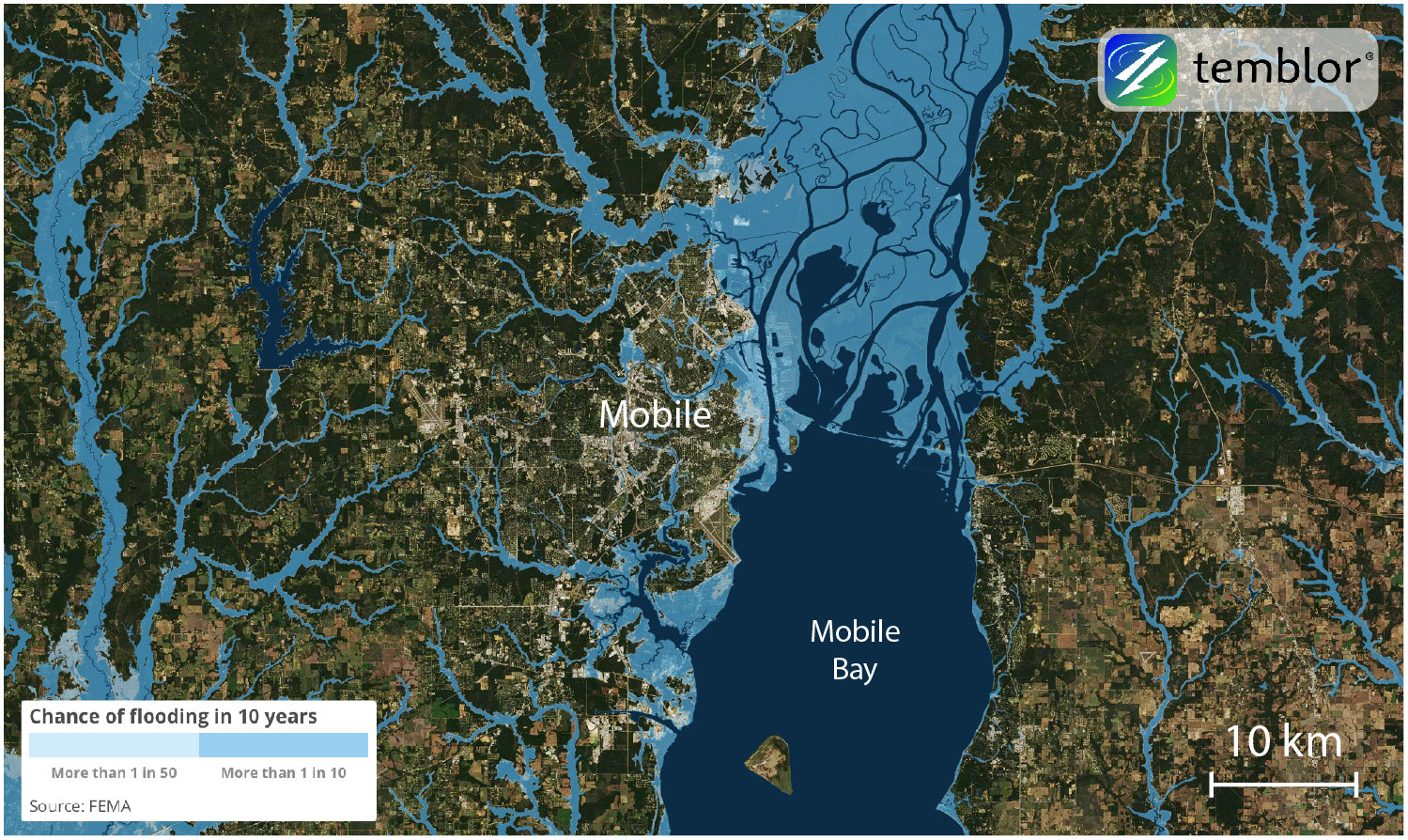
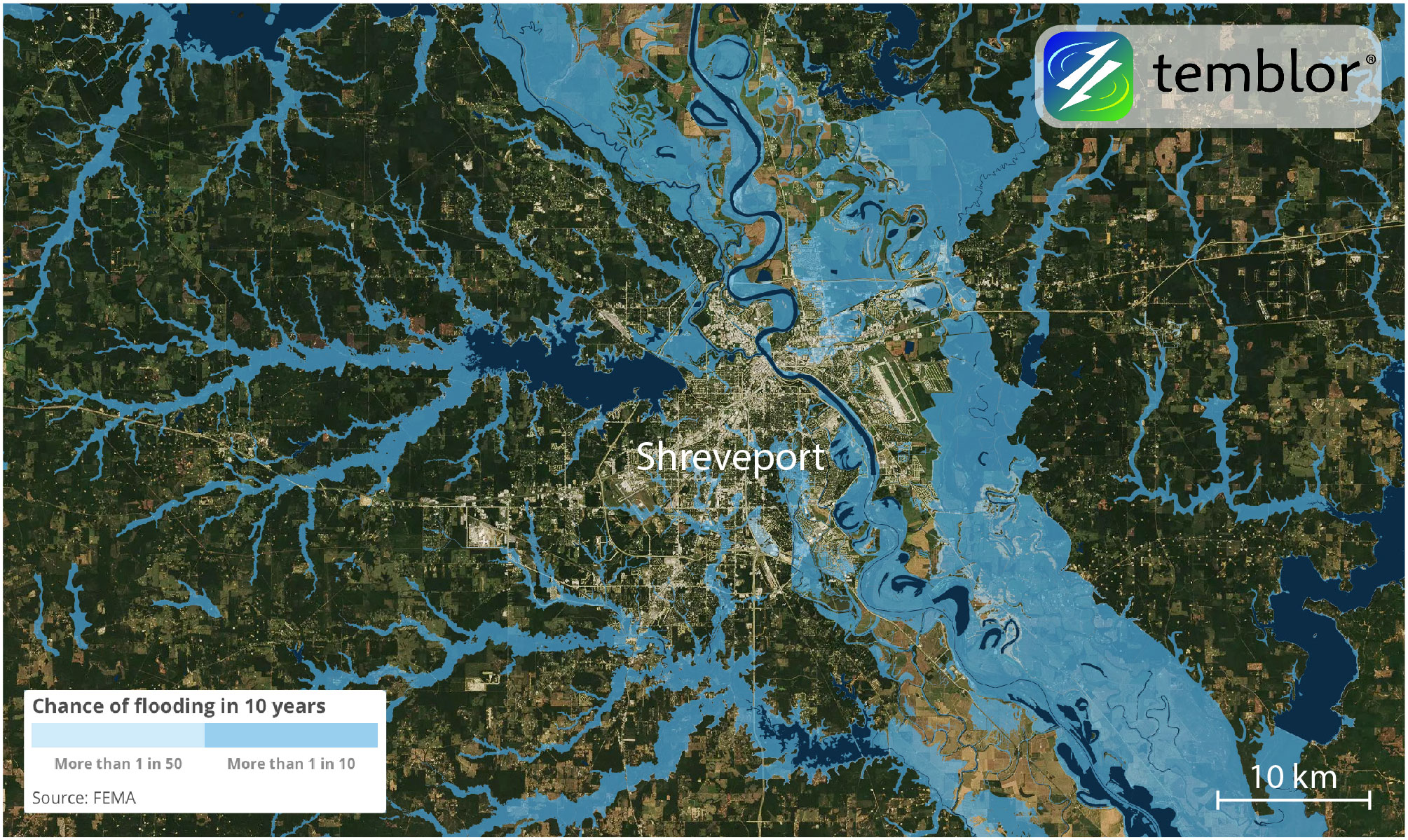
Two of the cities expected to receive the most rainfall over the coming days are Mobile, Alabama, and Shreveport, Louisiana. The Weather Channel forecasts that both cities could see 5+ inches of rain as Tropical Storm Cindy sweeps its way across the Gulf Coast. In the two maps below, Mobile and Shreveport are shown. It should be made clear that these are not projections for where flooding will occur, but rather where flooding could occur based on published flood maps.


What both of these maps show is that should flooding from Tropical Storm Cindy follow the FEMA flood maps, significant residential and industrial areas could be flooded. In addition to flooding, tornadoes and water spouts could cause damage. However, according to state officials, flooding in the greatest concern as it could lead to large economic losses and disruption.
References
FEMA
National Weather Service
NOAA
The Weather Channel
CNN
ABC News
- Earthquake science illuminates landslide behavior - June 13, 2025
- Destruction and Transformation: Lessons learned from the 2015 Gorkha, Nepal, earthquake - April 25, 2025
- Knock, knock, knocking on your door – the Julian earthquake in southern California issues reminder to be prepared - April 24, 2025
