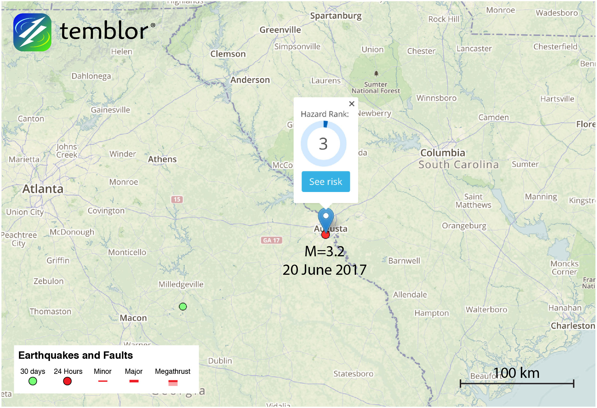
By David Jacobson, Temblor

This morning, at 11:14 a.m. local time, a M=3.2 earthquake struck just below Augusta, Georgia, and by 12:30, had garnered over 1,500 felt reports on the USGS website. While this earthquake was too small to cause damage, it registered moderate shaking in Augusta, which is home to the Masters golf tournament, and was widely felt throughout the region, including in Atlanta, over 200 km away.
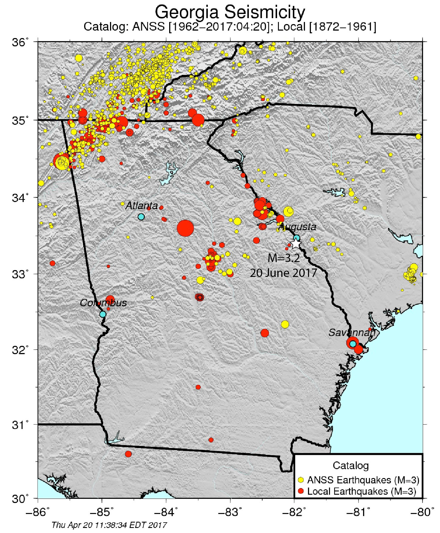
While most people do not think of earthquakes when the eastern United States is brought up, quakes in this region are not unheard of. The map below, courtesy of Professor Andrew Newman at Georgia Institute of Technology, shows seismicity in Georgia and the surrounding region (Today’s quake has been added to this figure). This map highlights how small earthquakes within the Appalachians are common, while larger quakes occur every few decades.
Even though earthquakes in this region are less frequent than those in the western U.S., they are often felt over a much wider region. For example, according to the USGS, a M=4 earthquake east of the Rockies, could be felt over an area ten times larger than a M=4 quake in California. This is because the eastern U.S. is predominantly made up of sediments, uninterrupted by crystalline rock. Furthermore, due to lower building codes east of the Rockies, smaller magnitude earthquakes can cause more damage than a comparable quake in California.
This part of Georgia, near the border with South Carolina, is in what is known as the “Fall line,” according to Prof. Newman. He told us that they have been getting a few tiny events in this area, and that the fall line “is a transition in topography between the Appalachians and the coastal plain, running roughly from Columbus through Macon, to Augusta. Today’s earthquake was the biggest we’ve seen in a little while, but M3’s are not all too uncommon (probably once every couple of years or so). Why they line up here, we really don’t know, but they do seem to self-organize around some of our reservoirs.”
Insight such as this helps sheds light on a often forgotten region of seismicity in the United States. While very low, the seismic hazard in much of the eastern U.S. is not zero. This can be seen in Temblor’s Hazard Rank, and in the USGS seismic hazard map below, which shows a band of higher shaking hazard between eastern Tennessee and eastern South Carolina (black rectangle). What this means is that damaging earthquakes can occur, and that residents of this region should be aware of the potential hazards.

References
USGS
Professor Andrew Newman (Georgia Institute of Technology)
- Earthquake science illuminates landslide behavior - June 13, 2025
- Destruction and Transformation: Lessons learned from the 2015 Gorkha, Nepal, earthquake - April 25, 2025
- Knock, knock, knocking on your door – the Julian earthquake in southern California issues reminder to be prepared - April 24, 2025